Curated OER
Ocean Floor
Students identify ocean floor features. For this earth science lesson, students predict the object inside a close box to make them realize the difficulties scientists faced then. They label the different zones of the ocean floor after...
Curated OER
Stratigraphy -- Layers of Time in the Earth
Students are introduced to the process of stratification. Using the internet, they read about the Richard Beene archeological site near San Antonio. Using a map, they color code the different layers present at this site and answer...
Curated OER
Mapping the Local Community
Students review the symbols and legends of a map. In groups, they follow a set of directions to create a map showing the route to a specific place. They present their map to the class and review the basic components of a community.
Curated OER
Orientation of the Earth in Space
Students hypothesize the location of the sun in the sky at diferent times of day and at different latitudes. They perform several experiments to provide evidence for their hypothesis. Experiments including observing the sun's position at...
Curated OER
Where Does Earth's Heat Come From?
Students try to determine how the Earth is heated by the sun and other sources. In groups, they identify the other sources of energy and discover why different parts of the world are heated differently during the year. They complete an...
Curated OER
Plate Tectonics
Students simulate the three types of plate boundaries using robots. In this earth science lesson, students explain how earthquakes and volcanoes are formed. They collect real-world earthquake data and plot them on the map.
Curated OER
Weather in Your City
Students observe weather conditions of a particular city. Multiple intelligences are explored within this lesson. They locate their particular city on a United States map. Each student writes about their discoveries in his/her journal...
Curated OER
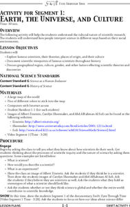
Earth, the Universe, and Culture
Students view segment of documentary, Swift: Eyes Through Time, explore famous scientists, their theories, places of origin, and culture, document scientific viewpoints of famous scientists throughout history, and discuss geographical...
Curated OER
Clouds
For this recognizing cloud shapes and their elevations worksheet, students cut out labeled cloud shapes and paste them on an elevation map. Students identify the location of five cloud shapes.
Curated OER
Earth: Land Use Picture Project
Students explore how changes in human land use are impacting local environments. They also explore some of the social impacts of various land uses in their area. They identify and discuss some social impacts of the different land uses.
Curated OER
Using Repeat Photography to Map Environmental Hazards
Learners investigate the changes of their environment by experimenting with photography. In this environmental observation lesson, students compare historic photographs of areas with pictures they have just taken. Learners...
Teach Engineering
Incoming Asteroid! What's the Problem?
Oh, no! An asteroid is on a collision course with Earth!. Class members must rise to the challenge of designing a shelter that will protect people from the impact and permit them to live in this shelter for one year. In this first lesson...
NASA
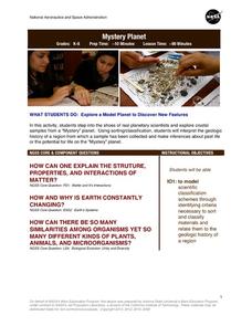
Mystery Planet
What can one learn about a planet based on a small surface sample? Learners will explore artifacts from a mystery planet and see what they can determine about the planet based on the evidence in front of them.
Laboratory for Atmospheric and Space Physics
A Classroom Solar System
Create a scaled model of our solar system in your classroom! Scholars work collaboratively to build paper mache planets and hang them in their proper position to showcase each planet's location in the solar system.
Curated OER
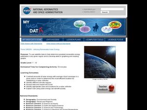
Think GREEN - Utilizing Renewable Solar Energy
Students use data to find the best renewable energy potential. In this solar energy lesson plan students import data into Excel and explain how solar energy is beneficial.
Urbana School District
Magnetism
The compass was first used in 206 B.C., but we didn't discover magnetic poles until 1263 A.D. Presentation begins with the history of magnetism before continuing on to magnetic fields, magnetic forces, electromagnets, currents,...
Laboratory for Atmospheric and Space Physics
Orbit Simulator
Researchers think they have evidence of a new planet deep in our solar system that is the size of Neptune and orbits the sun far beyond Pluto. The orbit simulator shows the orbits of our well-known planets, as well as Pluto and the comet...
Curated OER
Common Themes
Tenth graders test usefulness of a model Earth by comparing its predictions to observations in the real world. In this landforms lesson students construct an island from a contour map using model clay then analyze the landscape...
Curated OER
Ring of Fire
Students locate some of the 1,500 active volcanoes on a world map. Then by comparing their maps with a map of the world's tectonic plates, they discover that volcanoes occur because of the dynamic nature of the Earth's lithosphere.
Curated OER
Climatic Zones
Third graders recognize and locate Frigid, Temperate, and Torrid climatic zones on the word map or globe. They explain that plants, animals, and human societies display adaptations to the climates they live in .
Curated OER
Plotting A Hurricane Using latitude and Longitude
Students explore map and plotting skills by tracing the movement s of hurricanes through the Earth's systems. a hurricane map is developed from daily media reports.
Curated OER
Rain Forests: A Disappearing Act?
Students examine and locate rainforests on maps, and research the patterns of their destruction. They develop a bar graph of rainfall and temperature data, write a journal entry, and research the people, animals, and plants/products of...
Curated OER
March of the Polar Bears: Global Change, Sea Ice, and Wildlife Migration
Students study global change and how these changes impact wildlife. In this polar bears lesson plan students analyze maps and data to understand climate change.
Curated OER
Blast It! (Learning About Copper)
Opening with background information on copper use and mining, this worksheet assesses junior geologists' reading comprehension. A map activity is available, but the map is not. There is a useful set of vocabulary matching cards and a...


