Curated OER
West and Central Africa
Students examine the unique physical and human characteristics of Russia and the former Soviet Republics, the Middle East and North Africa, and Sub-Saharan Africa. In addition, they compare how cooperation and conflict among peoples...
Curated OER
Sub-Saharan Africa: Physical Geography
In this geography skills worksheet, students respond to 22 short answer and map skills questions about the location and geographic features of sub-Saharan Africa.
Curated OER
Continuing Gandhi's Legacy of Cross-Cultural Understanding: Central Asia and the Middle East
Students investigate the lifestyle of Gandhi by creating a Venn Diagram. In this biographical lesson, students compare the philosophies of Martin Luther King Jr. and Gandhi while discussing their teaching methods. Students...
DePaul University
Egypt
The country of Egypt is more than just big pyramids and ancient pharaohs. After reading a brief overview of this African nation, young learners will demonstrate their understanding of the text by identifying the main idea and supporting...
Curated OER
Travel to Mesoamerica
Students research books, watch movies, and look on the internet to find information on ancient America, Mexico, and Central America. In this Mesoamerica lesson plan, students participate in a social studies unit on North America of the...
University of Wisconsin
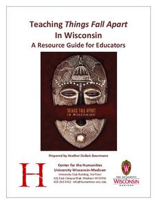
Teaching Things Fall Apart in Wisconsin: A Resource Guide for Educators
“There is no story that is not true, . . .” And uncovering the truths in Things Fall Apart is the focus of a 68-page resource packet designed to provide instructors with a wealth of materials that enhance understanding of Chinua Achebe’s...
Curated OER
Understanding "The Stans"
Students explore and locate "The Stans" in Central Asia to create, write and illustrate maps, graphs and charts to organize geographic information. They analyze the historical and physical characteristics of Central Asia via graphic...
Curated OER
Map Activities
In this geography worksheet, learners follow the directions and shade 3 different regions of a UK political map, shade European Union countries on a political map of Europe, match 4 physical feature of Africa to their descriptions, and...
Curated OER
Discovering Swahili
Students investigate the African language of Swahili by translating vocabulary words. In this foreign language lesson, students write 26 English words that define Africa and utilize the Internet to translate them into Swahili....
Curated OER
Describing A Place - Part I The British Isles
In this describing place worksheet, students label the cardinal and ordinal directions on a compass rose using the drop-down menus. They complete a matching activity by matching an item from column C with one in A and B. They read an...
Curated OER
Getting to Know My World
Students participate in hands-on activities using maps and globes to identify geographical features. Students use map legends to identify direction. Students locate oceans, continents, countries, states and cities. Handouts and...
Curated OER
Witchcraft & Sorcery
Give learners a chance to understand the practices and beliefs associated with witchcraft through an anthropological lens. Like any other belief system, witchcraft stems from specific sociological needs. This practice is well-defined in...
AGSSS
World Regions
Help your learners to visualize where historical events have taken place around the globe with a map that details the major regions of the seven continents.
Curated OER
Which Foods Come From Rainforests?
A very interesting and colorful presentation on the original sources of food is here for you. Learners discover where foods such as bananas, asparagus, potatoes, and oranges come from. They come from rainforests located all over the world!
Curated OER
Geography Quiz 25
For this geography worksheet, students answer short answer questions about geography around the world. Students answer 23 questions about cities, rivers, countries, and more.
Curated OER
Geography A to Z: The Letters W,X,Y and Z
Warm up the class with a fun geography quiz. They'll use the letters W, X, Y, and Z to answer seven geography-based questions. Y for Yangtze, Z for Zimbabwe, or Y for Yugoslavia.
Curated OER
Jewish Culture Through Food Recipes
High schoolers engage in studying Jewish culture through the experience of tasting and eating different foods. They answer key questions that are used to guide the lesson. The foods of Americans is contrasted with the Jewish foods.
Curated OER
Culture Is Like an Iceberg
Students examine features of culture to determine which are visible and which are invisible, and how the invisible affect the visible. They look at both their outline drawing of the iceberg and their Features of Culture worksheet and...
Peace Corps
Features of Culture
Young scholars enumerate features of their own culture and evaluate how those features have influenced their lives. They explain that many differences are related to culture-beliefs and ways of living that are handed down from one...
Curated OER
Probability
In this mathematics worksheet, 6th graders identify what probability is and what it measures. They write the number of favorable and possible outcomes for each and display as a ratio.
Curated OER
China - the Geography of European Imperialism - Spheres of Influence in China
Ninth graders create a map of China. They identify the various spheres of influence carved out by the Imperialist powers of Europe as well as locating geographical features of china and major cities. They explain the global impact of...
Curated OER
Exploring Islamic Lands
Young scholars examine the lives of Islamic teens. In this global studies lesson, students explore selected Internet sites to discover the attributes of Islam, the cultural traditions of Islam, and information regarding Middle Eastern...
Curated OER
How to Celebrate the 800th Anniversary of the Mogol Empire
Learners research information on the Mongolian Empire from various readings and online videos of primary sources and create a poster for oral presentation. Students connect history with the current day, while incorporating geographical,...
Curated OER
Maps that Teach
Learners study maps to locate the states and capital on the US map. Students locate continents, major world physical features and historical monuments. Learners locate the provinces and territories of Canada.


