Devine Educational Consultancy Services
Geography Student Workbook, Australia
Your youngsters will be experts on the geography of Australia after working with these activities and worksheets, which review the continent's weather, major landforms, dimensions, history, and climate.
Curated OER
Using Social Studies in Five Shared Reading Lessons: Geography
After several short 15-minute mini-lessons, your learners will gain an understanding of the characteristics of a non-fiction text. Using the book Map It by Elspeth Leacock, your class will become acquainted with non-fiction terms such as...
US Department of Education
Early Childhood: Five Themes of Geography
Any preschool teacher would be thrilled to have a resource like this one. It includes activity ideas, discussion leads, book suggestions, and a glossary for learners ages 2 - 5. The entire booklet focuses on ways to teach young children...
Curated OER
Geographic Terms Glossary
In this geography worksheet, students learn 60 common geographic terms. Students read the words that are arranged in alphabetical order along with the meanings. There are no questions to answer; this is a glossary.
Curated OER
Geography of the United States
Students examine the population growth of the United States. In this Geography lesson, students construct a map of the fifty states. Students create a graph of the population of the USA.
Alpha Omega
History and Geography—Two World Wars
Here's a combination textbook/workbook that examines the conditions in Europe that lead to World War I. Ideal for homeschoolers as well as classroom use.
Core Knowledge Foundation
Volume 1 - A History of the United States: Precolonial to the 1800s
Volume One of the 299-page Core Knowledge History of the United States covers events from the Precolonial Period to the 1800s.
Curated OER
Geography: examining the Glacial Features of Cape Cod
Students examine satellite images of the glacial features of Cape Cod. They analyze where human activity is located in terms of those features. Students make models of the features, including kettle holes. They also use contour maps...
Curated OER
Geographically Speaking
Learners play a matching game to reinforce the retention of vocabulary words. For this geography lesson, students watch a PowerPoint to define vocabulary words associated with geography, play a memory game with the words, and write an...
Film Space
Whale Rider
Ready for an educational movie day? Use a resource based on the movie Whale Rider to learn more about the Maori culture. Class members answer a variety of questions and listen to music from the soundtrack to further analyze and...
Curated OER
Making an Illustrated Dictionary with Geographic Terms
Students construct a geography dictionary. In this geography lesson, students work in small groups to construct a dictionary of geographic terms. Students use illustrations and descriptions to develop their geographic dictionaries.
Curated OER
Wales: An Interdisciplinary Unit
Students practice basic map and geographic skills as they compare Oregon to Wales. Students color map of Wales and Oregon using color codes to distinguish between land, water, and bordering nations or states, listen to stories and...
National Gallery of Canada
Reading Symbols
Introduce your upper-elementary students to printmaking. Class members view prints, select and research symbols in a piece, and create their own sets of prints using styrofoam trays. Pupils can wash off the paint on their trays to make...
National Gallery of Canada
Mastering One-Point Perspective
Cover one-point perspective through observation and practice. Class members examine several works of art that use one-point perspective, look at magazine images to find the vanishing points and horizon lines, and draw their own city...
National Gallery of Canada
Make a Parfleche
Examine American Indian art and culture by observing contemporary art and creating original pieces. Class members discuss artwork included in the plan and use these images to help inspire their own work, which should represent their...
National Gallery of Canada
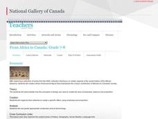
From Africa to Canada
Represent the African diaspora with figurines. Using a discussion on the contributions of people of African descent as inspiration, class members prepare sketches of a figure and put together a small sculpture from those sketches.
National Gallery of Canada
Taken Out of Perspective
Art does not always have to look perfectly realistic. Play with proportion and shape by stretching images. Pupils study works of art by Picasso, Cézanne, and Monet before selecting a photograph to adapt. They use a distorted grid to...
National Gallery of Canada
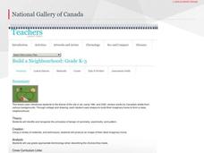
Build a Neighbourhood
What's special about your neighborhood? Build one with your class to find out. Individuals create their dream homes that, when completed, will be placed together around a green space in order to create a neighborhood. Learners also...
EngageNY
Relationships Between Key Scientific Concepts: Planning What Causes Earthquakes
That is ground shaking news! Scholars read Earthquake in multiple reads to determine the gist, identify cause and effect relationships, and understand vocabulary. Learners complete graphic organizers to describe what happens before and...
Curated OER
Map Your State: Regions of Arizona
Fourth graders define vocabulary and locate physical features on maps. In this mapping lesson, 4th graders explore regions of Arizona through landforms found on topographic maps. Students research the history and culture of the...
Curated OER
Geography: Islands and Alcatraz
Students, in groups, create maps of islands including map keys and compass roses. They compare and contrast their island communities with that of the island prison, Alcatraz. Students select from a series of projects, including writing...
Curated OER
Kansas Land
Fourth graders discover the geographic regions of Kansas. In this geography lesson, 4th graders explore the different regions of Kansas and determine how the different geography affects daily life in Kansas.
Curated OER
The Human Face of Flagstaff
Students make a brochure for Flagstaff, Arizona. In this geography lesson, students look at a map of Arizona and the Flagstaff Chamber of Commerce sheet to find natural and human features of the city. They create a brochure describing...
Curated OER
Discovering Prehistoric Trails
Eighth graders examine prehistoric terrain. In this geography lesson, 8th graders discover necessary resources for settlers. Students work in small groups to create a trail crossing the state of Kansas.


