Owl Teacher
Creating a Map to My House
Here is a simple assignment that will introduce your young geographers to location, one of the five themes of geography, through an activity in which they map the directions and lines of latitude/longitude of where they live.
Owl Teacher
Imaginary Nation: Constructing a Map
Your young geographers will combine what they have learned about the five themes of geography and their inner creativity to design a physical map for an imaginary nation.
Curated OER
Designing a Hiking Trail
Put your students' map skills to the test with this engaging cross-curricular project. Given the task of developing new hiking trails for their local community, young cartographers must map out beginner and intermediate...
Fremont Unified School District
4th Grade California Relief Map Project
Bring life to your next California geography lesson with this great project! Learners design a three-dimensional wall relief map of California, painting and decorating regions using a variety of materials and labeling major geographical...
Oregon State
World Map of Plate Boundaries
Young geologists piece together the puzzle of plate tectonics in an earth science lesson. Given a physical map of the world, they search for land formations that indicate the location of different types of plate boundaries.
It's About Time
The Changing Geography of Your Community
Lead your class in exploring their local communities as well as the general environment. As they determine continental distributions by investigating minerals, rocks, and fossils located in their local region, pupils construct...
Big History Project
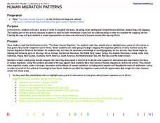
Human Migration Patterns
Humans have been on the move for millennia. Using an article from The Smithsonian, pupils chart human movement before written history on a world map. In addition, they examine the modes of transportation used by different waves of human...
Star Wars in the Classroom
Star Wars Geography Unit
What kind of animals live on an ice planet like Hoth? How would the habitat on Tatooine allow different organisms to thrive? Connect social studies, science, and Star Wars in one engaging activity that focuses on the ecosystems...
Sharp School
Travel Brochure Project
Designing a travel brochure is a classic project that will help your class members develop a variety of skills, such as researching informational texts, designing creative visual products, and communicating what you have learned.
Curated OER
Those Who Have Come Before Me
Class members are transformed into explorers as they work in groups to locate hidden items and map their journey along the way. They then leave clues for other groups of learners to follow, and ultimately discover how past explorations...
Sharp School
Geography Project
This very simple geography project can lead to a lot of useful referential information that can be displayed in your classroom! Learners construct a poster-size map of a country, identifying major demographic points and including pie/bar...
Environmental Education in Wisconsin
Biome Travel Guide
In a perfect marriage of social studies and science, groups work together to research and create a travel guide presentation to share with the class. Not only do kids learn about the climate and geography of a biome, but also the...
NOAA
Why is Hawaii's Ocean Important?
Studying the oceans? Focus on Hawaii's ocean with a resource packed with activity-based worksheets. Everything from products that come from the ocean to the abundance of plants and animals that call the ocean their home, Hawaii's ocean...
National Park Service
News Bearly Fit to Print
There are an average of three human fatalities by bears in North America every year, which is low when you compare it to the 26 killed by dogs and the 90 killed by lightning annually. The lesson encourages researching human-bear...
Curated OER
Create Your Own Country Project
Young scholars demonstrate their knowledge of geography with this fun, collaborative social studies project. Working in small groups, students develop their very own countries, writing descriptions...
Teach Engineering
What's Wrong with the Coordinates at the North Pole?
Here is an activity that merges technology with life skills as individuals use Google Earth to explore the differences between coordinate systems and map projections. The self-guided worksheet is the fourth segment in a nine-part unit....
Scholastic
Owl Moon Teaching Plan
Capture the engagement of young readers with this collection of activities based on Jane Yolen's book, Owl Moon. Following a shared reading of this children's story, the class explores the geography of the American Northeast,...
American Immigration Law Foundation
No Pretty Pictures
Here is a nice set of activities and discussion questions to accompany your class reading of No Pretty Pictures, a memoir of a young girl's experiences and struggle for survival during the Holocaust.
DocsTeach
Lewis and Clark's Expedition to the Complex West
Lewis and Clark's famous expedition is a prime example of the United States' westward expansion. Aspiring historians examine maps from Lewis and Clark's journey, as well as discuss their interactions with Native American tribes. The...
National Geographic
Rescuing, Relocating, and Rehabilitating Wildlife
Bring up the Deepwater Horizon (BP) oil spill that occurred in the Gulf of Mexico in 2010. Display the colorful diagram of the coastal and marine organisms living in the area. Show a video about relocating the eggs of the Gulf's sea...
Mesa Public Schools
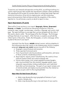
Country Project
Give your young learners the chance to discover more about countries in their world community with a research project. Class members write reports on an assigned country and include such major features as geography, important historical...
Wild BC
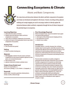
Connecting Ecosystems & Climate
Collaborators sort a set of cards into biotic and abiotic categories. Then, as a class, they discuss their work and relate each of the abiotic components to climate change. Finally, they form a web of components by connecting those that...
California Academy of Science
Which Way is North?
Who needs a compass to find cardinal directions? Just place a stick in the ground and record the movement of its shadow over the course of a day. Then, measure the shadow lengths in order to determine a north-south line. A simple...
Curated OER
3D Textured Globe
The earth, our home planet, and the star of Earth Day celebrations everywhere! Celebrate Earth Day or examine Earth's place in the solar system, with a fun and easy craft, perfect for children nine and up. Paper mache ornaments, paint,...
Other popular searches
- Geography Map Skills Scale
- Geography Map Skills Europe
- Usa Geography Map Skills
- Geography Map Skills Us
- Canada Geography Map Skills
- Map Skills Geography Themes
- Geography Map Skills Ohio
- Map Skills Geography


