Curated OER
Footprints: Take a Step into Estimation
Compare sizes of student footprints with those of elephants and sauropod dinosaurs! Upper graders make estimations of the areas of irregular shapes; students use grids to make and explain estimates within low and high ranges.
Bowland
Outbreak: Infection Detection
Explore the mathematics of infection outbreaks with activities that ask learners to use coordinate grids to locate infected patients. They calculate amounts of ingredients for antidotes and determine which groups of people should be...
Curated OER
Cartography Project
A lesson involving mapping, the use of a compass, writing and following directions, and exploring the first two themes of geography is here for you. Learners create original maps that show the routes they take through their own...
Curated OER
A Contouring We Go
Students examine the built environment and infrastructures of their community by constructing contour equipment, using the equipment, and comparing their results to current topographical maps of the same area
Curated OER
The Unseen Ocean Floor
Students build ocean floor structures, then map and model an unfamiliar ocean floor. They are introduced to bathymetry and sea floor features, and discover one of the most widely usd methods for studying the ocean.
Curated OER
Planet Earth
Pupils explore and analyze data from different maps in order to explain geographic diversity among the continents. Student groups research continents' physical features and examine how they contribute to quality of life for inhabitants.
Curated OER
Earth on the Earth
Fourth graders plot points on a graph and transfer those coordinates onto a large scale model resulting in an outline of the Western Hemisphere. They identify the major geographical landforms of the Western Hemisphere.
Curated OER
Monument Museum
Students design monuments, taking into account what is known about geometric shapes and measuring. Students create a museum complete with monuments and descritions of the monuments. Students provide guides at each monument in order to...
Curated OER
Algebra/Geometry Institute Summer 2007: Graphing Activity
Seventh graders practice identifying coordinates by examining a city map. For this graphing lesson, 7th graders create coordinate directions on an index card and practice locating these locations on a grid. Students read and...
Curated OER
Hurricane Tracking
Students access the Internet to find information on current hurricanes. They get locations, speeds, and air pressures and then plot the location of the hurricane on a hurricane-tracking map. They also access the FEMA website to solve...
Curated OER
Geography Grid
Fourth graders search a database to find images and scan and affix them on an 8-foot long map of the state of Illinois. They then use it as a basis for discussion.
Curated OER
Gridding An Archaeological Site
Students investigate using some of the basic skills of an archaeologist while using a Cartesian coordinate system. They establish a grid system for a dig site and determine the locations for different artifacts. Students use the...
Curated OER
Decimals: Collaborative Lesson
Pupils explore mathematics by participating in a group activity. In this number value lesson, students identify the uses for decimals and how to best estimate whole numbers based on decimals and fractions. Pupils collaborate with...
Curated OER
It's Happening, Where? Find the Absolute and Relative Location of News Articles
Students read newspaper articles. In this social studies lesson, students locate the latitude and longitude of the location where the news article takes place. Students write a summary of the news article.
Curated OER
Coordinating Coordinates
Third graders explore coordinate pairs and coordinate grids. They use a grid on which each letter of the alphabet is assigned a coordinate pair, 3rd graders decipher a coded message. Pupils compare coordinate pairs on a coordinate grid...
Curated OER
Interdisciplinary Unit Planning II
Students create playground maps and identify means of using these maps to enhance social studies learning of elementary students. They develop elementary-level interdisciplinary unit plans using social studies content for the primary...
Curated OER
Seeing What You Cannot See--RADAR
Student imitate mapping the ocean floor using the basic concepts of radar. Then they explain what radar is and how it workds. All of their measurements are recorded on a data sheet. Then the data is entered into a spreadsheet program. A...
Curated OER
Number Types: Where Vocabulary Meets Numbers
Rational, irrational, real, natural. All these words can refer to numbers. Who knew? Learners use the Visual Thesaurus and a semantic feature analysis grid to examine the different attributes of numbers. Step-by-step instructions for...
Curated OER
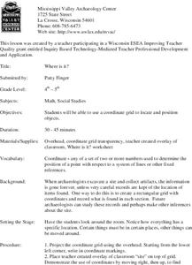
Where is it?
Students use a coordinate grid. They investigate and discuss what caused certain objects to be in specific places. They choose a room in their home to map and place objects in specific locations.
Curated OER
Lewis and Clark: Prized Possessions
Young scholars consider the role of Sacagawea as part of the Corps of Discovery. In this Lewis and Clark expedition lesson, students discover details about Sacagawea's wampum belt and then create their own wampum belts using their...
Curated OER
Sunken Slave Ship
Students investigate shipwrecks. In this marine archaeology instructional activity, students create the site of a shipwreck by using a tub filled with sand and items from a "ship". Students excavate the site and analyze the findings.
Mathematics Assessment Project
Discovering the Pythagorean Theorem
Young mathematicians join the ancient order of the Pythagoreans by completing an assessment task that asks them to find the area of tilted squares on dot paper. They then look at patterns in the squares to develop the...
Curated OER
Plotting A Hurricane Using latitude and Longitude
Students explore map and plotting skills by tracing the movement s of hurricanes through the Earth's systems. a hurricane map is developed from daily media reports.
Curated OER
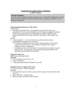
Exploring Wyoming Species Habitats
Students are introduced to the concept of species habitats and ranges. They introduced to ArcView GIS as a tool for mapping. Pupils use query data for species withina county, elevation, range, rivers and streams, land cover, and etc....
