Curated OER
Plotting A Hurricane Using latitude and Longitude
Students explore map and plotting skills by tracing the movement s of hurricanes through the Earth's systems. a hurricane map is developed from daily media reports.
Curated OER
Choose a Number
A quick description of a classroom management technique that allows a teacher to choose participants at random. Assigning grid locations is an easy way to reinforce grid structure as well as giveing an easy way to complete tidying tasks,...
Curated OER
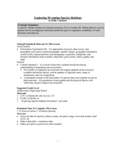
Exploring Wyoming Species Habitats
Students are introduced to the concept of species habitats and ranges. They introduced to ArcView GIS as a tool for mapping. Pupils use query data for species withina county, elevation, range, rivers and streams, land cover, and etc....
Curated OER
The Five Food Groups
Do you eat a balanced diet? Help your learners determine how healthy they are with a fill-in chart that will help them track their food intake. The grid provides color-in stars children can mark when they eat their meats, dairy, fruits,...
Curated OER
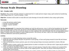
Ocean Scale Drawing
Students explain how to make pictures larger using a grid system by transferring scales images from 1/2 -1 inch to 6 inches - 1 foot. They create life-size scale drawings of ocean life studied in class using a grid system.
Curated OER
SAT Grid Practice Test 11
In this SAT practice test, students compute the area and perimeter of polygons. They determine the volume of a cylinder and solve problems with exponents. This one-page worksheet contains 10 problems. Answers are provided.
Curated OER
Math Grids
Fourth graders read an article, then search for verbs, adverbs, nouns, pronouns, etc. In groups, they exchange papers and try to guess what the other poem was about.
Curated OER
Mixing Complimentary Colors, Tints, and Shades
Students explore primary, secondary, and complimentary colors. They mix tempera paints to create secondary colors, tints, and shades, and design and paint a color grid demonstrating color theory.
Curated OER
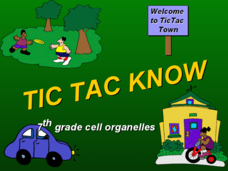
Tic Tac Know: organelles
Tic-Tac-Toe is a game most students will be familiar with. This fun activity prompts students to answer questions about cells organelles in order to place a mark on the grid. There are some non-essential humorous sound effects and...
Curated OER
Finding Important Community Sites
Pupils locate community sites on a city map using the map legend and grid system.
Curated OER
Pacific Atolls and Island Groups
Learners construct, interpret and translate maps and geographic data. Given a worksheet, students identify an island, an atoll, a scale, and a compass rose. Learners grid systems, legends, and symbols. They use the map to find answers to...
Curated OER
Powering a Green Earth
Students compare and contrast renewable and nonrenewable energy. For this environmental science lesson, students discuss the importance of going green. They identify the different components in a power grid system.
Curated OER
2 x 2
Students work together to grid a 2 x 2 meter unit using the formula for the Pythagorean Theorem. After creating the grid, they identify the location of artifacts and create a map of their location. They develop a graph and table of their...
Royal Society of Chemistry
Units of Volume
Did you know in the UK a quart is smaller than in America? This explains why a standard unit of measure is necessary for volume. Young scientists learn the similarities and differences between five different units used to measure volume....
Royal Society of Chemistry
Mass Concentration of Solutions
Ready to teach your class about molar mass and solution concentration? Make time for an interactive resource that will challenge their reasoning and problem-solving skills. Science scholars calculate the molarity of several solutions...
National Security Agency
Go One-on-One with Decimals
Shoot and score with three basketball-themed lessons about decimals. Young mathematicians compare game statistics, make trash can hoops, and play a data spinner game to practice identifying digits and values within decimal numbers.
Mathematics Assessment Project
Printing Tickets
That's the ticket! Pupils write and investigate two linear functions representing the cost of printing tickets. Individuals then determine which of two printing companies would be a better buy.
Curated OER
TE Activity: Nidy-Gridy
Students make a grid and coordinate system map of their classroom as they investigate why it is important to have a common map making system. They look at how landmarks are used for navigating an area.
Curated OER
Got Park? Or if you build it, they will come!
Students use GIS and GPS technology to evaluate, research, locate, and recommend where a new park should be located that benefit the community.
Curated OER
Rearrange the Room
Second graders measure and grid their ideas for the new classroom floor plan. They create their own ideas for the classroom arrangement on grid paper. When they finish, they share their draft plan with their peers and with the teacher...
Curated OER
Favorites
In this favorites worksheet, students complete the grid to organize a list of favorites. The favorite list includes color, fast food, breakfast, dinner, cold drink, TV show, song, movie, movie star, sport, game system, computer game, and...
Curated OER
What Does the Data Tell Us?
Create a grid system for measuring vegetation data while using the geometric concept of position. Complete the gridding, counting, and recording in two student teams. Many Internet sites are listed for the students to use in their...
Curated OER
Traveling aroud Our Town
Learners are asked to describe to a partner how he or she walks to school or the bus stop. They are shown on the overhead an one-inch grid paper, and at the intersection of two lines on the grid paper, students are shown a house and...
Curated OER
Where in the World? :Understanding Latitude and Longitude
Students play a grid-based game and devise clues to help classmates locate spots on the globe in order to recognize the value of using longitude and latitude for identifying locations.
Other popular searches
- Global Grid System
- Grid System Drawing
- Mapping Grid System
- Grid System Art
- Drawing With a Grid System
- Texas Grid System
- Grid System Worksheets
- Map Features Grid Systems
- Map Features "Grid Systems
- Map Features "Grid Systems"
- Alphanumeric Grid Systems


