Curated OER
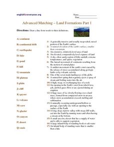
Advanced Matching--Land Formations Part 1
Using this activity, learners could review information they have covered about land forms, such as hills, mountains and plateaus. This 17 question activity could be used with upper elementary or ESL students to test or review information...
Curated OER
Understanding the Water Cycle
Investigate the water cycle and how water moves from the land to the air and back to the land. Create a terrarium and observe the water cycle at work. Define weather terms including evaporation, condensation, and precipitation.
Curated OER
Landforms - Landform Types (Matching)
In this landforms worksheet, students match land forms with their definitions. Students complete 11 matches total on this worksheet.
Curated OER
Landforms of Illinois
Fifth and sixth graders are introduced to the primary landforms of Illinois and discover how they were created. Landform cards are made for each pupil. They use the twenty-questions format until they have identified each one. Then,...
Curated OER
Landform Bingo
Students review landform terms and review fact and opinion. They make fact and opinion statements and play landform BINGO.
Houghton Mifflin Harcourt
Off to Adventure!: English Language Development Lessons (Theme 1)
Give language skills a boost with a series of ESL lessons in an Off to Adventure! themed unit. Using a speak, listen, move, and look routine, scholars enhance proficiency through grand conversation and skills practice....
Curated OER
Landforms and Bodies of Water
A simple worksheet helps your learners with geographic terms. This could be used as a template for future worksheets which have learners identify some geographic terms, then complete an essay about one of the terms.
Curated OER
Salt Relief Map of Virginia
Fourth graders create a salt relief map of the four regions of Virginia. They indentify land forms and bodies of water, and summarize how they made their project.
Curated OER
Over and Through Information Sheet
Eager earth scientists practice using vocabulary related to landforms and bodies of water. On the first page they categorize the terms and form sentences with them. Then, they test their knowledge with twenty-five multiple-choice...
Curated OER
Build a Model Watershed
Collaborative earth science groups create a working model of a watershed. Once it has been developed, you come along and introduce a change in land use, impacting the quality of water throughout their watershed. Model making is an...
Curated OER
Wet Water, Dry Land
Pupils observe and examine relationship between landforms and bodies of water, recognizing differences between them. Students then define island, peninsula, isthmus, archipelago, lake, bay, straight, system of lakes, and identify land...
Curated OER
I Am A Rock, I Am An Island: Describing Landforms and Bodies of Water
Students identify common landforms and bodies of water from descriptions of distinguishing features. For this landforms and bodies of water lesson plan, students describe the features they see in the pictures given to them.
Curated OER
Transportation
Engage in an 8-day study of different modes of transportation. Your students explore the concept of location and define the physical characteristics of places, such as, land forms, bodies of water, natural resources, and weather.
Curated OER
USA: Physical Map
In this United States physical map worksheet, students investigate the major landforms and bodies of water located throughout the country.
Curated OER
Coasts and Reefs: Shallow Marine Processes
A more thorough presentation on coastal systems would be difficult to find! Detailed diagrams illuminate the offshore, shoreface, foreshore, and backshore zones of beach. The sources and movement of sediments along the coastline...
Curated OER
Landforms of Illinois
Young scholars discover the primary landforms of Illinois. They examine how those landforms were formed as well. In groups, they research one of the landforms from their vocabulary list. They create their landform in a shoebox and...
Curated OER
Weather Olympics
Students consider the effects of topography on climate patterns. In this earth science lesson, students research weather patterns and make inferences of how the land forms may create different climates. Students compare Celsius...
Curated OER
The Happy Game: Physical Features
Students love to test their knowledge, use this game to see what your students know about landforms and other basic geographic terminology.
Curated OER
I Love the Mountains
First graders discuss and define different landforms. They read the book "Our Land", sing a landform song and perform it with motions and then complete a worksheet.
Curated OER
Mapping Landforms of South Carolina
Third graders analyze South Carolina maps. In this geography lesson, 3rd graders locate the five land regions in the state are and discuss how the regions are different. Students identify the major bodies of water and analyze how...
Curated OER
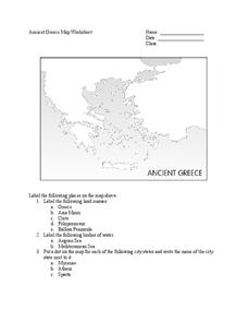
Ancient Greece Map Worksheet
Since the beginning of time, geography has shaped the development of human civilization, and ancient Greece is no exception. This activity supports young historians with exploring this relationship as they first identify key land masses,...
Curated OER
Explore Surface Types on a Journey Around Earth
Students explore satellite data. In this technology cross-curriculum math and world geography lesson, students locate specific map areas using a microset of satellite data. Students use technology and math skills to determine percentages...
Curated OER
War of 1812
Eighth graders locate the major land forms and bodies of water on a map of Louisiana. In groups, they discuss the role of the Mississippi River in the Battle of New Orleans and how land and water affect the outcome of battles. To end...
Curated OER
Map Skills
Students create two types of maps. In this map skills lesson, students discuss map vocabulary and view maps of Florida. Students draw a free hand map of Florida and include major cities, bodies of water and land forms. ...
