Curated OER
Student Tracking
Here is an interesting lesson plan on satellite tracking. Learners use various tracking techniques to find out where they go on a daily basis, what the environmental conditions are, and what they are doing during their "migrations." A...
Curated OER
The Landscape of a Novel
Students, after reading a novel, utilize geographic skills to map out the places described in the novel. They collect data, envision spatial features and then design a map to work off of to complete their assignment. Each student also...
Curated OER
Plotting Earthquakes
Students plot earthquakes on a map. In this lesson on earthquakes, students will explore recent earthquake activity in California and Nevada. Students will plot fault lines and earthquake occurrences on a map.
Curated OER
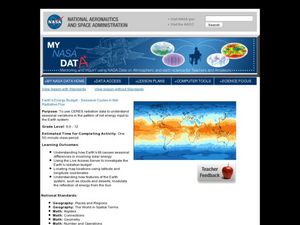
Earth's Energy Budget - Seasonal Cycles in Net Radiative Flux
Young scholars attempt to understand seasonal variation by viewing images of the energy received by the earth. In this weather lesson, students view images from NASA of the influx of energy from the sun and make predictions about...
Curated OER
Cold, Clouds, and Snowflakes
Students explore satellite data and graphing. In this weather data analysis math and science lesson, students analyze NASA satellite data to draw conclusions about geographical areas where precipitation might have happened. Students...
Curated OER
Differences Between Ground and Air Temperatures
Students examine the differences between air temperature and ground temperature. In this investigative lesson plan students find NASA data on the Internet and use it to create a graph.
Curated OER
Is Grandpa Right, Were Winters Colder When He Was a Boy?
Middle schoolers compare current weather data to historic data to see if there is a temperature change. In this weather activity students complete a lab activity and determine average changes in temperature, precipitation and cloud...
Curated OER
Radiation Comparison Before and After 9-11
Using the NASA website, class members try to determine if changes could be detected in cloud cover, temperature, and/or radiation measurements due to the lack of contrails that resulted from the halt in air traffic after the attacks...
Curated OER
Seasons Worksheet #1
First, your earth science pupils determine what season is depicted in a diagram of the tilted Earth as it receives radiation from the sun. They answer multiple choice questions about occurrences at different points on Earth in the...
Discovery Education
Physical Oceanography and Meteorology, Navy Search and Rescue Operation
It's an ocean rescue mission! Groups must find a pilot downed off the coast of the Chesapeake Bay. Rescuers must determine the distance needed to travel as well as the heading to get to the pilot's last known position. Taking...
Teach Engineering
Air Pollution in the Pacific Northwest
Scholars investigate levels of nitrogen dioxide in the Pacific Northwest by examining the role of nitrogen in air pollution and how remote sensing can be used to measure nitrogen levels. An Excel spreadsheet calculates the difference...
University of Southern California
What's the Catch?
There must be a catch! A comprehensive lesson looks at ocean fishing concerns through a set of five hands-on activities. Learners become aware of the risks of seafood contamination and factors that have affected the ocean environment.
Geography for Geographers
Five Themes of Iceland
How do the five themes of geography relate to the country of Iceland? Pupils learn about everything from the differences between relative and absolute location to how humans both adapt and change the environment. The presentation...
Curated OER
Reading Contour Maps
Students examine contour maps and bathymetry maps and discover how to interpret a contour map of the East Pacific Rise. Students look at a map as a class and answer questions together before working independently on a map of the East...
Curated OER
Graphing on a Coordinate Plane
Eighth graders explore the coordinate system. They identify the x and y-axis, parts of the coordinate plane, and discuss the process of plotting points. To emphasize the process of plotting points, 8th graders play an ordered pair...
Curated OER
Make Your Own "Weather" Map
Students develop and apply a variety of strategies to solve problems, with an emphasis on multi-step and non-routine problems. They acquire confidence in using mathematics meaningfully.
Curated OER
Where In The World Is Bermuda?
Students locate the Island of Bermuda, and identify its absolute and relative location.
Curated OER
Measure for Measure: Lengths and Heights
Students explore measuring tools by calculating heights and lengths of random objects. In this distance measurement lesson, students utilize the Internet service MapQuest to measure the distance between their current towns and many other...
Curated OER
Muppet Treasure Island
Young scholars watch the movie "Muppet Treasure Island" and then taking on roles of characters in the movie answer navigational questions to try discover the location of a treasure hidden by the teacher.
Curated OER
5 Themes Awareness of Current Event Issues
Young scholars identify the 5 themes of geography as being location, place, human-environmental interaction, movement and region. They explain a current event from the perspective of each theme and their interrelationship..
Curated OER
An Adventure to the New World
Fifth graders role play the position of an explorer traveling to the new world. They research the explorers journey and create their own explorer's notebook. They complete different activities and then present their evidence to the class.
Curated OER
Who Was Charles Darwin?
Students research the life of Charles Darwin and his voyage on the Beagle.
Curated OER
5 Themes Awareness of Current Event Issues
Students analyze newspaper articles for the 5 themes of geography. They create a colorful portfolio explaining how each theme: location, place, etc. is relevant in a chosen current event.
Curated OER
Plates on the Move
Students explore how Africa appears to be tearing apart from Asia and tha the other continents are moving and oceans are changing size.
Other popular searches
- Latitude and Longitude
- Latitude Longitude
- Latitude and Longitude Games
- Latitude & Longitude
- Latitude and Longitude Maps
- Longitude and Latitude Game
- Longitude and Latitude Math
- Geography Latitude Longitude
- Whaling Latitude Longitude
- Longitude Latitude Minutes
- Longitude and Latitude Lines
- Volcano Latitude Longitude


