Shaker Junior High School Library Media Center
WWII Project Outline
Work together as a class and get to know the ins and outs of World War II with this engaging collaborative project. Class members are broken into groups to research particular war topics, from life on the home front to the Holocaust and...
Curated OER
The Personal Concept Map
There are lots of details that make you who you are! Illustrate what those details are with a personal concept map project. After learners view a step-by-step presentation, the follow a rubric to complete a concept map about themselves.
American Museum of Natural History
Map Your Own World
Young archaeologists practice their mapping skills by creating a detailed site map of their room or another room in their home. After indicating walls, windows, doors, and closets, they add furniture and objects, labeling each item.
DiscoverE
LIDAR: Mapping with Lasers
We would be lost without maps! How are they made? Introduce junior topographers to LIDAR technology with a fascinating activity. Set up a mock city, then have learners operate a laser measure to determine the shape of the landscape using...
Teach Engineering
What's Wrong with the Coordinates at the North Pole?
Here is an activity that merges technology with life skills as individuals use Google Earth to explore the differences between coordinate systems and map projections. The self-guided activity is the fourth segment in a nine-part unit....
Owl Teacher
Creating a Map to My House
Here is a simple assignment that will introduce your young geographers to location, one of the five themes of geography, through an activity in which they map the directions and lines of latitude/longitude of where they live.
PBS
Map a Model Solar System
Creating a solar system map is a snap thanks to a hands-on activity! Science scholars explore the solar system by building it wherever they choose during an interactive from PBS's Space series. Users pick both the location and scale for...
Teach Engineering
Using Map Scales to Figure Distances and Areas
The asteroid is getting closer and the question is whether the state of Alabraska is large enough for the shelter calculated in the previous activity. Teams determine the scale of their project and then use the scale on the map to...
ReadWriteThink
Concept Map
When you think of one topic, related ideas and details invariably follow. That's concept mapping! Jot down ideas with a straightforward graphic organizer that works both electronically and as a printed resource.
Howard Hughes Medical Institute
Gorongosa: Making Observations Activity
Do you have young scientists wanting to make new discoveries rather than just completing the same experiments? Young scientists use their observational skills to identify animals and patterns in animal behavior. Through tracking...
Curated OER
Project Organizer: Follow an Explorer
This is both a great idea and a great way to help your class organize a themed project. They use these worksheets to assist them in writing a creative historical narrative about the life and travels of an explorer. They'll compare and...
Owl Teacher
Introduction to World of Geography Test
Assess your learners on the five themes of geography and the most important key terms and concepts from an introductory geography unit. Here you'll find an assessment with 15 fill-in-the-blank and 14 multiple-choice questions, sections...
Curated OER
Maps and the Pictures in Our Heads
Geographers of all ages examine different types of maps. They draw maps of their environment, utilizing both three-dimensional and picture maps. They interpret map information, noting how it can sometimes be misleading. Some good...
Kate Stickley
Reading the World: Latitude and Longitude Lesson latitude and longitude, maps, coordinates on a map, prime meridian, reading maps, equator, globes
Find five activities all about longitude and latitude! Use oranges to show the equator and prime meridian, plot birthdays on a map using coordinates, and plan a dream vacation.
Curated OER
CSI Interdisciplinary Projects
Work across content areas with an engaging project that highlights higher-level thinking, teamwork, and a STEM focus.
Curated OER
Isolines on a Weather Map
Ninth graders recognize isolines on a weather map and draw isolines based on temperature data on a weather map. They draw isotherms on a weather map to identify temperature patterns.
Curated OER
How To Make a Science Concept Map
Here is a clever way to get your pupils thinking about a science topic they'd like to research for a report, or a project they'd like to do for a science fair. The three-step process is easy to follow, and it really should help your...
Weebly
Liberty Theme Park Project
Invite your young historians to demonstrate how the American Revolution truly was one crazy ride after another as they design a theme park! This unique and engaging project prompts learners to consider major events leading up to and...
Curated OER
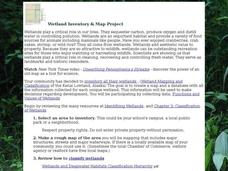
Wetland Inventory and Map Project
In this wetlands inventory and map project worksheet, students do research on the wetlands and complete a map project about it. Students follow 6 sets of directions with Internet links.
Curated OER
World Projections
Students identify map projections and examine polar maps. In this map skills lesson, students use a flat world map to identify various projections and calculate the distances between locations by using a map scale.
Curated OER
State or Region Project
Invite your youngsters to learn about a state or region through their choice of a creative project. The resource lists 15 project options that range from a 3-D map of the area, to a puppet show about the region. Pupils can also propose...
Curated OER
The Global Grapefruit - Maps vs Globes
Students tell how maps differ from globes, state some characteristics of 3 different types of map projections, and realize that distortions are inherent in various systems of map projections.
Curated OER
Exploring Maps: Lesson 2 Guide: Navigation
Students explore and examine how maps have been used in navigation. They research how travelers collected observations to keep track of their positions and plotted information on maps. Each student then makes a Mercator projection...
Curated OER
European Explorers: Research Project
What will your students choose to include in their explorer's treasure chest? Youngsters research an early European explorer and gather items to reflect their research, such as a detailed map of the explorer's voyages, portrait,...

