Annenberg Foundation
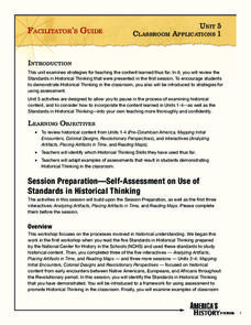
America's History in the Making: Classroom Applications One
Someone finds a time capsule 100 years from now, and it includes your family photo album. What would the photos tell that person about you and your place in history? Scholars investigate how artifacts tell stories. Using photos, maps,...
PBS
Arthur Compass Rose
Keep your class headed in the right direction with this printable compass rose. Large and easy to read with a smiling picture of Arthur in the middle, this resource would make a fun addition to the desk of any primary grade...
Office of the New Jersey State Climatologist
Play Ball! – Or Not…Making a Decision Using Weather Data
Should the game go on or not? An engaging lesson plan asks small groups to make a decision using weather data. After analyzing a map, an updated forecast, and radar information, groups have to decide whether to cancel a baseball game....
Curated OER
Lewis and Clark
Students investigate Lewis and Clark. In this Lewis and Clark lesson, students search the Internet for information about Lewis and Clark and the Corps of Discovery. Students use maps to understand the explorations and decide which...
Curated OER
Literature Study Guide: Siddhartha
Though this book report form is labeled Siddhartha, the multiple-page format would work for any novel you are reading in class. Complete with a reading schedule, a summary page, a list of generic literature response questions, and a list...
Curated OER
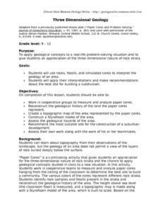
Three Dimensional Geology
Here is a fine lesson plan on geology designed for high schoolers. Learners use rocks, fossils, and other geological clues to determine the geology of an area. Then, they make recommendations to a fictitious city council about the...
Curated OER
Regents High School Examination: Physical Setting Earth Science 2008
Throughout this earth science exam, high-school geologists complete a series of multiple choice and short answer questions about the solar system, atmosphere, and earth system. This is an amazing test, as are all of the exams developed...
Curated OER
Great Lakes Homepage for Kids
Here are some outstanding lessons on the geology and history of the Great Lakes. These lessons are divided into Grade 4 -6, and Grade 7 - 8 activities. The activities all use the background information, maps, graphs, data, and Great...
Curated OER
Map It!
Fourth graders demonstrate map making skills by using the computer to create maps of the geographic features, regions, and economy for their state.
University of Florida
Sailing to St. Augustine
Using a Florida map from 1597, young explorers consider the physical characteristics they would need in a site for a new colony and the resources they would need to survive. After selecting a site, class members research to discover the...
Radford University
Escape from the Zombie Apocalypse - Exploring Quadrilaterals through Google Maps and Google Earth
Prepare for the zombie apocalypse ... by studying quadrilaterals? Given a map of an imaginary town, scholars identify quadrilaterals created by streets. They then use Google Earth and Google Maps to find parallelograms, rectangles,...
CK-12 Foundation
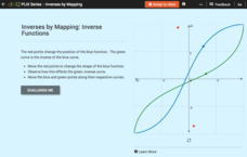
Inverses by Mapping: Inverse Functions
Map your way to successfully understanding inverse functions. Pupils use an interactive map to investigate how changes in the graph of a function affect the graph of its inverse. The results of the activity lead to the conclusion that...
Just Health Action
Environmental Justice Matters: Mapping Cumulative Impacts (Part 2)
A case study enables class members to confirm whether different geographic parts of Seattle, Washington have disproportionate environmental burdens and benefits. Groups use the EPA's Cumulative Health Impact Analysis formula and...
Curated OER
Why All Maps Lie
Eighth graders discover the fundamental advantages/disadvantages of both maps and globes. They see that maps may distort size, shape, distance and direction. They discuss the advantages and applications of 5 types of map projections and...
Curated OER
From Maps to Models
Students explore watersheds through the use of a topographic map. They observe topographical maps and discuss their characteristics. In groups, students create a model clay island and make a topographical map of it. Afterward, groups...
Curated OER
Make a Classroom Map
Students map the items in their classroom to explain the importance of coordinate systems.
Curated OER
Maps and Globes
First graders complete a unit on map skills and the globe. They label maps, create a styrofoam ball globe, create a map of their community, sing a continent song, and complete a map and globe assessment worksheet.
Curated OER
Let's Build a Map
Students gain an understanding of maps while studying the map of the Louisiana Purchase and the trail of Lewis and Clark and the Corps of Discovery. They demonstrate understanding of maps by creating a basic classroom map.
Curated OER
Map Skills
Students create two types of maps. In this map skills lesson, students discuss map vocabulary and view maps of Florida. Students draw a free hand map of Florida and include major cities, bodies of water and land forms. ...
Curated OER
Mapping National and Geographic Identity
Learners analyze geographic maps. In this map analysis lesson, students analyze the symbols in geographic maps and the impact of cultural, historical, and political concepts. Learners compare and contrast maps in various mediums by...
Curated OER
Map of Ship Trap Island
Students read the short story "The Most Dangerous Game," and create maps of Ship Trap Island and justify why items are placed on their map in certain locations.
Curated OER
Introduction to Field Mapping with a Compass and Pace
Students practice using compass and calibrate their own pace, take field measurements of pre-set course with compass and pace, convert measurements into map, using angles and vectors, and make composite class map by adjusting different...
Curated OER
North Carolina Salt Dough Map Social Studies Project
In this lesson, North Carolina Salt Dough Map, 4th graders create a salt dough map of North Carolina, Students use dough to form the shape of the state of North Carolina. Students label the three regions of North Carolina and all of...
Curated OER
Weather Map Challenge
In this weather learning exercise students use a weather map to answer given questions. Kids answer questions using map symbols and make predictions based on map. Students create additional questions with answers using the same map.
Other popular searches
- Making Maps Geography
- Making Maps and Research
- Making Maps Using Technology
- Making Maps of History
- China, Making Maps
- Making Maps of Community
- Reading Making Maps
- Neigborhoods and Making Maps
- Making Maps Lesson Plans
- Making Maps Usign Technology
- China Making Maps
- Neighborhoods and Making Maps


