Curated OER
The Personal Concept Map
There are lots of details that make you who you are! Illustrate what those details are with a personal concept map project. After learners view a step-by-step presentation, the follow a rubric to complete a concept map about themselves.
Curated OER
How To Make a Science Concept Map
Here is a clever way to get your pupils thinking about a science topic they'd like to research for a report, or a project they'd like to do for a science fair. The three-step process is easy to follow, and it really should help your...
Curated OER
Baseball Challenge: Social Studies TCAP
Using a baseball theme, this presentation provides a review of social studies topics covered in sixth grade. Students play a game in which they score based on the answers to various questions involving Ancient Rome, Ancient Greece, map...
Curated OER
Weather
Here is a comprehensive and colorful collection of slides to introduce 4th - 8th graders to all things weather-related. The factors that contribute to weather are defined, types of clouds and the related conditions are explained, air...
Rainforest Alliance
Knowing the Essential Elements of a Habitat
To gain insight into the many different types of habitats, individuals must first get to know their own. Here, scholars explore their school environment, draw a map, compare and contrast their surroundings to larger ones. They then...
Curated OER
Acadiana Map (Map of Acadians in Louisiana) PowerPoint Slide
Is your class studying the state of Louisiana? This slide provides a good visual of Acadiana Louisiana, or as it is otherwise known; the Historic Cajun Country. The 22 parishes that make up this French-influenced region are numbered on...
Curated OER
Science Jeopardy - The Earth Sciences
The earth sciences are the focus for this Jeopardy-style review game. Categories include geology, space, scientific investigation, meteorology, and oceanography. Diagrams and pictures are involved with most of the questions, making this...
Curated OER
States and Capitals
This map skills PowerPoint features an interactive states and capitals game. The object of the game is to identify the capital cities of each of the 50 states. The excellent presentation includes United States maps, game directions, and...
Compton Unified School District
How Can We Locate Places?
How can we locate places? Maps, of course! Expose second graders to the tools available in maps and discuss how these tools can help people find locations. Students also look at communities, including what makes a community and the...
University of Washington
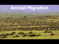
Animal Migration
Here is a unique resource to use with middle and high schoolers that deals with animal migration. Viewers discover the reasons for, types of, and animals that practice this behavioral adaptation. Specific animals that are introduced...
Curated OER
Practical GPS Applications in Forestry & Agriculture
An explanation of the Global Positioning System (GPS) and the Geographic Information System (GIS) is given in this presentation. Uses and applications are considered. How it works and sources of error are also touched upon. A large...
Mathematics Assessment Project
Modeling Motion: Rolling Cups
Connect the size of a rolling cup to the size of circle it makes. Pupils view videos of cups of different sizes rolling in a circle. Using the videos and additional data, they attempt to determine a relationship between cup...
Curated OER
First Grade Visits...Washington DC
Take your first graders on a virtual trip to around Washington, DC. This presentation provides illustrated slides featuring a map showing the location of Washington, DC, the White House, and some of the more famous memorials and...
Curated OER
Informational Text Features
How can you tell if the text you're reading is informational or narrative? Show your reading class this basic PowerPoint to illustrate the characteristics of an informational text. What makes this presentation especially effective is...
Curated OER
Baseball Challenge - Basic Geography Skills
A fabulous presentation/activity based on geography. The author has designed a "baseball game" where batters advance to the next base if they correctly answer a multiple choice question about geography. Geographic terms are used, along...
Curated OER
Global Studies I: Rise of Civilizations
Providing a list of presentations on a variety of topics focused on the development of civilizations throughout the world, this resource could be used in both an upper elementary or high school class. A few important topics covered are...
Curated OER
The American Revolution: 1775 - 1783
Track the ins and outs and wartime strategies used by both the British and the Americans during the Revolutionary War. Multiple comparisons are made between both factions, maps, statistical data, images, and light text is used throughout...
Curated OER
Domain and Range
Relations, and functions, and line tests, oh my! An instructional slideshow demonstrates the definitions of a relation, a function, and the domain and range of a relation. Viewers then learn how to use mappings and vertical...
Curated OER
World War II
Offering a comprehensive overview of the beginning of World War II, this resource could be a useful addition to a unit on this topic. It could be used as a way to lead a discussion on the war, or as a review tool before a test. Either...
Maths Revisions
Scaled Drawings
Your carpenters will enjoy learning scaled drawing techniques and applying their new knowledge to make some real-life scale drawings of gardens. Your carpenter scholars will be reviewing some basic skills in a warm-up section of problems...
Curated OER
South Carolina Jeopardy
One of the better PowerPoints I've come across is a "Jeopardy"-style game whose focus is South Carolina. Some excellent photographs and maps make the slides especially good. The "Final Jeopardy" clue is especially challenging. An...
Curated OER
The Settlement of New England
A thorough exploration of the Puritan Migration and settlement of Plymouth, this presentation is sure to engage your young historians with its clear maps and historical documents. The presentation differentiates the philosophies of...
Curated OER
The Wars of Religion (1560s-1648)
Providing the details of different religious wars in 16th - 17th century Europe, this presentation includes pictures and maps to help contextualize these important events. The last slide prompts viewers to answer a question about the...
Curated OER
The Geography & Peoples of Europe
Extremely throrough and informative, this presentation details many aspects of European geography and demographics, including natural resources, climate, topography, and population distribution. This slideshow would be an excellent...
Other popular searches
- Making Maps Geography
- Making Maps and Research
- Making Maps Using Technology
- Making Maps of History
- China, Making Maps
- Making Maps of Community
- Reading Making Maps
- Neigborhoods and Making Maps
- Making Maps Lesson Plans
- Making Maps Usign Technology
- China Making Maps
- Neighborhoods and Making Maps
