Curated OER
Understanding a Geological Map
Students identify different types of maps and observe a geological map. In this geology lesson students create a replica map of a geological area that includes a key.
Curated OER
Geologic Mapping I
Students create a geologic map and cross-section of an area of horizontal sedimentary rocks, exposed in several locations. Map must include a complete key or legend with rock descriptions of the various formations.
Curated OER
MAPPING THE TOPOGRAPHY OF UNKNOWN SURFACES
Students describe in words and graphic displays the elevation or depression profile of sections of Mars' Olympus Mons and/or Valles Marineris. They explain how orbiting spacecraft build up global maps one data slice at a time.
Curated OER
Continents and Oceans on the Move
Students create an awareness of the vast percentage of water covering the earth. They relate similarities/differences between topographical maps and other maps of various time periods. Students examine how to use a topographical map.
It's About Time
Volcanic Hazards: Flows
Did you know the largest volcano in our solar system is on Mars? Young scholars measure and experiment with how to predict lava and mud flows. This knowledge leads to better evacuation, safety, and preventative methods.
Curated OER
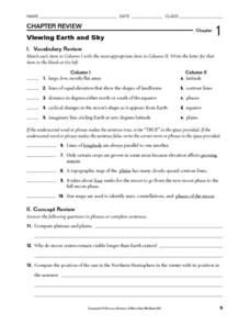
Viewing Earth and Sky
In this earth and sky worksheet, learners review terms associated with map reading. Students also review topographic maps and how contour lines represent elevation. This worksheet has 5 matching, 5 true or false, 5 fill in the blank, and...
Curated OER
Playdoh Mountains
In this mountain building activity, students use playdoh to create mountain features. They cut apart the mountain and then use the pieces to create a topo graphic map of their mountain.
Curated OER
River Study
Students study physical features of a local stream. They study how to identify water features on topographic maps.
Curated OER
Where are the Watersheds in San Francisco?
Students create a mental map of San Francisco. They compare it with actual topographical maps of the city. Then they label various locations on the San Francisco Hillshade map and locate watershed boundaries.
Curated OER
Topo Triangulation
Middle schoolers investigate how to read a topographical map and triangulate with just a map. They convert a compass measurement to a protractor measurement, reverse a bearing direction, and using a worksheet take a bearing of certain...
Curated OER
Siting Wind Power
Students analyze a variety of curves that describe the power extracted from the wind by a variety of commercially produced wind turbines. They utilize site specific topographic maps and political boundary data to evaluate and make...
Curated OER
Tracking Pollution - A Hazardous Whodunit
Students read a story problem about the issue of hazardous waste and pollution in a fictional town. In groups, they create a topographical map and predict how the water might flow and determine the place of contamination. To end the...
Curated OER
Stranded along the Coast
Young scholars plot stranding sites onto a map using latitude and longitude as well as compass directions with respect to coastal features. They identify several species of marine animals that might become stranded; distinguish their...
Curated OER
Virtual Geologic Field Trip to Griffith Park
Students explore the geological processes and research methodology involved in the evolution and development of Griffith Park. They justify the selection of a geologic hypothesis based on observations.
Curated OER
Park Brochures
Sixth graders investigate natural environments by researching national parks. In this brochure making lesson plan, 6th graders explore a specific national park and research it's information by utilizing the web. Students create travel...
Curated OER
The Marsh Land as a Changing Environment
Sixth graders continue their examination of the state of Connecticut. After taking a field trip, they identify the types of birds, plants, invertebrates and vertebrates who make their home in the salt marshes. In groups, they identify...
Curated OER
Build a Model Watershed
Collaborative earth science groups create a working model of a watershed. Once it has been developed, you come along and introduce a change in land use, impacting the quality of water throughout their watershed. Model making is an...
Curated OER
World Climate Growing Zones
Students create a map showing where crops would be grown around the world. In this crops lesson plan, students show how the world climate would produce different parts of the world at different times. Students fill out worksheets.
Science Matters
Slip Sliding Along
The San Andreas Fault is the largest earthquake-producing fault in California. In the seventh instructional activity in the 20 part series, pupils create maps of California, focusing on the San Andreas Fault system. The comparison of...
Curated OER
Plotting the Ocean Floor
Fourth graders plot points on a graph, connect the dots to make the ocean floor profile and label the topographical features. They utilize a worksheet and a website imbedded in this plan to plot the ocean floor.
Curated OER
Backwards Goes It Does
Students create a three-dimensional model of the Chicago river watershed to determine the flow of the river at its mouth. They use prepared clear gelatin and topographic maps to discover that the building of canals actually reversed the...
Curated OER
Geography: examining the Glacial Features of Cape Cod
Students examine satellite images of the glacial features of Cape Cod. They analyze where human activity is located in terms of those features. Students make models of the features, including kettle holes. They also use contour maps...
Curated OER
The Solution to Pollution is Dilution
Students consider what happens to herbicides or insecticides that are used in agricultural practices, especially herbicides that are used to control noxious weeds. They become acquaint with a chemical assessment method known as...
Science Matters
Seismic Activity and California Landforms
By the 19th lesson in the 20-part series, scholars realize volcanoes and earthquakes are related to plate boundaries. The lesson extends and applies the knowledge by having individuals create a bumper sticker for one specific area of...


