Curated OER
Unit II Worksheet 4 - Constant Velocity/Motion Maps
This is a smart approach to displacement concepts. Physics learners analyze a motion map and then draw qualitative graphs for time versus displacement and time versus velocity. Get your class thinking critically through the use of a very...
Houghton Mifflin Harcourt
Core Analysis Frame: Fiction
Dig into any piece of fiction with a series of analysis questions. There are two levels of questions provided: basic and in-depth. The basic questions can be copied double-sided onto a single piece of paper, while the in-depth questions...
Curated OER
Written Document Analysis
In this primary source analysis worksheet, students examine types of written documents and respond to 6 analysis questions about them.
Just Health Action
Environmental Justice Matters: Mapping Cumulative Impacts (Part 2)
A case study enables class members to confirm whether different geographic parts of Seattle, Washington have disproportionate environmental burdens and benefits. Groups use the EPA's Cumulative Health Impact Analysis formula and...
Teach Engineering
Where Are the Plastics Near Me? (Mapping the Data)
The last activity in a nine-part series has teams create a Google Earth map using the data they collected during a field trip. Using the map, groups analyze the results and make adjustments to the map to reflect their analysis. A short...
California Academy of Science
California's Climate
The United States is a large country with many different climates. Graph and analyze temperature and rainfall data for Sacramento and Washington DC as you teach your class about the characteristics of Mediterranean climates. Discuss the...
Curated OER
Mapping Perceptions
Students create and read maps. In this map skills lesson, students draw a map of their neighborhood, then use skills acquired during map-making to interpret a classmates map and a map of the Ming Dynasty.
Curated OER
Way to Go! Create a Road Map Game
Students create a travel game of one of the United States. They research a state of their choice and create a travel game using a common road map. They interpret map symbols as they calculate map mileage for their games. They create...
Tennessee State Museum
An Emancipation Proclamation Map Lesson
Did the Emancipation Proclamation free all slaves during the Civil War? Why was it written, and what were its immediate and long-term effects? After reading primary source materials, constructing political maps representing information...
Curated OER
Map It Out
Explore how illustrations add to a story. Young learners will look at picture books to see how the pictures tell the story. They create illustrations to go with a chosen story, and then flip the activity so they have to write a story to...
Curated OER
Matrix Analysis of Networks
Explore the connection between a finite graph, a directed graph, and a matrix. Graph lines and identify the relationship of matrices in real-world scenarios. Then use this information to work with a partner to plan and design a town...
National WWII Museum
On Leave in Paris: Maps as Primary Sources
Primary sources—even those that seem mundane—offer a window into those who experienced history. Using a Red Cross map offered to soldiers stationed in Paris after World War II alongside worksheet questions, scholars consider what life...
Curated OER
Eastern European Studies
One worksheet, three projects. Learners explore Eastern Europe and mark Eastern European countries on a map. They then collect and record census data on thirteen different countries, and write a 3-5 page expository essay on one of the...
NASA
Erosion and Landslides
A professional-quality PowerPoint, which includes links to footage of actual landslides in action, opens this moving lesson. Viewers learn what conditions lead to erosion and land giving way. They simulate landslides with a variety of...
Curated OER
Teaching With Documents: U.S. Constitution Workshop
What does it mean to be American? Explore the constitution and what it really means to be a citizen here. First, learners of all ages will investigate different primary source documents. Then, they establish each document's...
Curated OER
Mt. Whitney to Death Valley
This is an intriguing problem that brings together real-world data, technology, and mathematical problem solving. If visibility wasn't an issue, could you see from the highest point in the lower 48 states, Mt. Whitney, to the lowest...
Curated OER
Elena by Diane Stanley
This story is bound to motivate your class. Learners read a story called Elena by Diane Stanley. The story is about a young woman who marries for love but is soon widowed during the Mexican Revolution. She takes her children to...
Curated OER
1492: Using Data to Explain a Journey
Young scholars examine how Christopher Columbus made his way across the Atlantic. In this data instructional activity students use an Internet program to navigate like Columbus.
Curated OER
Holocaust Map Studies
Students analyze maps and answer discussion questions related to WWI. In this geography lesson, students analyze historic maps to determine causes and effects of WWI in Europe. Students read testimonies of Holocaust survivors and label...
Curated OER
Cold, Clouds, and Snowflakes
Students explore satellite data and graphing. In this weather data analysis math and science lesson, students analyze NASA satellite data to draw conclusions about geographical areas where precipitation might have happened. Students...
Curated OER
Finding Your Way Around the World
Students plan a trip around the world and create a PowerPoint presentation of the journey. In this map, atlas, and technology instructional activity, students plan a trip around the world in which they avoid using an airplane. Students...
Columbus City Schools
Thinking Like A Soil Scientist
Ready to roll up those sleeves and get your hands dirty? Dirty with soil science content, that is! Overcome those "But it's just dirt" objections with a trip outside to collect soil samples for some in-class analysis. Use the variety of...
Big History Project
Human Migration Patterns II
While humans have always been on the move, the period between 1400 and 1800 saw vast migrations of people between the East and the West. These migrations—whether through slavery or a desire to colonize new lands—shaped the modern world....
Howard Hughes Medical Institute
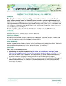
Lactase Persistence: Evidence for Selection
What's the link between lactase persistence and dairy farming? Biology scholars analyze data to find evidence of the connection, then relate this to human adaptation. Working individually and in small groups, learners view short video...
Other popular searches
- Weather Map Analysis
- Gis Data Map
- Gus Data Map
- Map Data Layer
- Interpreting Map Data
- Interpret Ting Map Data
- Interpretting Map Data
- Gs Data Map


