Curated OER
Regions of South America
Students explore facts about South America in the four lessons of this unit. Booklets are created from the materials produced as the class delves into the topic.
Curated OER
Capitals, Oceans, And Border States
Students investigate geography by completing games with classmates. In this United States of America lesson, students examine a map of North America and identify the borders of Mexico and Canada as well as the Pacific and Atlantic....
Curated OER
Spanish Influence in America
Students try out instruments from South America. In this multiculturalism lesson, students discuss the attributes of Latin American music and play instruments from South America.
Curated OER
World Map Labels
In this geography skills worksheet, students identify the countries and bodies of water labelled on the maps of the world, Africa, Asia, Canada, Europe, the Caribbean, the Middle East, North America, Australia, and South America.
Curated OER
Cacao Tree Geography
Students use a map to learn about where chocolate comes from. In this lesson on the cacao tree, students locate various regions where the cacao tree grows. They will discuss why the cacao tree grows more favorably in particular climates...
World Maps Online
Introduction to the World Map
Students identify the differences between maps and globes. In this map skills instructional activity, students are shown a globe and a map and recognize the differences. Students use post-it notes to locate several locations on the world...
Curated OER
Geography Concepts
Sixth graders use the five themes of geography and geographic tools to answer geographic questions and analyze geographic concepts. This unit focuses on an introduction to South America. The history, people and cultures is included.
Curated OER
Contour Map Worksheet #2
Following a contour map of a hill, a stream, and the ocean, are five multiple choice questions. Earth science enthusiasts determine elevation, direction of water flow, distance, and steepness. They also match the map to a selection of...
Curriculum Corner
Earth Day Book
This Earth Day, celebrate our beautiful planet with an activity book that challenges scholars to show off their map skills, complete a crossword puzzle, write acrostic poems, alphabetize, and reflect on their personal Earth-friendly habits.
Global Oneness Project
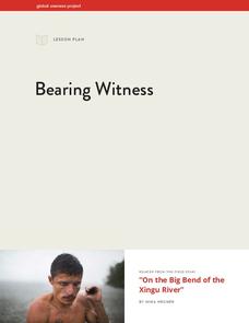
Bearing Witness
A controversial construction project in South America, the Belo Monte dam, is endangering local cultures, ecosystems, and communities. High schoolers create a concept map based on an online article they read before engaging in...
Curated OER
Agriculture: It Doesn't Just Happen
After reading an informational text on the Agricultural Research Service, learners research the role of the ARS in Oklahoma. Using reputable online sources, they label a map of the state with relevant areas. Researchers focus on one of...
Curated OER
Map Creation
Second graders identify a map, symbol, key, and compass rose. Students create and print a map for teacher evaluation using the computer. Students identify the symbols on their map and orally present them to the class.
Curated OER
Equator, North Pole, and South Pole
Students identify the Equator, North Pole, and South Pole on the globe. In this map skills lesson, students use a globe marker to locate specific locations on the globe. Students find where they live in relation to the Equator.
Curated OER
Africa Capitals Map Quiz
For this online interactive geography quiz worksheet, students examine the map that includes 53 African countries. Students match the names of the countries to the appropriate locations.
Curated OER
HEALTH AND BEHAVIORAL STUDIES
Students select a country in South Africa and writes a one-page report on the economic and social issues facing that country, offering suggestions as to how the conditions of poverty and HIV/AIDS.
Curated OER
Follow the Leader
Students examine the roles of national leaders and the three branches of government and their duties. They view and discuss the images on the South Dakota Quarter Reverse transparency, complete a worksheet, and create a mobile of the...
Curated OER
Places on the Planet: Latitude and Longitude
Middle schoolers locate different places on globes and maps by learning about latitude and longitude lines. In this latitude and longitude lesson plan, students identify specific locations based on the degrees of latitude and longitude.
Curated OER
Directions, Directions
Third graders review cardinal directions, moving around the room so that they are standing in the part of the room that is nearest the north, south, east and west. They are asked what would you do if they are lost? Pupils work as a...
Curated OER
Brazil and the Amazon
Sixth graders examine the features of the country of Brazil. In this Geography lesson plan, 6th graders complete a graphic organizer on the geography of Brazil.
Cornell University
Too Much of a Good Thing?
Continuing their study of beneficial insects, young entomologists discover where in the world some of these bugs are. By labeling, coloring, and using the scale on a map, pupils explore the territories and arrival of the Asian lady...
Midwest Institute for Native American Studies
Introduction to Pre-Columbian Lessons
Native peoples established civilizations all over Central and North America. Introduce native civilizations with a unit that promotes discussion, reinforces map skills, enhances reading comprehension, and exposes young historians to...
Curated OER
Revolutionary Women of South Carolina
Students examine multiple primary sources. For this revolutionary war lesson, students read case studies regarding women from South Carolina. Students will compare the different roles women played during the Revolutionary War. Students...
Curated OER
Latin American Relief Map
Students, in groups, research, design and construct a relief map of a section of Latin America using papier-mache. They show major landforms, elevations and notable bodies of water. They present their maps to the class.
Curated OER
Places and Production
High schoolers calculate United States GDP and GDP per capita, use a choropleth map to acquire information, and create choropleth maps of GDP per capita in South America. They identify regions with high and low GDP per capita
Other popular searches
- South America Map
- South America Physical Map
- South America Map 1500
- South America Map `500
- South America Map Worksheet
- Physical Map of South America
- South America Map 500
- South America Outline Map
- South America Map Skills
- South American Geography Map
- South America Map \`500
- Choropleth Map South America


