Beverly Hills High School
Mapping Napoleon's Empire at Its Height (1812)
The complicated political history of Europe becomes apparent as young historians create a map of the borders of France when Napoleon's Empire was a its height in 1812.
Curated OER
Mapping West Virginia
Fourth graders explore West Virginia. For this Unites States geography lesson, 4th graders discuss the type of land and the cities in West Virginia. Students create two overlays, with transparencies, that show the natural land and the...
Radford University
The Roanoke Adventure!
Travel about town. Pupils work in pairs to find the distances between landmarks with a map. The teams determine how far to travel on the streets and the length between the landmarks with the distance formula and compare the two. Learners...
Curated OER
Designing and Creating Earth Science Lessons with Google Earth
Everything from adding an overlay to uploading images to navigating the software, teachers become apt at using Google Earth™ in the classroom to create Earth Science lessons.
Curated OER
Chromosomes and Genetic Mapping
Students are introduced to mapping by crossover frequency. Genes travel as packaged trains on chromosomes. They use this experiment, genetic mapping assignment, that allow students to quickly complete the assignment and yet examine the...
Curated OER
Mapping the Many Underground Railroads
Students determine the beginning and the end points of the enslaved person's journey to freedom, noting landmarks mentioned along the way such as cities, towns, rivers, mountains, and other geographic features.
Illustrative Mathematics
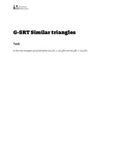
Similar Triangles
Proving triangles are similar is often an exercise in applying one of the many theorems young geometers memorize, like the AA similarity criteria. But proving that the criteria themselves are valid from basic principles is a great...
Curated OER
South America Layered
Seventh graders create an overlay map of South America. They show the relationships between population, landforms and economies with their maps.
Curated OER
Is Urban Sprawl Causing Us To Lose More Than Ground?
Learners map the changes that occur in the land as a result of urban sprawl. They explore the problems that paving and building have on the watershed and the habitats on the Northshore.
Curated OER
Investigating Earthquakes: GIS Mapping and Analysis
Students describes the technique of preparing "GIS-ready" data and shows how to map that data and conduct basic analyses using a geographic information system (GIS).They use latitude and longitude fields to plot the data in a GIS and...
Curated OER
Candy Bar Subsurface Geology
Students are introduced to drawing and interpreting topographical maps. They each cut through there Jell-o mountain at regular height intervals, and trace around the shape of the Jell-o cut off at the height, overlaying the different...
Curated OER
Chromosomes and Genetic Mapping
Students create models of chromosomes using clay, coins, beads, or marbles. They complete a worksheet regarding their crossover frequencies they created with their chromosomes and gene models. They read an essay on sex chromosomes and...
Curated OER
Volcano Contour Models Activity
Students experiment with water levels and plastic topographic volcano models to determine the contour lines that would be used to create a topograpohic map of a volcano. They use the traced lines to actually develop the map.
National Park Service
News Bearly Fit to Print
There are an average of three human fatalities by bears in North America every year, which is low when you compare it to the 26 killed by dogs and the 90 killed by lightning annually. The lesson encourages researching human-bear...
Curated OER
History In Pictures
Sixth graders explore Lewis and Clark's expeditions. In this Lewis and Clark lesson, 6th graders view the routes they took and discuss how the territory has changed. Students make a timeline of their journey. Students research online for...
Curated OER
Eagle Creek Park (A Hike)
Students plot a hiking course using aerial photos and a topographic overlay and find the latitude and longitude of absolute locations. They measure the total distance of a hiked area and figure the area of the ground walked using Heron's...
Curated OER
GIS: Mapping Watersheds of the Edwards Aquifer in Travis County
Students manipulate existing GIS data to create and map a new layer of information that shows that watersheds in Travis County that are on top of Edwards Aquifer. They create and map that shows the watersheds in Travis County that are on...
Curated OER
Volcano Contour Models Activity and Tracing the Highs and Lows in San Francisco
Learners investigate how to draw topographic contours and read topographic maps.They examine the topography of San Francisco and contrast the elevation of different points within San Francisco.
Smarter Balanced
Growth and Expansion of America
Despite the difficulty of travel, the US expanded significantly between the 1800s and the early 1900s. To prepare for a performance task assessment on the rapid expansion of the US in the 1800s, class members engage in a write-pair-share...
Curated OER
Mapping your watershed
Students investigate the importance of watersheds around the world. By visiting resource links, students can locate watersheds and their sources in the USA and Russia and analyze their effects on the surrounding topography. This lesson...
Curated OER
Grid it, Map it
Students participate in designing a city layout using grids and coordinates. They work on a city space and create a grid on a life size layout on the gym floor.
Curated OER
Battlefield Walks
Learners create a picture of a Civil War battle using Google Earth. In this Civil War lesson, students pick a battlefield and research it with a partner. They find the location on Google Earth and use colors and overlays to show...
Curated OER
LRO and the Apollo-11 Landing Site
In this Apollo-11 landing site worksheet, students read about the NASA Lunar Reconnaissance Orbiter (LRO) that will collect images at a higher resolution than ever before. Students study a grid showing the lunar landing site from Apollo...
Curated OER
Where is it?
Young scholars use a coordinate grid. They investigate and discuss what caused certain objects to be in specific places. They choose a room in their home to map and place objects in specific locations.


