Curated OER
Central And South America And Their Ancient Civilizations
Fifth graders listen to lectures on the ancient civilizations of the Aztecs, Incas and Mayans. They construct a mask base and then decorate it in thirds with symbols meaningful to each of the three cultures being studied.
Curated OER
A Flip of Life in the 13 Colonies
Fourth graders create a flip book illustrating the 13 original colonies. They study the growth and development of each of the three groups of the original colonies. They use maps to observe and interpret geographic information and...
Curated OER
The American Revolution: 1775 - 1783
Track the ins and outs and wartime strategies used by both the British and the Americans during the Revolutionary War. Multiple comparisons are made between both factions, maps, statistical data, images, and light text is used throughout...
Curated OER
Exploring an Atlas
Students explore global geography by participating in an atlas activity. For this countries of the world lesson, students collaborate in small groups and analyze an atlas while researching continents, countries and demographics. Students...
Curated OER
Mesoamerica
Learners demonstrate knowledge of early Middle American civilizations. They study Mesoamerican i religions, governments, and achievements. They identify geographies of North and South America.
K12 Reader
Conflict Over North American Lands
Readers are introduced to some of the conflicts that arose over land and resources in the Americas in a two-part cross-curricular comprehension worksheet that asks kids to study the article and then to use information provided to...
Curated OER
Couriers in the Inca Empire: Getting Your Message Across
Learners examine how the Inca communicated over large distances. They locate the Inca Empire on a map, define key vocabulary terms, play the game, 'telephone,' and create a quipu to show the year they were born.
Curated OER
Continental Drift
Be sure to come prepared to discuss the theory of Pangaea and the two super-continents, Laurasia and Gondwanaland. Collaborative learners look for fossil evidence that supports the theory that one super-continent divided into two. They...
Curated OER
The Geography of the United States
Full of bright maps and interesting information, this presentation details U.S. Geography. Slides include basic facts about size, regions, topography, and demographics, as well as fascinating trivia about the United States, including...
Curated OER
Coiling Geography "On the Pampas"
First graders are introduced to the rope coiling form of art used by the gaucho culture of South America. They read "On the Pampas" by Maria Cristina Brusca, view the illustrations of the coiling technique and create original pieces.
Curated OER
Continents Adrift
Young scholars examine how tectonic plates change the Earth's land. In this geology lesson, students are divided into small groups to construct a continent puzzle. Young scholars use transparency pieces to demonstrate how Africa and...
Curated OER
Building from the Ground Up
Third graders research the interdependence of communities within different countries. For this community lesson, 3rd graders create a new community from a preselected country in South America. Students use the findings from their...
Curated OER
Hazards: First Grade Lesson Plans and Activities
Examine the environmental hazards associated with volcanoes with a three-part science lesson. In the pre-lab, first graders learn that gas, landslides, ash, and lava are all hazards that come from volcanoes. They then explore...
Curated OER
Absolute Location
Fifth graders examine the geographic concept of absolute location. Using a variety of resources, they create a life-size classroom grid and locate the coordinates of a point, identify latitude and longitude of different locations, and...
Curated OER
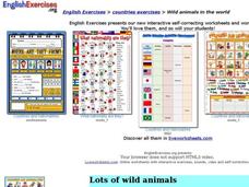
Wild Animals in the World
In this wild animals worksheet, students answer multiple choice map questions, choose the correct animal names for the pictures, and more. Students complete 4 activities.
Curated OER
Natural History of Costa Rica
Students use outline maps to become acquainted with Costa Rica. They see how it was formed and how its origin has created very diverse environments. Students then use atlases and compare their physical maps with maps of climate and the...
Curated OER
World Map and Globe - Lesson 15 (K-3)
Students discover mountain ranges and their locations in the world. In this physical map lesson, students locate and identify major mountain ranges of the world on a large physical map.
Curated OER
Getting to Know My World
Students participate in hands-on activities using maps and globes to identify geographical features. Students use map legends to identify direction. Students locate oceans, continents, countries, states and cities. Handouts and...
Curated OER
Continents
Learners investigate World Geography by researching the different continents. In this Asian Geography lesson, students discuss the continent of Pangaea and color a worksheet of the continents. Learners locate China on the map worksheet...
Curated OER
Old World and New World - Why Contact Took So Long
Students use a globe to determine why contact between the old world and the new world took a long time. In this map skills lesson, students analyze routes between regions to determine why it took so long for the old world and the new...
Curated OER
Breaking News English: Map Shows the Chinese Discovered America
In this English instructional activity, students read "Map Shows the Chinese Discovered America," and then respond to 47 fill in the blank, 7 short answer, 20 matching, and 8 true or false questions about the selection.
Curated OER
Global Lesson: Social Studies On-Line Global Lesson: Social Studies On-Line Continents
In this geography PowerPoint a simple world map on which each continent is represented by a solid green landform is the background for each of the nine slides. The continent names appear in a list on the first slide, followed by one...
Curated OER
Stranded along the Coast
Students plot stranding sites onto a map using latitude and longitude as well as compass directions with respect to coastal features. They identify several species of marine animals that might become stranded; distinguish their...
Curated OER
Our States, My State
Here is a very nice lesson on the shape of the United States, and the shapes of the individual states for your young geographers. They utilize worksheets embedded in the plan to color in a variety of states and to become familiar with...
Other popular searches
- South America Map
- South America Physical Map
- South America Map 1500
- South America Map `500
- South America Map Worksheet
- Physical Map of South America
- South America Map 500
- South America Outline Map
- South America Map Skills
- South American Geography Map
- South America Map \`500
- Choropleth Map South America
