Echoes & Reflections
Timeline of the Holocaust
An interactive timeline uses images, videos, primary source documents, and links to informational text to chronicle the history of the Holocaust from 1933-1945.
Echoes & Reflections
The Children and Legacies Beyond the Holocaust
Using video testimony, primary source documents that detail international agreements, and structured discussions, learners consider the precarious position of children during the Holocaust and other international conflicts, and how to...
Echoes & Reflections
Survivors and Liberators
The end was just the beginning. The period immediately after the end of World War II and the Holocaust is often called "The Return to Life" as survivors looked to reunite and recreate broken families and shattered lives. A two-lesson...
Curated OER
Topo Map Mania!
Seventh graders describe the major features of maps and compasses. They read a topographical map. They take a bearing using a compass. They practice using scales on a map.
Curated OER
What Are Maps For?
Middle schoolers create a story about a problem someone could have which could be solved by the use of a map. They complete a worksheet that guides them through the features of a map of Chicago. Then they calculate story problems using...
Curated OER
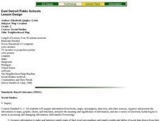
Topographic Map Unit Plan
High schoolers examine topographic maps and discover how to decipher contour intervals, use contour lines and apply information to complete a topographic map lab. Working in groups, they identify the scale of the map, latitude and...
Curated OER
Mapping a Garden
Second graders recognize the components of a map, particularly the legend, the key, the symbols and the area. They develop their own map of a garden they be planting in their upcoming science lesson.
Curated OER
Map Creation
Second graders identify a map, symbol, key, and compass rose. Students create and print a map for teacher evaluation using the computer. Students identify the symbols on their map and orally present them to the class.
Curated OER
Map your Schoolyard
Students practice their mapping skills by creating an accurate map of their schoolyard using an aerial photo from the National Map web site. Students include legends, a scale, and a north arrow on their maps.
Curated OER
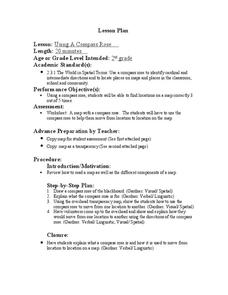
Using a Compass Rose
Second graders practice navigating around their neighborhood by utilizing a compass. In this geography lesson, 2nd graders view a compass rose, discover the purpose of it, and utilize it to navigate through a printed map of their...
Curated OER
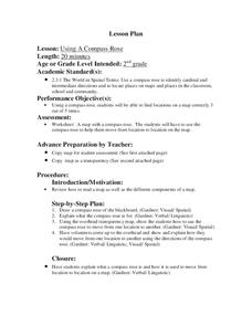
Using a Compass Rose
Second graders explore geography by completing a mapping activity in class. In this directional lesson plan, 2nd graders examine a map in class and utilize a compass rose to identify their location and destination. Students write...
Curated OER
Generate an Accurate Landscape Profile from a Topographic Map
Learners enerate an accurate landscape profile from a topographic map. They determine the correct interval needed to accurately graph the change in elevation on a single piece of graph paper.
Curated OER
CLASSROOM MAPS
Students do a blind tour of their school by responding to verbal commands. They look and discuss various maps in the classroom. They locate the direction of the sunrise and discuss the compass directions of North, South, East, and West.
Curated OER
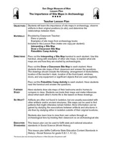
The Importance of Site Maps in Archaeology
Students consider the importance of site maps in archeology. They interpret site maps, draw site maps of their classroom and home and then participate in simulated Paleolithic archeological camp activity.
Curated OER
Analyze a Street Map
In this street map worksheet, students analyze a section of a street map of Washington D.C, finding parallel streets, listing streets that form given shapes, and following directions. Answers on page 2.
Curated OER
Maps Not Drawn to Scale
In this maps activity, students redraw a map to make it more accurate and drawn to scale in the space given. Students draw 1 map and answer 2 questions.
Curated OER
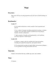
Maps
Students figure out the mileage from one state to another using a map. In this map instructional activity, students look at the scale factor and turn it into a fraction. They measure the distance between two cities and use the proportion...
Curated OER
Me On the Map
Second graders listen to Joan Sweeney's book, Me On the Map. They design a map of their bedroom and their house emphasizing the important characteristics.
Curated OER
Mapping the Most Common U.S. City Names
Pupils discuss the most common U.S. place names. They map the locations of U.S. cities with the most common names and use an atlas, or an online map tool such as MapQuest or Yahoo Maps.
Curated OER
Map of the Ottawa Valley
Students locate Ottawa Valley on a map. They then answer questions in reference to the map such as: What was the first use of timber in the Ottawa Valley?, What occurred first in Gatineau?, and On the Ontario side of Ottawa River, how...
Curated OER
Map Reading
After examining a map from 1803 and 2003, they explore how to become map readers. They describe what they see on the map from 1803 and compare the information to the map from 2003. Students create their own map of the neighborhood that...
Curated OER
Mapping Population Changes In The United States
Students create a choropleth map to illustrate the population growth rate of the United States. They explore how to construct a choropleth map, and discuss the impact of population changes for the future.
Curated OER
Mapping Crime
Students use data on break and enter crime incidents to make a map that prompt discussion about the spatial location of crime in the city, why it would occur in those places, and how residents may reduce crime.
Curated OER
Map Readng And Giving Directions
Pupils read a story to create the context for the lesson. Then they are given or create a community map. Then students use the scenario of being lost in order to role play giving directions to a partner to find a destination. The...


