Curated OER
The Barbarian Invasions of the Roman Empire
Fifteen different locations to map and correctly label. Use the provided list to show major areas of Barbarian invasions occurring during the Roman Empire.
Curated OER
The Spread of Printing
Document the spread of printing, which occurred in the 1500s. Use the provided list of water ways, countries, and cities to label specified locations on the map.
Curated OER
Bronx Zoo
Students prepare for a field trip to the Bronx Zoo. They use maps and descriptions of animal exhibits to give and interpret directions on how to navigate the zoo. They play games, participate in pairwork and whole class discussion.
Curated OER
Sir Francis Drake
Help your learners prep for an exam testing content knowledge related to Florida's State History. Your class can use this printable page to review vocabulary, identify locations on a map, and research both knights and the Sir Francis...
Curated OER
European Language Groups, 1850
Document the linguistic diversity and major language groups common to Europe in 1850. A map and a list of regions, countries, and water ways is provided.
Curated OER
Decolonization in Asia
Pin point areas in Asia that went through decolonization and regained independence from colonial rule. There are 32 countries and bodies of water to identify on the provided map.
Curated OER
Eastern Europe in 1989
Major political shifts occurred in Eastern Europe during the late 1980s. Locate, identify, and label 90 different areas on the provided map. A list of cities, countries, and water ways is provided.
Curated OER
Science Jeopardy - The Earth Sciences
The earth sciences are the focus for this Jeopardy-style review game. Categories include geology, space, scientific investigation, meteorology, and oceanography. Diagrams and pictures are involved with most of the questions, making this...
Curated OER
The Case of the "Lost Gorge:
Students examine the case of a map making expedition. In groups, they read a case study on "The Lost Gorge" in the Finger Lakes region of New York state. They examine maps and determine where the error in the map-making occured to end...
Curated OER
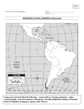
Global History & Geography: Latin America
The instructions say to use a text-book to label 11 different regions in modern Latin America. If a text-book is not available a map can be found on-line and printed for student reference.
Curated OER
Weather Adjectives
How would you describe that twisting, powerful, destructive, ferocious tornado? Have your scholars analyze a tornado using adjectives: students write six adjectives on a graphic organizer, and then use each in a sentence below. This...
Curated OER
Scarcity of Land Throughout the World and in Hawaii
Students discuss the importance of "land." They review the four types of land classification--urban, rural, agricultural and conservation--and participate in an activity involving an apple that demonstrates the use of land in Hawaii....
Curated OER
You Are Here
Students map local places and learn to use scale and distance. In this mapping lesson plan, students map their school and a favorite place. Students recreate their maps showing distance and scale sizes. Students locate their...
Curated OER
Fossil Fuels (Part II), The Geology of Oil
More of a mini-unit than a lesson, these activities lead inquisitors through a survey of oil deposits. In the first part, they read about and view diagrams of sedimentary rock layers that trap oil. Next, they test porosity and...
Curated OER
What's Down There?
Investigate the coral reefs around Mokolai Island, Hawaii by researching and writing about improving the reef ecosystem. Students map threats to the ecosystem and use the list of key words to assist in their descriptions
Curated OER
The Hatfield and McCoy Feud
Fourth graders investigate the Hatfield and McCoy feud. In this Hatfield and McCoy feud activity, 4th graders examine factors that caused the feud. Students also locate on a map where the feud took place, make a timeline of the main...
Annenberg Foundation
America's History in the Making: Classroom Applications One
Someone finds a time capsule 100 years from now, and it includes your family photo album. What would the photos tell that person about you and your place in history? Scholars investigate how artifacts tell stories. Using photos, maps,...
Teach Engineering
Who Can Make the Best Coordinate System?
Working with a map that does not have a coordinate system on it, small, collaborative teams must come up with a coordinate system for their map. Groups then explain their coordinate structure to the class.
NET Foundation for Television
1850-1874 Railroads and Settlement
Have you ever wondered how your town was placed where it is? Scholars research the impact the advancement of the railroad due to the passage of the Kansas-Nebraska Act had on the formation of civilization in the Great Plains. Map...
Curated OER
Map Puzzles
Young scholars make puzzles from world maps, dramatizing how much of the globe is covered by ocean.
Columbus City Schools
Geological Effects of Plate Tectonics
Don't get your classes all shook up about plate movement, instead use a thorough unit that guides learners to an understanding of plate tectonics. The lessons incorporate a study of the types of plate boundaries and their effects on the...
Science Matters
Ring of Fire
Over a period of 35 years, earthquakes and volcanoes combined only accounted for 1.5 percent of the deaths from natural disasters in the United States. The 15th lesson in a 20-part series connects the locations of earthquakes and...
Cornell University
Too Much of a Good Thing?
Continuing their study of beneficial insects, young entomologists discover where in the world some of these bugs are. By labeling, coloring, and using the scale on a map, pupils explore the territories and arrival of the Asian lady...
Teach Engineering
Stormy Skies
Young meteorologists examine the four main types of weather fronts and how they appear on a weather map. Participants learn about the difference between the types of weather fronts along with their distinguishing features. A...


