Ashbrook Center at Ashland University
The Constitutional Convention
Imagine sitting down with representatives of your school to write a new student handbook. What arguments would ensue? How would compromises be made to finish the project? Scholars research the Constitutional Convention using a directory...
Curated OER
Earth's Water
If the majority of our planet is covered with water, why do we need to bother conserving it? With a thorough and varied investigation into the location and types of water on the earth, learners will gain an understanding of why this...
Moanalua Gardens Foundation
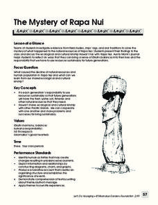
The Mystery of Rapa Nui
What caused the collapse of the environment on Rapa Nui (Easter Island)? Who constructed the Moai? What was their purpose? Class members assume the role of investigators and use evidence drawn from field studies, ships' logs, and...
NET Foundation for Television
1850-1874 Homestead Act Signed: Who were the Settlers?
Life in the great, wide-open spaces of the West! Scholars analyze the reasons behind the vast movement to the Great Plains after the passing of the Kansas-Nebraska Act and the Homestead Act. Using photographic, document, map, video, and...
Big History Project
Human Migration Patterns
Humans have been on the move for millennia. Using an article from The Smithsonian, pupils chart human movement before written history on a world map. In addition, they examine the modes of transportation used by different waves of human...
101 Questions
Home Depot
Household emergencies often require supplies from a home improvement store. Pupils view a map showing a home and three different stores to determine which is the closest. Follow-up activities find close food options as well.
Teach Engineering
Projections and Coordinates: Turning a 3D Earth into Flatlands
Introduce your class to map projections and coordinates, the basics for the work done in a GIS, with an activity that uses Google Earth to challenge learners to think about the earth's shape.
Midwest Institute for Native American Studies
Introduction to Pre-Columbian Lessons
Native peoples established civilizations all over Central and North America. Introduce native civilizations with a unit that promotes discussion, reinforces map skills, enhances reading comprehension, and exposes young historians to...
University of California
Decolonization
The ripple effect from one small event can impact many others. Young historians research the ripple effect World War II had on decolonization in the second installment of an eight-part series. Through primary and secondary documents as...
101 Questions
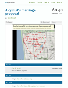
A Cyclist's Marriage Proposal
One cyclist goes to great lengths to make his proposal! Your classes must figure out just what length that is. Using a map with a bike route that spells out Marry Me, learners calculate the total distance of the ride. They base their...
National Endowment for the Humanities
Hopi Place Names
What's in a name? Historians consider the question as they examine places important to the Hopi people and the meanings of their place names. Included worksheets include maps and charts to help class members examine the geography of Hopi...
National Park Service
Remembering Pearl Harbor: The USS Arizona Memorial
Young historians use primary source materials to investigate the 1941 attack on Pearl Harbor and the sinking of the USS Arizona. After reading background articles and studying maps and images of the attack, class members consider whether...
EngageNY
Definition of Reflection and Basic Properties
Discover the results of reflecting an image. Learners use transparency paper to manipulate an image using a reflection in this fourth lesson of 18. They finish by reflecting various images across both vertical and horizontal lines.
Shakespeare Globe Trust
Fact Sheet: Playhouses
Laborers used common materials to build London's first performance venues, including sticks, plaster, and ... hair? Using an informational handout, scholars learn about the construction of different types of playhouses where actors...
Common Sense Media
The Masque of the Red Death
Poe goes high tech with a lesson that asks high schoolers to use the internet and various apps as they read and analyze "The Masque of the Red Death." In addition to responding to comprehension questions in Quizlet, they use Minecraft to...
National Wildlife Federation
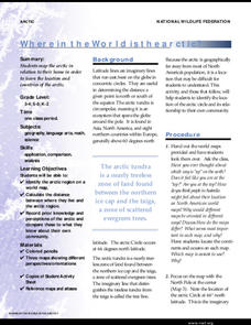
Where In the World Is the Arctic?
Exactly how far away is the Arctic? Learners use maps to orient themselves to their locations on the globe. They then make calculations to describe how their location relates to the location of the Arctic regions.
Notion
Popplet
Add color to the mind-mapping process! Users double tap to create a bubble and everything flows quickly from there as they drag, draw, type, and more.
Statistics Education Web
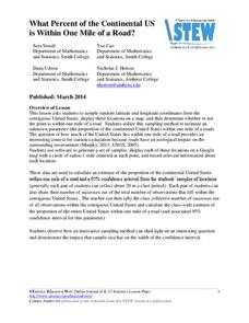
What Percent of the Continental US is Within One Mile of a Road?
There are places in the US where a road cannot be found for miles! The lesson plan asks learners to use random longitude and latitude coordinates within the US to collect data. They then determine the sample proportion and confidence...
Curriculum Corner
Fiction Graphic Organizers
Analyze a fictional text with a four-page packet that explores a story's main character and moral, challenges scholars to ask and answer questions about the text, and to create a story map.
American Institute of Physics
The Tuskegee Weathermen: African-American Meteorologists during World War II
Chances are good that young scholars have heard of the Tuskegee Airmen but few would predict that these pilots had their own support in the form of the Tuskegee Weathermen. These Black meteorologists were recruited and trained to provide...
Institute of Electrical and Electronics Engineers
Coloring Discrete Structures
What's the least number of colors needed to color a U.S. map? The lesson begins by having pupils view a video clip on continuous and discrete phenomenon, then launches into an activity reminiscent of Zeno's paradox. A separate video...
It's About Time
Taking a Ride on a Lithospheric Plate
Assist your pupils and broaden their horizons with several activities that determine the exact positioning of various communities over the globe. Pupils use data from the Global Positioning System to determine the position and rate of...
EngageNY
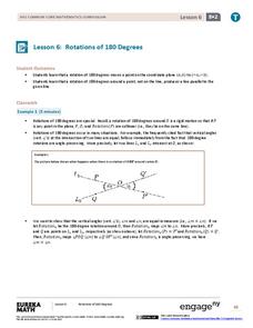
Rotations of 180 Degrees
What happens when rotating an image 180 degrees? The sixth lesson in the series of 18 takes a look at this question. Learners discover the pattern associated with 180-degree rotations. They then use transparency paper to perform the...
National Park Service
Leave it to Beavers
Many people know cats mark their territories by rubbing the back of their necks to leave a scent, but not many people know beavers also leave a scent to mark their territories. During the first activity of two, scholars use their noses...


