Teach Engineering
Earthquakes Living Lab: Locating Earthquakes
There are patterns in nearly everything — even earthquakes. Pairs research current earthquakes to see if there are any patterns. They determine the mean, median, and mode of the earthquake data, along with the maximum and...
Curated OER
Northridge, California Earthquake Map
In this earthquake intensity learning exercise, students are given a map labeled with the intensity of shaking for the Northridge area and its surroundings for the earthquake that occurred in 1994. Students color an intensity scale and...
Curated OER
Look for Patterns
In this earthquakes worksheet, students look at maps of earthquake patterns and answer short answer questions. Students answer 12 questions.
Curated OER
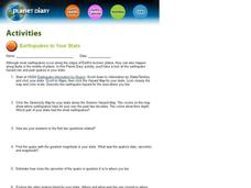
Earthquakes In Your State
In this earthquake instructional activity students complete an interactive activity then answer a series of short answer questions on different earthquakes and their magnitude, and epicenter.
Curated OER
Musical Plates-Earthquakes
In this plotting earthquake data worksheet, students use a large world map and given web sites showing the latitude and longitude for the epicenter of recent earthquakes around the world. Students plot 2 weeks of earthquake data...
Curated OER
Plotting Earthquakes and Volcanoes
In this earthquakes and volcanoes activity, students are given the latitude and longitude of earthquakes and volcanoes and they plot them on a world map. They answer questions based on their results.
Curated OER
Student Exploration: Building Topographic Maps
In this earthquake exploration learning exercise, students complete 2 prior knowledge questions, then use "Building Topographic Maps Gizmo" to conduct several activities, completing short answer questions when finished.
Teach Engineering
Earthquakes Living Lab: The Theory of Plate Tectonics
Find out if your class agrees with Ice Age: Continental Drift ... or if it's just a fun family movie! Class members research the theory of continental drift, examine evidence of plate tectonics, connect...
Curated OER
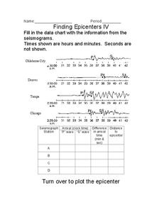
Finding Epicenters
In this earthquake worksheet, students use the seismographs from different locations to determine the epicenter for the earthquake. Students plot the epicenter on a map. This worksheet has 1 graphic organizer.
Curated OER
Plotting Earthquakes
In this earthquakes worksheet, students access a website to gather information about the magnitude and location of earthquakes for 5 days. Then students complete 7 short answer questions.
Curated OER
Anatomy of an Earthquake
In this earthquake worksheet, students read and study earthquake maps and statistics. They complete 8 short answer questions that follow.
Oregon State
World Map of Plate Boundaries
Young geologists piece together the puzzle of plate tectonics in an earth science lesson. Given a physical map of the world, they search for land formations that indicate the location of different types of plate boundaries.
It's About Time
Effects of Plate Tectonics
Explore our world from within as you lead young scientists on a thrilling adventure. Pupils examine the location of plate boundaries to determine earthquake and volcano distribution around the globe and explore the cause of hot spots in...
Curated OER
Determining the Time of an Earthquake
In this earthquake worksheet, learners will study a table showing the travel times of seismic waves from an earthquake. Students will use this information to determine when and where the earthquake occurred. This worksheet has 6 short...
Lrymple Secondary College
Plate Boundary
Scholars examine diagrams and complete a concept map to discover key details about convergent, divergent, and transform plate boundaries.
Curated OER
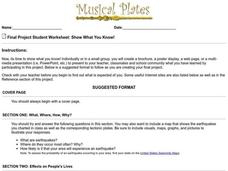
Show What You Know!
In this earthquakes worksheet, students create a brochure, poster, or other form of presentation to show what they know about earthquakes. Students complete 4 sections.
Curated OER
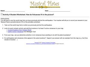
How do Volcanoes Fit in the Picture?
For this volcanoes worksheet, students look at maps and answer short answer questions about volcanoes, plate boundaries, and earthquakes. Students complete 4 questions.
Curated OER
Japan's Geography Worksheet
In this geography skills worksheet, students label a map of Japan and then respond to 8 short answer questions about the country.
Curated OER
Active Volcanoes, Plate Tectonics and the "Ring of Fire"
In this volcanoes, plate tectonics and "Ring of Fire" worksheet, students view the location of volcanoes on a map of the Earth, they see the "Ring of Fire" and they locate the major plates of the Earth's crust. They use the map as...
Curated OER
Comparing the New Madrid and San Andreas Fault Zones
In this faults worksheet, students use an earthquake reference sheet to find the numbers for a modified Mercalli and Richter scale. They compare the San Andreas Fault zone and the New Madrid fault zone on the United States map. They...
Curated OER
Plate Tectonics
In this geology worksheet, students will cut a map of California along the San Andreas fault line to see how California might change in the future. Then students will compare a world map from 50 million years in the future with a present...
Curated OER
Endangered Giant Pandas
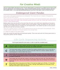
In this giant panda activity, students read and complete 5 pages of information and activities pertaining to the giant panda. Students study maps of the area, read fun facts about pandas, cut and paste life cycle sequencing, and read...
Curated OER
Tsunami Waves
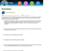
In this tsunami waves worksheet, students explore data from the Indonesian tsunami of 2004 and answer ten questions about the data. They draw conclusions about the devastation and destruction based on the amplitude and speed of the tsunami.
Curated OER
English Vocabulary Skills: AWL Sublist 10 - Exercise 1b
In this online interactive English vocabulary skills worksheet, students answer 10 matching questions which require them to fill in the blanks in 10 sentences. Students may submit their answers to be scored.


