Curated OER
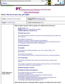
Why Do We Have Day And Night?
Second graders demonstrate knowledge and appropriate use of hardware components, software programs, and their connections. After a lecture/demo, student groups utilize raisins and apples to demonstrate day and night. They put togethre a...
Curated OER
The Rivers and Lakes of Alberta
Learners are introduced to the online Atlas of Canada and they identify the lakes and major rivers of Alberta.
Curated OER
Message in a Bottle
Sixth graders write a short story about being stranded on a deserted island. After a brief geography review of locations at various latitudes and longitudes, 6th graders draft their story about being stranded. They use sensory and...
Curated OER
Landscape Diversity in the Yukon Territory
Students review and analyze a satellite image of the Yukon territory.
Curated OER
Globe Lesson 13 - When the Day Changes
Young scholars explore the patterns of day and night. In this geography skills lesson, students read brief selections and examine diagrams that note the transition of day and night around the world. Young scholars respond to the...
Curated OER
Give Me Some Latitude
For this latitude worksheet, students use an atlas or other reference to respond to 4 multiple choice questions about the equator and the poles.
Curated OER
You Can Die Here – Death Valley California
Students use Google Maps to explore the rain shadow desert. For this climate lesson, students use the Internet, Google Maps, and directed inquiry worksheets to understand how rain shadow deserts form. Students apply climate concepts to...
Curated OER
Continental Drift
Students simulate convection waves using a model. In this earth science instructional activity, students explain the effect of plate movements to Earth's geography. They use the internet to find answers to graphic organizer questions.
Curated OER
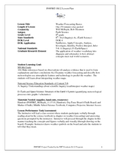
Weather Forecasting Basics
Eighth graders analyze weather diagrams and weather maps. In this earth science lesson, 8th graders explain why it is important to know the weather. They complete a handout at the end of the lesson.
Curated OER
Geography, Map Skills & the Internet:
Learners research various websites focusing on Italy while enhancing student utilization of computer, keyboards and the Internet. They discuss their findings on the geography, history, topography, and culture.
Curated OER
Mapping the National Parks
Students research national parks. In this science lesson, students view a video about the national parks and discuss the environments found within the national parks.
Curated OER
The Earth's Rain Forests
Learners study the importance of the world's rain forests. In this rain forest instructional activity, students read about the role of the rain forests in the world's environment. Learners then write a formal letter to a member of...
Curated OER
Earth Science: In Depth Look at Earthquakes
Students engage in an interactive Internet lesson covering the reasons and results of earthquakes. After reading eyewitness accounts and viewing animations, they use seismograms to measure and locate the epicenters. In an ongoing study,...
Curated OER
Structure of the Earth
Sixth graders investigate earthquakes and volcanoes. They demonstrate fault lines with a folded piece of paper, conduct an erosion experiment, and construct a volcano using clay, baking soda and vinegar.
Curated OER
The Earth, Sun Mood and Stars Unit (Planets too!)
Fifth graders prepare five activities to do then show their energy saving skills. In this investigative lesson students create five projects then participate in an energy saving demonstration.
Curated OER
Measuring the Earth
Students identify types of arcs and angles in a circle, find the measure of arcs and angles, and solve real world problems involving lengths of segments in circles, lengths, and areas.
Curated OER
Using Star Charts and Maps
Students study star charts and describe locations of objects. In this scientific models lesson students use coordinates and identify characteristics.
Channel Islands Film
Island Rotation: Lesson Plan 1
How do scientists provide evidence to support the theories they put forth? What clues do they put together to create these theories? After watching West of the West's documentary Island Rotation class members engage in a series of...
Prairie Public Broadcasting
Egyptian Pyramids Virtual Field Trip!
A virtual field trip takes enthusiastic travelers to the pyramids of Giza. Using Google, scholars explore the grounds of the ancient pyramids found in Egypt then complete three worksheets: a photo analysis page, a reflection sheet, and a...
Curated OER
Think GREEN - Utilizing Renewable Solar Energy
Students use data to find the best renewable energy potential. In this solar energy lesson plan students import data into Excel and explain how solar energy is beneficial.
Laboratory for Atmospheric and Space Physics
A Classroom Solar System
Create a scaled model of our solar system in your classroom! Scholars work collaboratively to build paper mache planets and hang them in their proper position to showcase each planet's location in the solar system.
Urbana School District
Magnetism
The compass was first used in 206 B.C., but we didn't discover magnetic poles until 1263 A.D. Presentation begins with the history of magnetism before continuing on to magnetic fields, magnetic forces, electromagnets, currents,...
Curated OER
Separate Vacations
Students plot the migration paths of birds using latitude and longitude data from a table.
Laboratory for Atmospheric and Space Physics
Orbit Simulator
Researchers think they have evidence of a new planet deep in our solar system that is the size of Neptune and orbits the sun far beyond Pluto. The orbit simulator shows the orbits of our well-known planets, as well as Pluto and the comet...
Other popular searches
- Earth Scene Concept Maps
- Earth Scone Concept Maps
- Earth Science Mapping
- Earth Sciecne Concept Maps
- Mapping Earths Surface
- Mapping Earthquakes


