Curated OER
Africa, A Look Through the Eyes of A Child
Second graders read literature about Africa, examine physical characteristics of the continent, explore animals native to Africa, and discuss distance between Africa and locations in the United States.
Curated OER
Lesson 2 Activity 2: In the Wake of Lewis and Clark
Students study the route of Meriwether Lewis and iam Clark's travels and the important events in their journey. They mark the sites on a map and then plan a trip along part of the route.
Curated OER
Move Around the Map
Fourth graders, while working with a partner, label and identify on a tarp map six major cities and five major rivers in Indiana. They traverse along the rivers utilizing a different locomotor skill (hop, skip, walk, run, leap, gallop,...
Curated OER
River Study
Students study physical features of a local stream. They study how to identify water features on topographic maps.
Curated OER
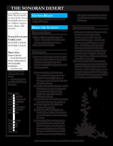
The Sonoran Desert
Little learners examine a map of the southwestern United States and identify the Sonoran Desert. They locate different cities and rivers, determining whether or not each is found within this special ecosystem. A student handout is...
Curated OER
Rivers And Capitals
Pupils become familiar with the use of GIS for research and become aware of the importance of rivers to cities. They also analyze the placement of cities and learn the names of rivers in the United States.
Curated OER
Tooling Around Arizona: Reading Arizona Maps
Students study geography. In this Arizona maps lesson, students develop their map reading skills. They have class discussions and work independently with various copies of Arizona maps to practice those skills. This lesson mentions...
Curated OER
Postcards from California: A Unit on Geography, Social Studies, History and California's Resources
Fourth graders examine patterns that influence population density in the various regions of California. The unit's three lessons utilize graphic organizers for the interpretation and presentation of data.
Curated OER
Living Swamps, Bayous and Forests
Third graders explore interesting environments by exploring Louisiana. In this wetland lesson, 3rd graders utilize the web to research the State of Louisiana, the bayous in the area, and the Gulf of Mexico. Students write a journal entry...
Curated OER
Big Blue Sky- Based on the Montana Quarter Reverse
Students use a Montana quarter to help describe geographical features such as landforms and bodies of water. Students read an article about Montana as a group and discuss examples of landforms and bodies of water. After reading,...
Curated OER
Africa
Second graders explore Africa. They label the popular places in Africa on a map. Students label the different cities and monuments that are popular in Africa. They discuss the similarities and differences between cities in Africa and...
Curated OER
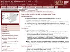
Interpreting Statistics: A Case of Muddying the Waters
Is river pollution affecting the number of visitors to Riverside Center, and is the factory built upstream the cause of the pollution? Let your class be the judge, literally, as they weigh the statistical evidence offered by the factory...
Curated OER
Mesopotamia
Students map Mesopotamia. In this Geography lesson, students are introduced to Ancient Mesopotamia. Students use an atlas to label the defining features and areas of Mesopotamia on a map.
Curated OER
MEDIEVAL SUB-SAHARAN AFRICA
Seventh graders examine the area of medieval Sub-Saharan Africa through eyes of travelers in the company of one of history's greatest travelers, Ibn Battuta. The project has been structured to include all the State standards for this unit.
Curated OER
Philadelphia and the Constitutional Convention "Heat Up"
Students explore the Constitutional Convention of 1787. In this U.S. Constitution lesson, students role play the parts of delegates in a simulation of the convention.
Curated OER
Invasives and Marsh Birds
Students are taught that invasive plant removal can have a variety of impacts. They are shown this by using graphs. Students view maps of vegetation change on Iona Island. They discuss implications of changes on marsh birds using data...
Curated OER
Alexis de Tocqueville’s America
Students analyze de Tocqueville's America. In this democratic history lesson, students use primary sources to determine what de Tocqueville found to be so unique in the America. Students analyze artifacts, maps and documents through...
Curated OER
Survey of the Louisiana Purchase in 1815
Students explore the survey of the Louisiana Purchase by creating their own surveying and mapping techniques such as natural maps, pace maps, and orienting. Other students then try to follow the maps.
Curated OER
Lewis and Clark Expedition
Fourth graders read excerpts and research the Internet to learn about the expeditions of Lewis and Clark and their impact on the United States. Students fill out a KWL chart as they learn.
Curated OER
Major American Water Routes
Sixth graders locate and identify the major bodies of water and waterways in the United States. Through a simulation activity, they describe how early explorers would have described their surroundings. Working in groups, they create...
Curated OER
U.S.-Cuba Relations
Students study the history of United State/Cuba relations. In this diplomacy lesson, students research selected websites to gather information regarding various topics of significance between the U.S. and Cuba since 1868. Students...
Indian Land Tenure Foundation
Respect for Land
Youngsters examine how people show respect and care for the land. Specifically, learners see how the Native Americans truly did care for and respect the land, and still do so to this day! They also explore how they themselves can care...
Curated OER
Landform Tag
Third graders explore various landforms. They play landform tag while exploring the various types of landforms that are found within the United States. Students locate landforms as they are called by the teacher.
Curated OER
Geography: Map Making
Learners, working in groups, share notes and maps collected during a study of the Lewis and Clark Expedition. They draw large composite maps of the western United States on butcher paper including land formations, bodies of water, and...


