Curated OER
New Mexico Map
In this state maps worksheet, students identify the state of New Mexico. Students fill in the state capital, major cities, and other state attractions.
Curated OER
Vermont Map
For this state maps worksheet, students identify the map of Vermont. Students fill in the state capital, the major cities, and other state attractions.
Curated OER
Using the Landscape Picture Map to Develop Social Studies Skills
Enhance your class' geography skills using this resource. Explore a variety of concepts including production and distribution, and people and the environment. Learners make predictions and identify locations on maps. This is a creative...
Curated OER
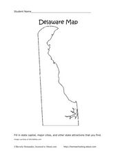
Delaware Map
In this state maps worksheet, students identify the state of Delaware, and fill in the state capital, major cities, and other attractions in the state.
Curated OER
Connecticut Map
In this state maps activity, students identify the state of Connecticut, and fill in the state capital, major cities, and other major attractions.
Curated OER
Colorado Map
In this state maps activity, learners identify the state of Colorado, and fill in the state capital, major cities, and other attractions for the state.
Curated OER
Tennessee Map
In this Tennessee outline map, students examine the political boundaries of the state. Students mark the state capital, major cities, and other state attractions.
Curated OER
Mapping Perceptions of China
Students discuss what types of things are included on a map. They compare and contrast maps of China with a map they create and practice using different types of maps. They write analysis of their classmates maps.
Curated OER
Using Different Kinds of Maps
Third graders explore the landforms and population diversity. They read maps and examine geographic terms. Students create their own map of the United States and answer questions about the location of people. After exploring the map, 3rd...
Curated OER
Ozark Folk Culture and Geography in the Mountain View, Arkansas Area
Upper grade through early high schoolers develop an understanding of Ozark culture, and the geography of the Ozark Plateau. They study place, location, human environmental impacts, and movement. This interesting plan incorporates muic,...
Little 10 Robot
Geography Drive USA™
A trivia-style virtual road trip in which the player's car is moved from state to state as questions are correctly answered. Ideally, a player would learn about different states by reading the simple brochures available in the...
Student Handouts
Geography of Dr. Martin Luther King, Jr.
Young geographers follow Dr. Martin Luther King's journey during the civil rights movement by identifying major events on a map of the eastern United States, such as his birth in Atlanta, Georgia and his famous "I Have a Dream" speech in...
Curated OER
Identifying, Mapping, and Personifying Countries Involved in WWII
Get artsy with this WWII group activity, starting with a whole-class assignment. Create a map of Europe, Northern Africa, and the Pacific using geometric shapes cut from construction paper and placed on the floor. Consider splitting the...
Curated OER
Geographic Regions and Backyard Geology with the USGS Tapestry Map
A beautiful tapestry map of North America is examined by geology masters. The map incorporates the topography and geology of different regions. You can purchase printed copies or a large poster of the map, or if you have a computer lab...
Curated OER
The Geography of China
Viewers will love this field trip to China, complete with information about China's economy, topography, geography, climate, and demographics. Maps and photos help to support the claims in the slides, especially in some interesting...
Curated OER
Exploring Arizona's Biotic Communities Lesson 1: Mapping Biotic Communities
As part of a unit on Arizona's biotic communities, young ecology learners create a map. They describe how humans and animals adapt in their habitat. They take notes and create graphic organizers from articles they read. Beautiful maps,...
Curated OER
Blank Europe Map
Simple blank map, limitless possibilities! Here is a single-page resource of a blank map of Europe, without any country boundaries or text.
DocsTeach
Red Record of Lynching Map Analysis
Long before the civil rights movement, leaders were working to secure equal rights. An informative activity explains the 1922 anti-lynching campaign with a map. Scholars analyze the map, complete a worksheet, and participate in group...
Indian Land Tenure Foundation
Maps and Homelands
You are never too young to learn about maps. To better understand the concept of a homeland, students work together to construct a map of their local area out of paper puzzle pieces. They'll put the maps together and then add details by...
Curated OER
Map of Africa
Using a completed map (not provided), pupils will use this map to fill in the geographic features of Africa. An appropriate map can be printed using the Internet and placed under a document camera for the class to reference.
Curated OER
War of 1812: Map and Label
Map test! Hand out this map of the East Coast of the United States and let learners mark each of the nine sites listed. They'll be making a map that shows the battle sites and areas involved in the War of 1812. Great as a test or as a...
Curated OER
The Netherlands: map
Use the provided list to label a map of Europe and the Netherlands. There are 77 locations to label. You have to know your stuff to fill out this challenging map.
Curated OER
Cause and Effect: Light Clusters and Geography
After viewing a map of lights at night over a variety of geographic formations, young topographers connect the location of light clusters to geographic features that encourage human settlement. They list causes and effects of large...
Curated OER
Map Puzzles
Students make puzzles from world maps, dramatizing how much of the globe is covered by ocean.
Other popular searches
- Geography Maps of Europe
- Geography, Topographic Maps
- Geography Maps
- Europe Geography Maps
- East Asia Geography Maps
- Geography Contour Maps
- Making Maps Geography
- Geography Topographic Maps
- United States Geography Maps
- Geography Lessons, Maps
- Geography Mind Maps
- World Geography Maps


