Curated OER
Hi, Deer!
Students collect, organize by table, and examine census data in a simulation, estimate the size of the population in the simulation and make predictions based on the collection of census simulation data.
Curated OER
Understanding Geography
Students create a map of their own neighborhood to show the relationships between the geography of the neighborhood and its economy and culture. They view and discuss an introductory video on how geographers study an area then go out...
Curated OER
Pythagorean Theorem
In this Pythagorean theorem worksheet, 9th graders solve and complete 8 different types of problems. First, they go to the given website and copy the picture shown. Then, students draw a right triangle using the straight line between the...
Curated OER
Exploring for Petroleum - Modeling an Oil Reserve
Students experiment with locating oil reserves. For this conservation lesson, students use a cardboard box to create sand, rocks, and an oil reserve (water balloon). They use a probe to dig around in the box to find the oil reserve and...
Curated OER
Modeling an Oil Reserve
Students conduct an experiment. In this oil and natural gas instructional activity, students learn how geoscientists identify and explore reserves of petroleum. Students make a model of an oil reserve, record how much it...
Rocklin Unified School District
Spanish Speaking Countries Project
Ask your class members to provide a tour of a Spanish speaking country with a brochure and flag project. Learners research their assigned country, making sure to check off each of the required pieces of information listed on the first...
Curated OER
Map Skills
Do you need to practice map skills? Children with a range of abilities will complete a KWL chart about maps, practice important map vocabulary and then read a few pages from their textbook. They will use their vocabulary words and...
T. Smith Publishing
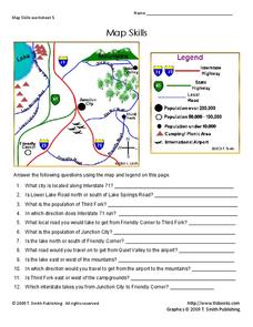
Map Skills
Help younger learners develop their map skills with this simple activity, which includes 12 questions utilizing a map legend that involves highway markers, population indicators, and other landmark signs.
Fun Music Company
Treasure Island Clues: Intervals
You may know about A, B, and C, but now you can include "arrrrr" to the list of music notes to practice! Here is a fun pirate-themed activity in which young musicians determine the intervals of various notes in the treble...
Curated OER
Latitude/Longitude Activity
Youngsters work in groups to solve clues involving latitude and longitude coordinates in order to decipher mystery animals in this fun learning experience!
Curated OER
The Non-violence Grid
Students discuss violence. In this promotion for peace lesson, students share their opinions on different scenarios presented by the teacher. They discuss each scenario as a class to determine if various acts are too violent or just...
K12 Reader
Absolute Location
Where in the world are we? As a reading comprehension exercise, kids read a short passage about navigation using latitude and longitude, and then respond to a series of questions based on the article.
British Council
Weather 1
Match weather words with pictures in a weather vocabulary learning exercise. Beginning readers look at pictures of various weather patterns and choose/write the word that describes the weather. They create a map and write about the...
Curated OER
"Police Action": The Korean War, 1950-1953
Students investigate facts about the war in Korea in the 1950's and attempt to classify American foreign policy as a triumph or a failure. Why the U.S. became involved and the unpopularity of the war in America forms the focus of this...
Balanced Assessment
Bouncing Off the Walls
Apply geometry concepts to improve your pool game! Here scholars create the perfect bank shot using angles of incidence and refraction. They create three different options for the same shot.
Curated OER
The Railroads and Settlement of the Great Plains
Enhance your American literature unit with this resource, in which readers access the Nebraska Studies website and read about "Railroads and Settlement." They search for a photograph of some aspect of the railroad from the Prairie...
Mr. E. Science
Introduction to Earth Science
From the layers of Earth's spheres to latitude and longitude to looking at topographic maps, learners discover the elements of Earth's systems.
NET Foundation for Television
1850-1874 Railroads and Settlement
Have you ever wondered how your town was placed where it is? Scholars research the impact the advancement of the railroad due to the passage of the Kansas-Nebraska Act had on the formation of civilization in the Great Plains. Map...
Curated OER
Season Worksheet #5
Sunrise, sunset, swiftly fly the years! Your earth scientists can also fly through a year of daylight data. They analyze a graph and then answer five multiple choice questions about the rising and setting of the sun, the total number of...
Curated OER
Plotting Earthquakes
Students plot earthquakes on a map. For this lesson on earthquakes, students will explore recent earthquake activity in California and Nevada. Students will plot fault lines and earthquake occurrences on a map.
Curated OER
Baseball Challenge: Social Studies TCAP
Using a baseball theme, this presentation provides a review of social studies topics covered in sixth grade. Students play a game in which they score based on the answers to various questions involving Ancient Rome, Ancient Greece, map...
Nevada Outdoor School
Let It Snow! Let It Melt!
Winter weather offers a great opportunity to teach young scientists about the states of matter. This activity-based lesson includes a range of learning experiences, from experimenting with the rate at which ice melts...
Curated OER
Landforms: Geomorphology of Arkansas
Second graders create large, salt dough maps of Arkansas and the natural regions in the state created by geographical and morphological features.
Curated OER
United States: Physical Features Fun
In this map worksheet, students color and trace eleven listed features on a map of the United States. Students answer six additional questions about the map. A United States map is not provided. However, websites are provided to find...
