Curated OER
World Cities of 5 Million or More
Students consult online resources to identify and map the world's largest cities and metropolitan areas. They analyze birth rates, settlement patterns and other demographic data and make predictions for the future. They write essays...
Curated OER
Tracing the Route of Bracero
Students make a map showing the work of a Bracero Worker. In this Bracero lesson, students listen to a worker in an online oral history as he explains his work locations and crops. They use a map to plot the areas he worked and the crops...
Curated OER
Rising Sea Levels: UK and Bangladesh
Learners explore the possible effects of global warming. In this geography/global warming lesson, students identify regions using an atlas and complete a global warming worksheet. Learners perform an experiment in which they simulate...
Curated OER
Let the Good Times Roll
Students read an online New York Times article and investigate the Mardi Gras celebration in New Orleans. They examine how Hurricane Katrina affected the celebration. They design a float that represents the Mardi Gras celebration.
Curated OER
Re: Forest Station
Students read an online article to explore rainforests of the world starting with the Barro Colorado reserve in the Panama Canal. They participate in a mock international summit about rainforest conservation issues.
Curated OER
Social Studies: Where I Come From
Young scholars research the countries of their origins and examine life there today. They write family travel logs by interviewing family members about their heritages, and they visit the Xpeditions Website for online resources about...
Curated OER
Where Am I? Navigating Around the Globe
Third graders review spatial sense learned in grades one and two. They measure distances using map scales. They use atlases, and on-line sources to find geographical information.
Curated OER
Early Explorers Web Quest
Students use the Canadian atlas online to research early explorers and settlers in Canada. They also complete a Web Quest to gather information from maps. They make generalizations about the early settlement patterns as well.
Curated OER
Canada's Landform Regions
High schoolers use a atlas to identify and describe Canada's Landform region. Using the information they collect, they create a thematic map of the region and describe all of the physiographic regions and the processes that formed them....
Curated OER
Where We Live
Students analyze Canada's population distribution. They access online information to gather demographic information about two Canadian cities. They compare and contrast the quality of life in the two cities and present their findings.
Curated OER
Cod Calamity
Students research the history and aims of sustainable cod fishing in Canada. They read articles, conduct online research, complete worksheets and present their findings to the class. They also complete self and peer evaluations using a...
Curated OER
Organization of a Territory, Map Elements
Third graders compare printed and online maps and use proper geographic terminology to answer questions.
Curated OER
State of Arkansas Travel Brochure
Eighth graders design a travel brochure to persuade others to visit Arkansas. They depict particular points of interest they decide are the best in the state.
Curated OER
Being a Good Detective
Students examine a variety of reference resources when seeking information. They discuss atlases, almanacs, dictionaries, encyclopedias, thesauri, online search engines for the Internet, and online library card catalogs. They complete a...
Curated OER
The Exploration and Settlement of North America
Students locate place in Canada and explore highlights of early of early American exploration and settlement. In this North American history lesson plan, students locate provinces, major cities, and physical features of Canada. Students...
Curated OER
Mapping the Most Common U.S. City Names
Pupils discuss the most common U.S. place names. They map the locations of U.S. cities with the most common names and use an atlas, or an online map tool such as MapQuest or Yahoo Maps.
Curated OER
The Commonwealth - Members and Structure
Students research the member countries that make up the Commonwealth. They develop research skills using atlases. They define the word community. They complete an online geography quiz.
Curated OER
Discovering the Physical Geography of Washington
Students develop a mental map of the state of Washington and draw it on paper. Using the Virtual Atlas, they identify the physical features of the state and draw them on their map. They also examine the populations and diversity of the...
Curated OER
How Do You Say Hello?
Students access an online resource to study how to say hello in Spanish, Japanese, and Arabic. They complete a worksheet telling how to say hello in these three languages before practicing the proper pronunciation of each.
Curated OER
Anza and Font in Search of Latitude
This is an integrated lesson that incorporates Social Studies, Science, and Mathematics. In Social Studies, 7th graders complete an online interview and complete an online worksheet about latitude of sites on the Anza trail. In Science...
Curated OER
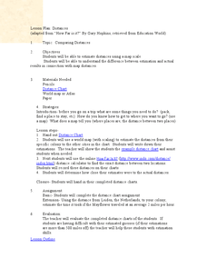
Comparing Distances
Learners practice estimating distances by analyzing a map. In this length measurement lesson, students view a map with a distance key and use their measurement skills to estimate the distance between two cities. Learners utilize an...
Curated OER
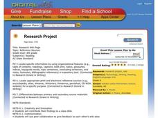
Research Project
Eighth graders research a project of their choice in relation to a career they may want. In this language arts lesson, 8th graders create a bibliography of references used both print and online sources. Students make an outline of their...
Curated OER
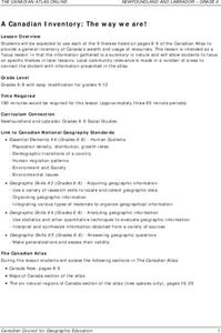
A Canadian Inventory: The Way We Are!
Students use the Canadian Atlas to discover an inventory of Canada's wealth and usage of resources. Using charts and graphs, they produce a wall of selected data of importance to the country and identify one issue of sustainability. ...
Curated OER
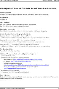
Underground Sleuths Discover Riches Beneath the Plains
Students identify Alberta, Saskatchewan, and Manitoba on map, and use Canadian Atlas to locate regions of natural resources in Central Plains, which have vital impact upon the economy. Students then complete scavenger hunt worksheet.


