World Maps Online
Introduction to the World Map
Students identify the differences between maps and globes. For this map skills instructional activity, students are shown a globe and a map and recognize the differences. Students use post-it notes to locate several locations on the...
Curated OER
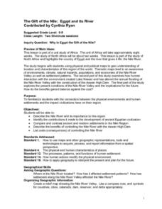
The Gift of the Nile: Egypt and its River
Middle schoolers begin with a piece of a puzzle that shows an artifact from ancient Egypt. They find others who have pieces that go with their puzzle piece. Students work in these groups to construct a relief map of the Nile River Valley.
Curated OER
World: Continents Map
In this World outline map instructional activity, students note the political boundaries of the continents of the world on this Robinson projection map.
Curated OER
World: Continents Map
In this outline map worksheet, students note the political boundaries of the continents of the world. The map is labeled with the names of the 7 continents.
Curated OER
Geography of Canada
All about Canada! Learners explore the geography and providences of Canada by watching videos, studying maps and conducting internet research. By the end of this lesson, your class should be able to locate major areas and compare and...
Curated OER
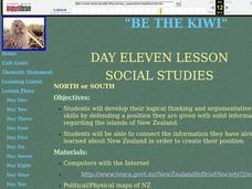
Be the Kiwi
Compare the North and South of New Zealand. Exploritive minds identify which island is better to live on, taking into consideration such things as social, political, and economic aspects. They research an argument to present and debate...
Curated OER
Writing Exercise: The Age of Reaction
Explore the French Revolution of 1830, The Age of Reaction. The class answers five short essay questions where they define political philosophies, summarize the Revolution of 1830, and discuss the effects of the Metternich system and...
PBS
What's In a Name?
What is in a name? Eager historians trace the geographical history of places in the United States with Spanish names. Using a worksheet activity, clues, and web research developed in conjunction with the PBS "Latinos in America" series,...
Delegation of the European Union to the United States
Cultural Identity
How does cultural diversity impact political identity? That is the question researchers face as they continue their examination of the European Union and the programs it has developed in its attempt to achieve unity in diversity. To gain...
AGSSS
World Regions
Help your learners to visualize where historical events have taken place around the globe with a map that details the major regions of the seven continents.
Smithsonian Institution
A Ticket to Philly—In 1769: Thinking about Cities, Then and Now
While cities had only a small fraction of the population in colonial America, they played a significant role in pre-revolutionary years, and this was certainly true for the largest city in the North American colonies: Philadelphia. Your...
Curated OER
Mapping Your Community
Students define the boundaries of their community by comparing the community's official boundaries with other historical, political, physical, and perceived boundaries of the area and create a community map.
Curated OER
Relief Maps
Students study geographical maps and their functions. In this geography lesson students work in groups to build a map to scale.
Curated OER
Mending the Rift
Students determine what factors identify a country's political borders. After reading an article, they investigate questions surrounding the Great Rift Valley. On a map, they trace the valley from Asia through Africa and research the...
Curated OER
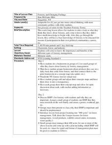
Forestry and Changing Feelings
Students investigate how the forest affects their daily lives by creating a concept map. In this ecological lesson, students create a concept map linking the forest to the many things they use each day. Students take a field...
Curated OER
All Aboard The Campaign Train!
Students explore campaign politics. In this political campaign lesson, students investigate multimedia sources in order to examine the structure of political parties and platforms from previous presidential elections. Students then...
Curated OER
George Washington's Revolutionary Journeys
Students take a closer look at historical maps. In this American Revolution lesson plan, students examine the provided historical maps and documents to determine the assignments that George Washington assigned to subordinates during the...
Curated OER
Government Lesson Plan: Lesson Plan 12
Students investigate various political systems around the world. They complete a chart that compares the U.S. political system with other nations' governments, conduct research on a selected nation, and present an oral report.
Curated OER
Paul Conrad's Perspective on Civil Rights
Students review a political cartoon and discuss desegregation. In this cartoon analysis lesson, 11th graders discuss the impact of a political cartoon and its relation to a Supreme Court case. Students read additional...
Curated OER
Cartoons for the Classroom: Don't Get It? You're Not Alone
In this historical events worksheet, students analyze a political cartoon from the 1700's and one from the 1900's . Students respond to 2 short answer questions.
Curated OER
Cartoons for the Classroom: Geographic Inspiration
In this current events worksheet, students analyze a political cartoon about piracy near the Arabian Peninsula and respond to 3 talking point questions.
Curated OER
Money Matters: The Importance of Global Cooperation
Students prepare for a visit to the International Monetary Fund (IMF). For this lesson students create a concept map of money. They discuss the goals of the IMF. Students research countries currently changing into market economies. After...
Curated OER
Armenian Genocide
As your historians examine the beginnings of WWI, ensure they are familiar with the Armenian Genocide. This basic introductory lesson plan utilizes teacher-led discussion, map analysis, and a Socratic seminar. Not much detail is offered...
Curated OER
NATO Geography & Language
The class receives background information on NATO, an atlas, and a blank world map. They color the original 1949 countries in red, the 1952 additions in green, and the 1990 additions in blue. This exercise would be a good starting point...
Other popular searches
- Wwi Political Map
- Maps of Europe Political
- Physical and Political Maps
- Canada Political Map
- Americas Political Map
- Blank Political Maps
- Political Map of Africa
- United Kingdom Political Map
- Europe Political Map
- Physical & Political Maps
- Mexico Political Map
- State Political Maps


