Curated OER
Western Civilizations, Chapter 5: Roman Civilization
Investigate Ancient Rome with this comprehensive online western civilizations website. While designed for use alongside the Western Civilizations textbook, the tools on this site can be used to emphasize any study. A chapter quiz...
Curated OER
Western Civilizations, Chapter 9: The High Middle Ages: Religious and Intellectual Developments
If you are looking for a comprehensive guide to western civilizations, explore this online resource! Although designed for use with the Western Civilizations text, this site can be implemented in any course. A chapter quiz challenges...
New York State Education Department
Global History and Geography Examination: January 2017
Global history and geography class members demonstrate their knowledge of and ability to analyze primary sources such as graphics, maps, political cartoons, and texts from important documents with an assessment that includes multiple...
Newseum
Weighing the Arguments
To understand how personal perspectives can affect policy and politics, scholars examine the woman suffrage media map and historical artifacts to analyze arguments for and against women's suffrage. Class members then take on the role of...
Newseum
Persuasion Portfolios
After class members brainstorm a list of current social and political issues, groups each select a different topic from the list to research. Teams create a portfolio of at least 10 examples of stories about their issue, stories that...
Curated OER
Polar Bears and Ice
Students explore the Arctic food chain. They examine the needs of the polar bear and the threat that global warming poses to them. Students write a letter to a local political representative explaining what they have studied and...
Curated OER
Overland Trails To The West
Consider the political, physical, and geographical factors that led to and marked the Westward Expansion. Learners will track the various routes developed during the 1800's. They create a first person journal describing what they see,...
Curated OER
Charting Neptune's Realm: Profiles
Young scholars identify and describe the importance of nautical profiles in early navigation. They draw a profile of a street or mall and explore the effectiveness of different types of directions.
Curated OER
Hungary: The Landscape
Learners work in small groups to create a topographic map of Hungary. The map will include labeled line drawing of the bordering countries. Hungary should be three dimensional, made of salt and flour clay. The mountains, plains and...
Curated OER
The Brief American Pageant: The Resurgence of Conservatism
Take a short trip back in time with this presentation, which details the political and electoral contexts of 1980's and 1990's America. Covering the Gulf War as well as domestic economics, these slides feature easy-to-read charts and...
Curated OER
We Live in an International Community
Students locate the different countries from which their clothing originates. Using a blank map, they identify and color in those areas.
Curated OER
Italy: The Landscape
Students work in small groups to create a topographic map of Italy. They must include labeled line drawings of bordering countries and bodies of water. Students use salt and flour clay to make Italy three dimensional, showing the many...
Curated OER
The ABC's of Apportionment
Students are introduced to the terms of apportionment and redistricting. Using a Census map, they identify the states that had the highest and lowest numbers of change during the past ten years. They examine a map of voting districts and...
Curated OER
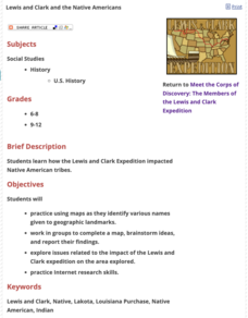
Lewis and Clark and the Native Americans
Students practice using maps and identifying landmarks on the Lewis and Clark expedition. They research Lewis and Clark's relationship with the Native Americans and report their findings to the class. They identify the impact of the...
Curated OER
Tibet and the U.S.
Students examine the relationship between Tibet and the United States. They explore the political relationship between the two countries. Students identify geographical features and political boundaries of the Tibetan and Chinese regions.
Curated OER
World Hunger - A Cultural Crisis
Students explore the problem of world hunger and starvation. After a class discussion, students use a map to identify specific areas where populations are starving. In groups, students research reasons for the lack of food. They prepare...
BBC
Eu, Un, and Commonwealth: Keeping Peace
What are the UN, the EU, and Commonwealth? Have the class brainstorm all they know about these powerful international organizations. Then have them compare and contrast the ways in which different countries or political groups...
Curated OER
Probing the Unknown: Artists as Explorers
Students gain an understanding of humans need to explore. They create a "journey map" depicting the accomplishments of artistic explorers, and research the influences that caused the artists to embark on these "explorations."
Curated OER
Create a Migrant's Scrapbook from the First Great Migration
Help young historians personally engage in the stories of African Americans during the Great Migration! Assessing a migration route map, learners create a migrant character's experience, adding details while studying primary sources. A...
Curated OER
The Brief American Pageant: The Cold War Begins
With the beginning of the Cold War came numerous social and political changes around the world - many of which are featured in this series of maps and graphs. This short but informative slideshow will help to bridge the gap between a...
Curated OER
Narrative Structure: Les Miserables
What is the initiating event? What is the protagonist's goal? What attempts are made to achieve this goal? What is the outcome? Model for your class how to map out the structure of any narrative. Readers then search for answers as the...
Curated OER
Sam Houston for President...Again
Fourth graders discover the political career of Sam Houston. In this Texas history lesson, 4th graders research primary resources and create a modern-day version of Sam Houston's political campaign of the 1840s.
Curated OER
Hellenistic Greece 324-100 BCE
Although it is visually appealing, this presentation on Ancient Greece does not provide a lot of information. But,it could be used to spur a discussion. There are maps and diagrams that would be helpful when covering this topic. Adding...
Curated OER
The Brief American Pageant: The Stormy Sixties
Intended for use with The American Pageant by David Kennedy, Lizabeth Cohen, and Mel Piehl, this slideshow includes maps and graphs that detail politics and social dynamics in 1960's America. The textbook is not necessary for...
Other popular searches
- Wwi Political Map
- Maps of Europe Political
- Physical and Political Maps
- Canada Political Map
- Americas Political Map
- Blank Political Maps
- Political Map of Africa
- United Kingdom Political Map
- Europe Political Map
- Physical & Political Maps
- Mexico Political Map
- State Political Maps

