Curated OER
Map Skills
Thirds graders reinforce that a map is a drawing that shows what a place looks like from above. They use a map key and symbols to create a map of the school and its neighborhood.
Curated OER
What Do Maps Show?
This teaching packet is for grades five through eight, and it is organized around geographic themes: location, place, relationships, movement, and regions. There are four full lessons that are complete with posters, weblinks, and...
Curated OER
Mapping My World
First graders make two maps. In this developing and reading maps lesson, 1st graders read Mapping Penny's World, discuss the parts of a map, create a map of their classroom, and create a list of directions of how to get to various...
Curated OER
Map Keys
Third graders examine maps and map keys. In this locating map features lesson plan, 3rd graders use crayons, markers and colored pencils to label maps. Students work in partners to read map keys and locate given places and things.
Curated OER
Read a Fall Foliage Map
Young scholars examine the purpose of a color key and use a color key to help them read a map.
Education World
The African American Population in US History
How has the African American population changed over the years? Learners use charts, statistical data, and maps to see how populations in African American communities have changed since the 1860s. Activity modifications are included to...
Curated OER
Exploring Arizona's Biotic Communities Lesson 1: Mapping Biotic Communities
As part of a unit on Arizona's biotic communities, young ecology learners create a map. They describe how humans and animals adapt in their habitat. They take notes and create graphic organizers from articles they read. Beautiful maps,...
Curated OER
Where Am I: How to Read a Map
Third graders develop an understanding of maps. They explore what a map is, who uses maps, and how to use maps. Students investigate the compas rose. They create a compose rose which illustrates the cardinal directions. Students practice...
EngageNY
Close Reading of Bullfrog at Magnolia Circle: Predators and Prey
Reading is fantastic, especially when it's reading about bullfrogs. Kids get cozy with predator/prey relationships as they hone their information-reading skills. They start out as they read a portion of the text aloud, then they...
Public Schools of North Carolina
Democratic Republic of Congo - Map Skills
Work on your map skills with a packet of activities about the river basins in the Democratic Republic on Congo. Learners study the maps provided before answering the geography questions and writing an acrostic poem about the region.
Curated OER
Cinderella Map Key
Students design a map key in order to show where the different Cinderella stories have taken place. In this map key lesson plan, students place symbols on a map to show the diversity of the stories.
Curated OER
Mapping Perceptions
Students create and read maps. In this map skills lesson, students draw a map of their neighborhood, then use skills acquired during map-making to interpret a classmates map and a map of the Ming Dynasty.
EngageNY
Reading Closely to Expand Understanding of Adaptations
Third graders work to determine the main idea, recall key details, and answer questions using an informational text on the topic of animal adaptations. Using the non-fiction text "Staying Alive: Animal Adaptations" (provided) the teacher...
EngageNY
Close Reading of Bullfrog at Magnolia Circle: Text-Dependent Questions, Main Ideas, and Key Vocabulary about the Bullfrog
As your 3rd grade class finishes reading Bullfrog at Magnolia Circle, the eighth lesson plan of this unit helps readers from an understanding of the very specific information on the final page of the book. As with the entire unit,...
EngageNY
Mid-Unit Assessment: Close Reading of Bullfrog at Magnolia Circle: Bullfrog Life Cycle
The sixth lesson plan in this Bullfrog at Magnolia Circle unit assesses your third graders' ability to read and understand informational text. The included assessment asks learners to take notes about the main idea and supporting...
Curated OER
What Do Maps Show?: Lesson 4 How to Read a Topographic Map
Students examine the use of topographic maps as two dimensional representations that show elevations and slopes with contour lines. They read maps of the Salt Lake City, Utah area and complete the associated worksheets that show map...
KOG Ranger Program
Fire Behavior in Forests
Understanding the ways a fire will act is a key factor in fire safety and fire prevention. Young campers focus on how the weather and terrain can affect the behavior of a fire with topographic maps and different...
National WWII Museum
What It Takes to Win: Mapping Primary Source Evidence
World War II was not just waged in Europe and Asia; the home front was key to Allied victory. Using newspaper clippings from World War II and a map, scholars plot out wartime production in the United States. After that, class members...
Curated OER
Mapping Perceptions of China
Young scholars discuss what types of things are included on a map. They compare and contrast maps of China with a map they create and practice using different types of maps. They write analysis of their classmates maps.
Curated OER
United States Map- State Capitals
Students explore map skills. In this state capital lesson, students view a United States Political Map and identify and use post-it notes to label the state capitals.
Howard Hughes Medical Institute
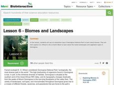
Lesson 6: Biomes and Landscapes
Aside from the amazing animals in Gorongosa National Park, what else is there to discover? The sixth installment in an eight-part themed series contains an interactive map where scholars can learn more about the geographic features of...
McGraw Hill
Study Guide for Island of the Blue Dolphins
Dive your class into a reading of Island of the Blue Dolphins with this in-depth study guide. Breaking the novel into three parts, the resource begins each section with a focus activity that identifies a specific theme or question...
Curated OER
Map Skills
Students explore geography by creating a poster presentation in class. For this mapping lesson, students identify the different components featured on a modern day map and how to utilize them in order to navigate. Students read a book...
Curated OER
Archaeology- State Map
Students study state maps. In this map skills lesson, students identify the states' location and how to use a legend. Students complete photocopies of the state map.


