Curated OER
Linguistic Diversity Secondary
Don't be scared off by the title! Read this information packet with your class, or send them off on their own. After each section, you'll find a series of comprehension questions. Great preparation for state testing!
Curated OER
Native Americans and Topography at Rose Bay
Students visit a wetland ecosystem. While they are there, students explore how to read topography maps of Rose Bay.
Curated OER
Book: Germany
Students, after reading Chapter One in the book, "Germany," analyze and recreate the political boundaries as well as the physical features of the nation of Germany with the assistance of play-doh or salt dough. In groups, they create...
Curated OER
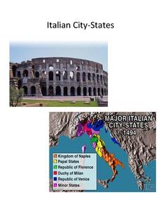
Italian City-States
Check out this packet of worksheets involving mapping activities, vocabulary logging, reading and comprehending informational texts, etc., which focuses on Italian city-states during the fourteenth and fifteenth centuries. There are also...
Curated OER
Maryland’s Chesapeake Bay Landscape Long Ago and Today
Combine a fantastic review of primary source analysis with a study of Captain John Smith's influence on the Chesapeake Bay region in the seventeenth century. Your young historians will use images, a primary source excerpt, and maps...
Defining US
Integration of Education and American Society
How did the struggle for Civil Rights during the 1950s transform American society and politics? Why are American schools integrated today? Class members explore these essential questions by examining a series of primary and secondary...
Curated OER
Deutschland und die Europäische Union (Germany and the European Union)
Introduce your language learners in German class to the European Union, including the historic developments, the current structure, and some of the political and social principles behind it with this instructional activity. In small...
Curated OER
Ann Arbor Growth & Immigration
Third graders describe some of the factors that brought early settlers to Ann Arbor. They read Narrative-A Trip from Utica, New York, to Ingham County, Michigan in 1838. As an added challenge, 3rd graders can use maps to track Silas...
The New York Times
Kiev in Chaos: Teaching About the Crisis in Ukraine
Provide a historical context for the political unrest between Russia and Ukraine that began in late 2013. Learners review their prior knowledge and chronicle new understandings with a KWL chart, watch a video explaining the Ukrainian...
iCivics
Drafting Board: Interest Groups
Does the influence of interest groups harm a political system? Your class members will analyze the role of interest groups in American politics, as well as consider the effect of perspective, bias, loyalty, and the...
Curated OER
The Times and Life During the California Gold Rush
Fourth graders read about the era in their history books, write in their journals revolving around the Gold Rush, making crafts such as newspapers, and also play the part of the Forty-niners.
Core Knowledge Foundation
Thanksgiving with the Pilgrims
Teach kindergartners about the First Thanksgiving with a series of lessons about the Pilgrims' journey to the New World. As they practice handwriting, CVC words, reading comprehension, and fun Thanksgiving songs, they learn about what...
Curated OER
The Mekong River
Junior geographers explore the region through which the Mekong flows, its pathway, the landscape, how people depend on the Mekong, and future uncertainties. They apply the five themes of geography to examine the region. They create a...
Curated OER
The Hajj: Muslim Pilgrimage in a Geographic Perspective
Students read information on the Hajj. They discuss pilgrimage and ways it differs from going to a church, mosque or synagogue. Students discuss logistical problems that might be posed for the host country of a pilgrimage. Students do an...
Curated OER
The Birth of the Ancient Games: The Olympics
This exercise includes a lengthy article on the history of the Olympics as well as a map of Ancient Greece. The last page includes 15 reading comprehension questions about the passage. A fairly thorough look at this topic - geared toward...
Curated OER
Understanding Growth of the Phoenix Area
Students study the growth of the Phoenix area using geographic images, maps, tables, and graphs. They study the idea of community.
Curated OER
Pioneer Values in Willa Cather's My Antonia
Included in this resource are a variety of activities to do while reading Willa Cather's My Antonia. The activities, which range from mapping out Nebraska to writing activities about pioneer living, are all designed with one...
Curated OER
The Battle of Brandywine
Learners explore the Battle of Brandywine, how to analyze maps, and construct a model of a battlefield.
Curated OER
Breaking News English: Prisoners
In this North Pole activity, students read the article, answer true and false questions, complete synonym matching, complete phrase matching, complete a gap fill, answer short answer questions, answer discussion questions, write, and...
Curated OER
Lesson 2: Mapping With Words
Students demonstrate an understanding of the personal relationship that Wabanaki peoples had with the land by analyzing selected Wabanaki place names. They practice map-reading and map-making skills.
Curated OER
It's Happening, Where? Find the Absolute and Relative Location of News Articles
Students read newspaper articles. In this social studies lesson, students locate the latitude and longitude of the location where the news article takes place. Students write a summary of the news article.
Curated OER
Polar Bears and Ice
Students explore the Arctic food chain. They examine the needs of the polar bear and the threat that global warming poses to them. Students write a letter to a local political representative explaining what they have studied and...
Curated OER
Narrative Structure: Les Miserables
What is the initiating event? What is the protagonist's goal? What attempts are made to achieve this goal? What is the outcome? Model for your class how to map out the structure of any narrative. Readers then search for answers as the...
Curated OER
We Live in an International Community
Students locate the different countries from which their clothing originates. Using a blank map, they identify and color in those areas.


