Curated OER
Ancient Egypt Geography
Nine questions to answer and one map to read. Seventh graders will use the map of Ancient Egypt to practice map reading skills and build a visual image of Ancient Geography.
Curated OER
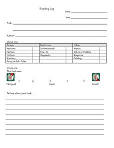
Reading Log
In this reading log worksheet, students fill in a reading log, noting title, author, genre and rating on a scale of 1-5. Students then write, "telling about the book."
Curated OER
Cylinders and Scale
Students review what a cylinder is and how a cylinder is measured. They build a variety of cylinders with different heights and radii. They compare the surface area and volume of each cylinder and discuss anything that surprises them...
K20 LEARN
Manifest Destiny: U.S. Territorial Expansion
A close examination of John Gast's painting "American Progress" launches a study of the concept of Manifest Destiny used to justify United States' policy of westward expansion. Young historians read statements from persons with different...
Anti-Defamation League
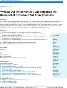
“Walling Out the Unwanted”: Understanding the Barriers that Perpetuate Anti-Immigrant Bias
As part of a study of immigrant bias, high schoolers investigate the language used in blogs, readings, media reports, and current legislation whose language perpetuates xenophobia. They then consider ways they can get involved in...
Florida Center for Reading Research
Phonics, Letter-Sound Correspondence: Letter Bag
An activity focuses on final sounds sorting. Scholars pull objects out of a bag, identify what letter sound the object ends with, then draw the picture under the appropriate column.
K20 LEARN
Ichabod and Brom - Two Wild And Crazy Guys: Characters' Differing Perspectives
After reading Washington Irving's "The Legend of Sleepy Hollow," class members compare the characteristics of Ichabod Crane and Brom Van Brunt. Next, they read an article about ghosts that supposedly haunt the campus of Oklahoma...
K20 LEARN
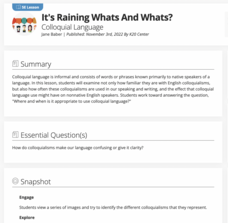
It’s Raining Whats and Whats? Colloquial Language
"Yuns betta outten the lights!" Colloquial language is the focus of a lesson plan that asks middle schoolers to consider the pros and cons of using idioms. They read articles, match expressions with their meaning and place of origin, and...
Utah Education Network (UEN)
Character Changes Lesson and iPad Assignment
Round, flat, static, dynamic. As part of a characterization study, scholars review the different types of characters and create a slide show demonstrating how a dynamic character in a story they have read changes throughout the tale.
Curated OER
Navajo Weaving: A Lesson in Math and Tradition
Combine geometry and tradition with a lesson that spotlights Navajo weaving. The book, The Goat in the Rug by Charles L. Blood and Martin Link hooks scholars before watching a video of Navajo people tending their sheep and beginning...
Anti-Defamation League
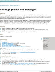
Challenging Gender Role Stereotypes
Through thoughtful discussion and a read-aloud, scholars challenge gender role stereotypes. Pupils examine pictures and collaborate with their small groups to debunk stereotypes. They explain what gender role stereotypes they know of and...
Elementary School Counseling
The Day Jace Kelly Popped
Anger can creep inside and build up in all of us. Prepare your youngsters for this feeling by reading the story of Jace Kelly through this series of storytelling printables, and discover the strategies he would eventually...
NASA
What Comes Next
Where is NASA going next with their rockets? A reading provides an overview of the next generation of rockets for space exploration. A full-page diagram gives the reader a scaled perspective of what this rocket may look like, for both...
Curated OER
What do Maps Show?
Eighth graders practice the skill of reading maps. In this geography lesson, 8th graders participate in a classroom lecture on how to read a map.
Curated OER
Are We There Yet?
Students discover how to use maps and why they are important when using a map. They calculate distance using a map scale and time using travel speed and a map scale.
Curated OER
Map Your House
Pupils are introduced to the concepts of maps as scale models of the whole. After a brief lecture on creating and using an accurate scale when drawing and reading a map. They create a scale drawing of the floorplan of their homes.
Curated OER
World Projections
Students identify map projections and examine polar maps. For this map skills lesson, students use a flat world map to identify various projections and calculate the distances between locations by using a map scale.
Curated OER
Something's Fishy
Learners study fish habits and traits. In this marine life lesson, students complete four learning centers of a fish memory game, a fish habitat study, draw and glue fish craft activity, and a fish read-a-thon. Learners complete their...
Curated OER
Any Nook or Cranny
Students create a reading nook. In this measurement lesson, students find a spot in the classroom to turn into a reading nook. They need to measure how much space they need to fit students and supplies into their nook.
Curated OER
Topo Map Mania!
Seventh graders describe the major features of maps and compasses. They read a topographical map. They take a bearing using a compass. They practice using scales on a map.
Curated OER
Language Arts: Chasing Vermeer - A DaVinci Code for Children
Young scholars read the mystery novel, Chasing Vermeer, research the artist and his works. Through observation of his works, they create their own pencil sketches of selected paintings. Finally, students simulate Vermeer's interiors...
Curated OER
Teen America Travels New England
Students simulate the role of a travel agent to understand how to read and use road maps. They plan a bus trip through New England for a group of travelers that includes, bus travel, meals and attractions. They plan the distance that...
Curated OER
KEYBOARDS
Second graders become familiar with appearance and characteristic sound of piano, identify piano as part of percussion family, find middle C on the keyboard, observe scale, chord, and "broken" chord, and listen to a well-known classical...
Curated OER
Exploring Earth Through Maps and Technology
In this maps worksheet, students read 3 pages of detailed information about maps, latitude, longitude, topography, satellites and global positioning. Students then answer 10 questions. There is also a research project assignment available.
Other popular searches
- Reading Scales and Capacity
- Math Reading Scales
- Reading Scales Weight
- Measurement Reading Scales
- Scales Reading
- Geography Reading Scales
- Reading Scales for Science
- Reading Scales and Balances
- Map Reading and Scales

