Curated OER
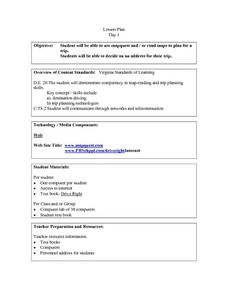
Plan a Trip
Students plan for a trip. They use map quest and / or road maps to decide on an address for their trip. They determine the mileage, lodging, gasoline to be used, shortest distance and fastest distance.
National Endowment for the Humanities
Lesson 1: On the Road with Marco Polo: A Boy in 13th Century Venice
Learners investigate Marco Polo's life as a young boy in 13th century Venice. They analyze maps, explore various websites, complete a chart and answer discussion questions, and create a travel brochure about visiting 13th century Venice.
Curated OER
Should the Ming End the Treasure Voyages?
During the first century of Chinese Ming dynasty (1368-1644), the government sent out a total of seven voyages into the Indian Ocean. Young historians will discuss, explain, role play, and compare the decisions made by rulers during the...
Curated OER
Denali Park Topographic Maps
Middle schoolers construct a topographic map of the Denali National Park. They identify different elevations and record historic landmarks in student science journals.
Curated OER
On the Road with Marco Polo: Marco Polo in China
Learners investigate who the Mongols were and where their empire was located. They research Kublai Khan and the region he ruled. They study the major products of 13th Century China.
Curated OER
Introducing Topographic Maps: Guiding Students from Concrete Models to Graphic Representations
Young scholars interpret topographic maps and infer human activity as it is influenced by the landscape.
Curated OER
Mapping School Grounds
Students map and analyze the natural and cultural environment of the school grounds. In small groups, they sketch the natural and cultural features of each side of the school building, create a map, participate in a class discussion,...
Curated OER
Westward Expansion : Mapping
Fifth graders travel along exploring the expeditions of John F. Fremont. In this Westward expansion lesson, 5th graders gain understanding of the events that shaped the west through the use of maps. Students use mapping skills to...
Curated OER
Topographic Maps
In this topographic map worksheet, students learn how to read a topographic map and create a topographic map of their own using clay or Play-Doh. Students include contour lines by layering the clay. Students answer 6 questions about...
Curated OER
Introduction to Maps
Learners develop their map skills. In this geography lesson, students participate in an activity that requires them to survey their social studies book in order to find different types of maps and purposes for their uses.
Curated OER
On the Road Again
Students trace the migration route of a gray whale. They color and label a map of North America, and using photocopy pictures of a gray whale, they move the whale along the migration route over a ten week period.
Curated OER
Learning to Read a Map
First graders identify the map and globe symbols: Cardinal Directions; Compass Rose; Mountains; Rivers; Lakes; Towns; Roads.
Curated OER
Traveling the Silk Road
Students take a virtual trip down the Silk Road. Using a map, they trace the location of the trade route and others that were developed later. They use different spices and goods to trace how they came to the Americas. They answer...
Curated OER
Mapping the Halifax Explosion
Young scholars research the Halifax Explosion using historical maps.
Curated OER
Learning to Read a Regional Map
Pupils locate the local community, surrounding communities and major geographic features of the SE Utah and the Four-Corners region on a map, after receiving direct instruction.
National Endowment for the Humanities
Factory vs. Plantation in the North and South
North is to factory as South is to plantation—the perfect analogy for the economy that set up the Civil War! The first lesson in a series of five helps teach beginners why the economy creates a driving force for conflict. Analysis of...
Montana State University
Meet Mount Everest
Learning about one landform might seem boring to some, but using the resource provided practically guarantees scholar interest. The second in a sequential series of eight covering the topic of Mount Everest includes activities such as a...
Curated OER
Discovering New Mexico
Seventh graders discuss the elements of maps and using basic linear measurement. They calculate the distance between the cities and create a simulated journey around New Mexico using a road map. They write out the directions for their...
Curated OER
The Silk Road
Learners explore the Silk Road of Asia in this multi-day lesson that includes a "Silk Road roll play" and a mapping activity. This lesson can be used in a social studies or language arts classroom.
Kentucky Educational Television
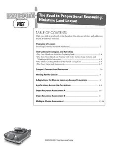
The Road to Proportional Reasoning
Just how big would it really be? Young mathematicians determine if different toys are proportional and if their scale is accurate. They solve problems relating scale along with volume and surface area using manipulatives. The last day of...
Curated OER
The Road to Success
Young scholars chronicle the main events in their lives so far. They draft, revise, and publish an anecdote. Students get to know their fellow classmates and they build a nurturing learning community. Young scholars take an interest...
Curated OER
The Silk Road, An Ancient Internet
Students examine how goods and ideas moved along an ancient trade route between China and Europe. They make charts of items, ideas, etc. that were transported along the Silk Route.
Curated OER
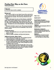
Finding Your Way on the Farm
Third graders make a grid map. In this directionality lesson plan, 3rd graders review how to use a grid to locate objects or places on a map. Students draw a grid map of the classroom and locate seating assignments. Students create a...
Curated OER
In Celebration of the Silk Road
Sixth graders explore the ancient trade routes of the Silk Road with a focus on a province in China to identify artifacts and research how these items arrived in the city of Turpan.


