Curated OER
Islamic Society: A Lesson in Surrender
High schoolers examine the third pillar of Islam. They discover the influence of Islamic ideas and practices on other cultures, Explore the various meanings of social group and the ways that each group functions. Then, they research the...
Institute for Geophysics
Understanding Maps of Earth
Here is your go-to student resource on primary geography concepts, including facts about the surface of the earth and its hemispheres, latitude and longitude, globes, types of maps, and identifying continents and oceans.
Boston University
Scramble for Africa
For this fantastic simulation, your young historians take on the roles of imperialistic European countries in the nineteenth century and then "scramble" to carve up the continent of Africa! This is a very hands-on activity that will help...
Roy Rosenzweig Center for History and New Media
Westward Expansion: Image and Reality
As your young historians study Westward Expansion, practice in-depth primary source analysis with the documents and guidelines presented in this resource. They will examine a lithograph and excerpts from two letters written by a Nebraska...
Curated OER
Continents of the Globe
Students identify the continents on the globe. In this map skills lesson, students define the term "continent" and identify the seven continents on the globe.
Curated OER
Continent Adventure
Young scholars review or learn information regarding the 7 continents on our planet. It is also a fun movement and fitness activity.
Curated OER
Learning About the Equator, The Seven Continents and the Four Oceans
Students use a globe or map to locate the equator, oceans and continents. Using the internet, they spend time surfing through predetermined websites on continents and oceans. They write facts on different parts of the globe on index...
Curated OER
United States Map- Continent, Country, State
Students identify their continent, country, and state on a globe. For this geography lesson, students use a globe to identify the seven continents, the United States, and the state which they live in. Students define key terms.
Curated OER
Locate and Name the bodies of water and the continents
Second graders locate the equator, bodies of water, and different continents on a globe. In this globe lesson plan, 2nd graders recall geographical information on a globe.
Curated OER
Name That Continent
Students practice locating the seven continents, four hemispheres, and four oceans using a large world map and a review song. They also import a world map to the Kid Pix computer program then type in proper labels on the map. There are...
Curated OER
The Peanut Wizard
Students investigate the history of the peanut. In this social studies lesson, students read the book A Pocket Full of Goobers and examine the a peanut. Students discuss the peanut's characteristics and take notes on an article about...
National Endowment for the Humanities
Chronicling and Mapping the Women's Suffrage Movement
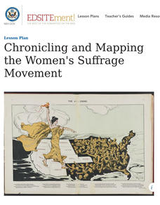
While women's suffrage is often believed to be the result of a single constitutional amendment, the effort of women to secure the vote spanned decades and continents. Using primary sources in online archives, class members explore the...
Curated OER
2nd Grade - Act. 22: The World Game
Second graders play World Game to become more familiar with continents, oceans, countries and states.
Curated OER
Continents Lesson
Fourth graders write the correct name of the continent on each land mass. They locate Asia and outline the country of China and label it. They lightly color in the continents.
Curated OER
Continents And Islands
Students engage in a literature study in order to address the concept of exploring the culture of Puerto Rico. The instructional activity looks at the culture through the eyes of two children. This helps students to connect to the...
Museum of Tolerance
Immigration Journeys
Through the journey of four stories of immigration, scholars complete graphic organizers and apply knowledge to create a visual representation of their findings on a large poster. Third and fourth readers write a letter to their family...
Museum of Tolerance
Where Do Our Families Come From?
After a grand conversation about immigration to the United States, scholars interview a family member to learn about their journey to America. They then take their new-found knowledge and apply their findings to tracking their family...
Curated OER
Geography With Dr. Seuss
Students read the book, The King's Stilts by Dr. Seuss and discuss the geographical information given in the book. Then they discuss and locate on a map the physical features that make up the continent of Africa. They create an original...
Curated OER
China is Unique
Sixth graders study the culture of China by comparing it to that of the United States. They write all questions and notes in a journal. The students access the internet to obtain the information and internet sites are suggested in the...
Curated OER
The Importance of Imports
Students explore world trade by examining items they find at home and listing countries those items came from. Data is displayed on a map and charted according to continent. They discuss how products are transported.
Curated OER
Exploring the World's Geography
Students discuss the seven continents of Earth and the diverse geography. After discussion, they create their own paper-mache globes which properly display all seven continents, the equator, and the prime meridian. They conduct research...
Curated OER
Me on the Map Lesson 2
Students analyze and interpret maps, globes and geographic information systems to define and identify cities, counties, states, countries and continents to create a booklet called me on the map. They also determine and calculate the...
Curated OER
Geography Puzzles
Students study the continents of the world. In this Internet geography lesson, students connect to online mapping games. Students collaborate in order to develop their understanding of world geography, including countries and capital...
Curated OER
Putting the World in Perspective
Students work in small groups to: make a mental map of the world by tearing paper shapes of the seven continents and locating them on a flat surface in their relative positions, compare their finished mental map to a reference world map,...


