Curated OER
Welcome to the Americas
Students research and map the North and South American continents. In this geography lesson on the Americas, students can locate North, Central and South American countries and states. Students choose a location to research and prepare a...
Curated OER
Latin America Map Quiz
In this Latin America map quiz worksheet, students label all of countries on Central and South American shown on the blank outline map.
Curated OER
Toco Toucan - Oil Pastels
Students create a picture of a toucan from the continent of South America using a pencil, marker, and oil pastels. Students identify the continent of South America and discuss the Toco Toucan. They follow teacher directions to create...
NASA
Outline Maps
Don't miss this gold mine of blank maps for your next geography lesson! Regions include traditional continents such as Asia, Europe, and Africa, as well as other major world areas such as the Pacific Rim and the Middle East.
Curated OER
South America Layered
Seventh graders create an overlay map of South America. They show the relationships between population, landforms and economies with their maps.
Curated OER
South America: Physical Map
In this South American physical map worksheet, students make note of the major landforms and bodies of water located on the continent.
Curated OER
South American Outline Map
In this blank outline map worksheet, students study the political boundaries of the continent of North America and those of the countries located there.
Curated OER
The European Conquest of the Americas
Witness the birth of the Americas in this presentation, which details the European Explorers who contributed to adding vital details on our modern-day maps. Viewers' worlds will literally expand after seeing the results of Cortes and the...
Institute for Geophysics
Understanding Maps of Earth
Here is your go-to student resource on primary geography concepts, including facts about the surface of the earth and its hemispheres, latitude and longitude, globes, types of maps, and identifying continents and oceans.
Curated OER
Bank Loans Money to Start Businesses
After locating Latin American countries on a world map, children read about how microbanks are loaning money to help start small businesses. Involving both current events and economics, the teacher introduces the article with a map...
Curated OER
South American Gauchos
Fourth graders explore the culture and background of the South American Pampas and Gauchos. Through reading and discussion activities, 4th graders gather information about the Gauchos. To conclude the instructional activity, students...
Curated OER
Dos mapas de Florida, el Caribe y parte de Sur America
What can maps tell us about the past? Find out with a Spanish lesson that incorporates geography. After examining maps individually, comparing two old maps of Spanish Florida and writing notes in the provided Venn diagram, pupils pair up...
Curated OER
Understanding Latitude and Longitude
Teaching learners about latitude and longitude can get a little complicated. Present the concept by first representing it as a graph. Just like finding a location on a graph using the x and y-axis, learners will be able to locate items...
Curated OER
Geography Words, Page 1
In this geography words and maps worksheet, students examine maps of North and South America. Students respond to 12 multiple choice questions regarding the maps.
Curated OER
Geography Words
This worksheet uses maps of South America and Canada to combine basic geography vocabulary and using prepositions. Students use the maps to answer questions about the locations of various countries on the two maps. This would be a good...
Curated OER
First Nations Contributions
Seventh graders examine countries when they first became nations. In this Social Studies lesson, 7th graders investigate food that was present in North and South America. Students prepare a presentation on food for their...
Curated OER
Hernando De Soto's Trip Through South Carolina
Fourth graders become familiar with the explorations of Hernando DeSoto. In this DeSoto lesson, 4th graders recognize the routes and territories of DeSoto's explorations. Students use primary and secondary sources and research to answer...
Curated OER
Rivers, Maps, and Math
Students use maps to locate and label the major rivers of North and South America. Using the internet, they identify forests, grasslands, mountain ranges and other landforms on the continents as well. They compare and contrast the...
Curated OER
School-Home Link: Maps
In this atlas and parent communication form worksheet, students use an atlas to find several things: the capitol city of Japan, the number of countries in Africa, where to buy a newspaper, the names of Presidents of the United States,...
University of Florida
Sailing to St. Augustine
Using a Florida map from 1597, young explorers consider the physical characteristics they would need in a site for a new colony and the resources they would need to survive. After selecting a site, class members research to discover the...
Curated OER
South Carolina: Loyalist or Patriot?
Eighth graders examine the battle waged in South Carolina over the American Revolution. In this American Revolution lesson, 8th graders analyze primary sources as they determine how the Loyalists and Patriots chose sides in the war.
Curated OER
Christopher Columbus: The Man, the Myth, the Legend
Learn more about maps by examining Christopher Columbus's voyage to the New World. Kindergartners will learn about basic map skills and how to identify the compass rose, oceans, and land masses. They will also discover the purpose of...
Curated OER
South America
In this map of South America worksheet, students study the map of South America and then write the names of the 15 countries and territories on the provided lines.
Curated OER
South American Capitals Quiz
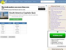
In this online interactive geography quiz worksheet, students respond to 12 identification questions about the capital cities of South America. Students have 4 minutes to complete the quiz.
Other popular searches
- Map of South America
- Reading Maps South America
- South America Map 1500
- South America Map `500
- South America Map Worksheet
- Physical Map of South America
- South America Map 500
- South America Map Skills
- Maps South America
- South America Map \`500
- Choropleth Map South America
- Blank Map South America


