Teach Engineering
Let's Learn About Spatial Viz!
Can you see your class working on spatial visualization? The first installment of a five-part module introduces the concept of spatial visualization and provides a 12-question diagnostic assessment to test spatial visualization skills....
Middle Tennessee State University
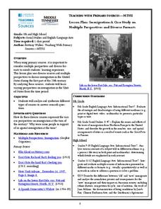
Lesson Plan: Immigration: A Case Study on Multiple Perspectives and Diverse Formats
As part of a case study of U.S. immigration during the first part of the 20th century, class members examine a variety of primary sources that present multiple perspectives of the responses of those in favor of immigration and those...
Curated OER
Face Study: Draw the Other Half
Build fine motor, spatial, and drawing skills by having the class complete the other half of a portrait. They choose an image of a face from a magazine, then attempt to draw the other half of the face as accurately as they can. Two book...
EduGAINs
Introduction to the Great Depression—Canadian and World Studies
Ah, the classic business cycle model: recession, depression, recovery, prosperity. And then there was the Great Depression. Groups investigate the economic conditions that led to and social movements of the 1920s that great out of the...
Curated OER
California's Golden History: 1848-1880
Using a variety of online resources, learners study life and society in California during the gold rush. They use a map to identify area where gold was located, explore pre-selected websites, describe mining practices, and create an...
Curated OER
Spatial Terms
In this spatial terms worksheet, learners study the 4 pictures of the teddy bear and its location to the box. Students then write sentences using spatial terms to describe the teddy bear's position. Learners also write questions from the...
Annenberg Foundation
Teaching Geography: Workshop 4—North Africa/Southwest Asia
Can Jerusalem be equitably organized? Can Israel and Palestine be successfully partitioned? Part one of a two-part workshop looks at the geo-political history of Jerusalem while Part two investigates Egypt's dependence of the Nile River...
Curated OER
Geomnemonics: Facilitating the Teaching of Social Studies Content with Geography Skills
Students explore how to draw a world map by hand and how to locate countries.
Curated OER
A world of oil
Students practice in analyzing spatial data in maps and graphic presentations while studying the distribution of fossil fuel resources. They study, analyze, and map the distribution of fossil fuels on blank maps. Students discuss gas...
Curated OER
Mapping the Past
Students study historical maps to view how the world evolved from medieval times through the Renaissance. They work in groups to examine the maps and present a report on one of the listed maps.
Curated OER
Exploring our National Parks
Young scholars utilize maps/Atlases to find key spatial information, locate U.S. National Parks, characterize the geography of a specific region, and create a National Park brochure.
Curated OER
What Can a Map Tell You?
Students investigate how maps can provide useful information about health issues. They study a map to draw conclusions about cholera death in London.
Curated OER
Weather Dance
Students study weather and focus on specific dance concepts. They are introduced to different ty es of clouds and how they are formed. Next, they study wind and why it occurs.
Foreign Policy Research Institute
Exploring Korea
A thorough and fun lesson on Korea! In groups of four (Social Chair, Historian, Translator, Travel Agent) class members research North and South Korea to determine a good location for an overseas institute for studying abroad. Once this...
Society for Science & the Public
Easter Islanders Made Tools, Not War
When studying artifacts, especially tools, how do archaeologists determine what the devices were used for? In what ways might researchers' previous experiences influence their perception of an artifact? An article about researchers'...
Curated OER
Finding Meaning in the Badge
Children who are three to five years old study two rank badges from the Qing dynasty to develop an understanding of social rank, language skills, and symbolism. The instructional activity is discussion-based and requires learners to...
Constitutional Rights Foundation
Guest-Worker Program
The U.S. Guest-Worker Program and the H-2A visa are the focus of a social studies activity. First, class members assume the role of advisors who must present the president with four proposals that would amend the visas given to...
Constitutional Rights Foundation
Unauthorized Immigration and the US Economy
As part of a study of immigration and the U.S. economy, class members assume the role of newspaper editors to determine which submitted letters to print on their paper's editorial page to present a balanced view of the debate.
Constitutional Rights Foundation
Arizona v. United States — States and Immigration Law
As part of a study of immigration law, class members read a summary of the Supreme Court case, Arizona v. United States. They then examine a series of examples and acting as federal court judges, must determine if the scenarios meet the...
Curated OER
Using Maps to Make Public Health Descisions Case Study: Harmful Algal Blooms in the Gulf of Mexico
Students are introduced to GIS and its uses. Students participate as public health scientists to deliberate a course of action to explore possible research questions. Pupils interpret spatial data, and make predictions based on GIS data,...
Curated OER
A Multicultural Study: Chinese New Year
Learners study the customs and beliefs of the Chinese people as they experience Chinese New Year; students become aware that they live on one planet but their festivals and holidays vary.
Curated OER
We've got the whole world in our hands
Students explore spatial sense in regards to maps about the globe. In this maps lesson plan, students label oceans, locate the continents and poles, follow directions, and explain the symbols on a map.
Curated OER
Using GLOBE Data to Study the Earth System (College Level)
Students use the GLOBE Website to locate and study environmental data. They use the GLOBE Graphing Tool to display data. Students describe the role of solar energy in the annual fluctuations of soil moisture. They describe reservoirs and...
Curated OER
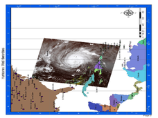
Hurricane Winds: A Spatial Hierarchy of Processes at Different Scales
In this earth science lesson, students study a satellite image of hurricane Isabel and write answers to 5 questions that follow. They match predictions to the map locations.


