Teach Engineering
Stormy Skies
Young meteorologists examine the four main types of weather fronts and how they appear on a weather map. Participants learn about the difference between the types of weather fronts along with their distinguishing features. A...
Curated OER
Reading Weather Maps
Fourth graders the symbols that are used on weather maps. They develop five day forecasts based on information they gather from weather maps in the newspaper and on the Internet.
PBS
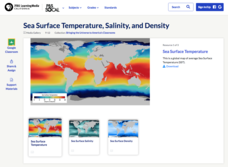
Sea Surface Temperature, Salinity, and Density
Earth's vast ocean is full of mysteries! Science scholars discover the big-picture properties that influence its characteristics at different latitudes using a lesson from PBS's Weather and Climate series. After completing a background...
Center Science Education
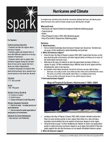
Hurricanes and Climate
Feeling under the weather? This lesson on hurricanes can whip things up! With professionally designed maps and handouts, teach your future weathermen (or women) where, when, and how hurricanes occur. They identify hurricane regions and...
Curated OER
Weather Predictions
Students record weather data and create a five day forecast. Students investigate the roles of meteorologists and identify symbols used on a weather map. After gathering weather data for a week, students will create a five day forecast...
Curated OER
Settlement Exploration: Then and Now
NASA has crafted an imaginative and memorable series of lessons, "NASA and Jamestown Education Module." This lesson is one of the five components. In it, middle schoolers connect history and science by comparing the settlement of...
Curated OER
Creating Station Models
Students work in groups to interpret weather maps. They use latitude and longitude readings to complete a worksheet together and turn in the worksheet along with the maps and a rubric.
NASA
Cloudy vs. Clear - Graphs
Explore the link between solar energy and cloud cover using real data from NASA from China! Future climatologists analyze and interpret graphs of solar energy on clear and cloudy days using a literacy cube. Investigators draw conclusions...
NASA
Hurricanes and Hot Towers with TRMM
Take cover because a wild presentation on hurricanes is about to make landfall in your classroom! An outstanding PowerPoint presentation is the centerpiece of this lesson. Not only does it provide information and photographs, but several...
Curated OER
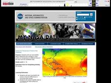
Surface Air Temperature Trends of the Caribbean
Students investigate the seasonal changes to sea surface and near-surface air temperatures near the equator. They use actual satellite data to track and graph the differences in air and sea temperatures during different seasons in the...
Polar Trec
Global Snow Cover Changes
Snow is actually translucent, reflecting light off its surface which creates its white appearance. Pairs or individuals access the given website and answer questions about snow cover. They analyze graphs and charts, examine data, and...
Curated OER
Acid Rain
Students use real-time weather maps to determine the likelihood of acid rainfall in a region. Students apply their understanding of interaction between weather systems, land and air pollution, to address acid rain and the effects on...
Curated OER
Earth's Water
If the majority of our planet is covered with water, why do we need to bother conserving it? With a thorough and varied investigation into the location and types of water on the earth, learners will gain an understanding of why this...
Curated OER
Wind and Wildfire
Emerging scientists research weather-related vocabulary terms, and map out where wildfires are most likely to occur. To bring this lesson to life, you could demonstrate what happens to a fire when you cool or remove the fuel, or cut off...
Science 4 Inquiry
An Investigative Look at Florida's Sinkholes
In May of 1981, the Winter Park Sinkhole in Florida first appeared and is now referred to as Lake Rose. Scholars learn about the causes of sinkholes through an inquiry project. Then, they analyze recent data and draw conclusions to...
Curated OER
Mars Geologic Mapping
Young scholars identify and interpret photographic details of a Martian surface image, design, and create a simple features map. They identify and interpret the geologic history of a part of Mars' surface and then, analyze and discuss...
National Wildlife Federation
Get Your Techno On
Desert regions are hotter for multiple reasons; the lack of vegetation causes the sun's heat to go straight into the surface and the lack of moisture means none of the heat is being transferred into evaporation. This concept, and other...
NASA
Earth's Global Energy Budget
Introduce your earth science enthusiasts to the earth's energy budget. Teach them using an informative set of slides that include illuminating lecturer's notes, relevant vocabulary, embedded animations, colorful satellite maps, and a...
Montana State University
Who’s on Top?
What's it like to climb Mount Everest? An educational resource encourages an in-depth knowledge of Mount Everest's scientific missions through a variety of activities, including an analysis of maps, a KWL chart, videos, a simulation, and...
Curated OER
Measuring Precipitation
A little engineering design is mixed into this lesson on precipitation measurement. Groups plan and construct a rain gauge, and use it to collect precipitation. As part of the PowerPoint presentation, learners view a satellite map of...
NOAA
Currents
Learn how ocean currents are vital to humans and marine life. The eighth installment of a 23-part NOAA Enrichment in Marine sciences and Oceanography (NEMO) program, focuses on ocean currents and how they affect global climate. The...
Curated OER
Introducing The Gulf Stream
Sixth graders research the average temperatures of different places on Earth. In this earth science lesson, 6th graders explain how the sun's heat cause ocean movement. They discuss how temperature change affects the weather we experience.
Curated OER
Geological Forces and Topography
Students discuss and research the Earth's geological processes. In this geology lesson, students study maps of Utah and the United States to learn about geological features. Students then complete the research cards for each area of...
Curated OER
Climate Patterns across the United States
Students articulate differences between climate and weather using examples in a written statement. Using climate data from across the country, they describe climate patterns for various parts of the United States on a map. Students...


