Curated OER
Jordan's Neighborhood: Using a Compass Rose
A neighborhood map is a great way to practice compass rose and key skills! Use these 2 worksheets to introduce these concepts through reading and comprehension activities. First, students look at 3 compasses, circling their favorite and...
Curated OER
Mapping Perceptions of China
Students discuss what types of things are included on a map. They compare and contrast maps of China with a map they create and practice using different types of maps. They write analysis of their classmates maps.
Curated OER
United States Map- Map Legend/City Symbols
Students investigate the United States map. In this map skills geography lesson, students explore city symbols on the map legend and identify them. Students use post-it notes to mark various symbols.
Curated OER
What Do Maps Show?: Lesson 4 How to Read a Topographic Map
Students examine the use of topographic maps as two dimensional representations that show elevations and slopes with contour lines. They read maps of the Salt Lake City, Utah area and complete the associated worksheets that show map...
Curated OER
Reading a Local and National Weather Map
Students investigate weather maps. For this weather lesson, students discover the meaning of different weather icons and symbols. Working independently, students use the local forecast to correctly label a state map.
Curated OER
We're on the Map!
Students identify a variety of topographic map symbols. They make generalizations about an unidentified community by reading and interpreting map symbols.
Curated OER
Finding Captain Hook's Treasure
Students use their map-reading skills to find Captain Hook's treasure. They see how the directions on a map correspond with "real-life" directions, and that symbols on a map represent real things.
Owl Teacher
Introduction to World of Geography Test
Assess your learners on the five themes of geography and the most important key terms and concepts from an introductory geography unit. Here you'll find an assessment with 15 fill-in-the-blank and 14 multiple-choice questions, sections...
Curated OER
Where Am I: How to Read a Map
Third graders develop an understanding of maps. They explore what a map is, who uses maps, and how to use maps. Students investigate the compas rose. They create a compose rose which illustrates the cardinal directions. Students practice...
Curated OER
Mapping Perceptions
Learners create and read maps. In this map skills lesson plan, students draw a map of their neighborhood, then use skills acquired during map-making to interpret a classmates map and a map of the Ming Dynasty.
Curated OER
Political Legends and Map Symbols
Students identify the legend and map symbols. For this map skills lesson, students use a world map to find various locations using a map key.
Curated OER
Way to Go! Create a Road Map Game
Young scholars create a travel game of one of the United States. They research a state of their choice and create a travel game using a common road map. They interpret map symbols as they calculate map mileage for their games. They...
Curated OER
Map Skills
Students explore geography by creating a poster presentation in class. In this mapping lesson plan, students identify the different components featured on a modern day map and how to utilize them in order to navigate. Students read a...
Curated OER
Map Exploration
Are you looking for a terrific lesson on map activities for your second graders? Then, this resource is for you! The activities range from decoding, to fill-in-the-blank, to read-and-search. There is a website activity related to maps...
Curated OER
Orienteering
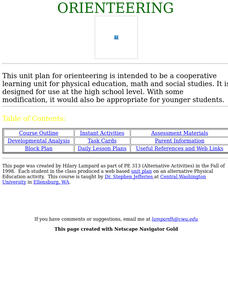
Everything you wanted to know about orienteering, and more! Take your class on an adventure with this creative activity. You will need to gather some supplies and materials and maps for your specific location, but the unit sounds like it...
Curated OER
Map Your Area
Students map the geographic boundaries of a recycling program's service areas and include the location of buyers important to the program. They use this map as an aid in managing a school recycling program or project.
Curated OER
Mapping My World
First graders make two maps. In this developing and reading maps lesson plan, 1st graders read Mapping Penny's World, discuss the parts of a map, create a map of their classroom, and create a list of directions of how to get to various...
Curated OER
Weather Map Challenge
For this weather worksheet students use a weather map to answer given questions. Students answer questions using map symbols and make predictions based on map. Students create additional questions with answers using the same map.
Curated OER
A Walk Around the School: Mapping Places Near and Far
After reading Pat Hutchins’ Rosie’s Walk, have your young cartographers create a map of Rosie’s walk. Then lead them on a walk around the school. When you return class members sequence the walk by making a list of how the class got from...
Curated OER
Map Scaling
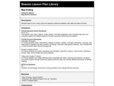
Second graders use a map scale to determine distances between cities in the state of Florida.
Curated OER
Mapping Electricity
Students complete Internet research and use their map reading skills to learn about how the United States creates and uses electricity in different states. In this energy sources activity, students study the mini map of energy usage in...
Teaching Tolerance
Identity Portraits
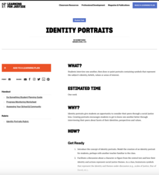
When you look at me, what do you see? Young learners answer this question by creating a portrait that reflects the identity of one of their peers. First, class members create interview questions. Then, they interview classmates to...
Curated OER
Using Concept Maps to Teach Evolution
Young scholars encounter concept maps for reviewing evolution. Concept maps provides an alternative method of interacting with the information and a forum for asking questions about vocabulary, concepts and interrelationships. A quiz is...


