Curated OER
Topos, Compasses, and Triangles, Oh My!
Students triangulate using a compass, topographical (topo) map and a view of outside landmarks. They take a field trip to another location away from school and mark discernible landmarks (like mountains or radio towers) and changes in...
Curated OER
A Map Mystery
Second graders solve a map mystery. In this technology lesson plan, 2nd graders develop an awareness of maps and the symbols associated with maps as they the "Neighborhood Map Machine."
Curated OER
Maps
Maps, globes, and computer software aid young explorers as they locate state capitols, major cities, geographic features, and attractions for states they are researching. They then use desktop publishing software to create a map to share...
Curated OER
Map It!
Fourth graders demonstrate map making skills by using the computer to create maps of the geographic features, regions, and economy for their state.
Curated OER
How To Read A Map
In this map skills worksheet, students view a map and answer five short answer questions by using the map key as a guide.
Curated OER
Determining Direction With A Map- Online Interactive
In this map skills worksheet, students analyze a city map and study the compass rose. Students answer 10 questions about the map. This is an online interactive worksheet.
Curated OER
CLASSROOM MAPS
Students do a blind tour of their school by responding to verbal commands. They look and discuss various maps in the classroom. They locate the direction of the sunrise and discuss the compass directions of North, South, East, and West.
Curated OER
Compass Deviation
Learners identify and describe the difference between the magnetic north pole and true north. They consider why sailors could not steer a straight course to the New World from the Old.
Curated OER
Compass Rose Activity
Which direction is which? Use this compass rose labeling worksheet to practice with basic directions as learners fill in the compass themselves. They use cardinal and intermediate direction abbreviations. Consider using their compass on...
Curated OER
Compass Rose
Keep it simple and visual when practicing directions using this compass rose labeling learning exercise. Learners fill in the compass themselves, using cardinal and intermediate direction abbreviations. North is done for them. Consider...
Curated OER
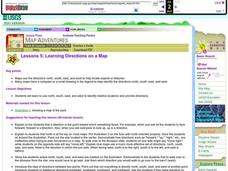
Learning Directions on a Map
Learners use north, south, east, and west to identify relative locations and provide directions.
K-State Research and Extensions
Water
How are maps like fish? They both have scales. The chapter includes six different activities at three different levels. Scholars complete activities using natural resources, learn how to read a map, see how to make a compass rosette,...
Curated OER
Mapmaking
Young scholars examine the craft of cartography and how the Lewis and Clark expedition created and used maps. They analyze maps, read a handout, create a map, participate in a mini expedition and map out a route based on travel...
Curated OER
Forest Fun
Students explore orienteering and how to use a compass. They explore the importance of forests and identify some of the trees in a local forest.
Curated OER
True North, Magnetic North
Young scholars explain why compass angles need to be corrected for regional magnetic variation. They observe the difference between magnetic and true north. Each student measures the angle of variation for a town in a different state.
Curated OER
Ecology Explorers
Students create accurate, detailed map showing physical features, plants and trees, and other details of three school sites.
Curated OER
United States Map
Students access prior knowledge and locate the North and South Poles on the map. In this mapping lesson, students understand the position of the United States relative to the poles. Students answer questions about the globe.
Curated OER
All About the Animals
Whose footprints are those? After reading Janet Halfmann's book, Little Skink's Tail, young scholars use footprints to determine where on a gridded map certain animals have been spotted. They use the map to answer 3 questions, one...
Curated OER
Map Making/Floor Plans/Map Reading
Young scholars apply their knowledge of scale when mapping the classroom. They determine the use of a map legend and orient a map using a compass. They create the classroom maps using transfer graph paper.
Curated OER
Using 4 main directions in a classroom
Students use the four directions of a compass rose to locate classroom features. In this directions lesson plan, students locate the features by identifying directions.
K12 Reader
Where On Earth Are You?
What do we use to determine the exact locations on the earth? Your kids can learn all about compass roses and latitude and longitude. Test understanding with the five reading comprehension questions included on the page.
Curated OER
Orienteering - Lesson 10 - Putting It All Together
Wrap up this unit by navigating through a prescribed course using a map and a compass. Put all the skills learned about reading a compass and using a map to navigate through an unknown course. Each learner should have a control card...
Curated OER
Second Graders on the Map
Second graders explore the various types of maps. They examine the differences between street maps and aerial photographs. Students identify various features on each map. They use cardinal directions and the compass rose. They write...
Curated OER
United States Map - Lesson 9
Students explore the concept of cardinal directions. In this geography lesson, students identify the compass rose on a large U. S. map and then discuss the cardinal directions.


