Curated OER
Roman Empire: Physical Framework - Location, Borders, Dimensions
Learners relate the classical world to the modern world. In this map skills lesson, students turn a blank map into a colorful complete map by following step-by-step directions. This lesson allows learners to connect our current geography...
Curated OER
Looking Toward a Higher Deity
Sixth graders study the tenets of the five major religions of the world. In this religion instructional activity, 6th graders investigate the tenets of Buddhism, Christianity, Hinduism, Islam, and Judaism by researching and recording on...
Curated OER
Around the World in 5 Days
Learners explore continents, draw map, discuss cultures, use research to learn geography, and investigate cultures.
Curated OER
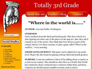
Where in the World is...?
Students work in groups to locate an appropriate planet where inhabitants of a fictional place can be relocated. They create a PowerPoint presentation to introduce their relocation site, as well as ecosystem information about the site....
Curated OER
Where in the World? The Basics of Latitude and Longitude
Students are introduced to the concepts of latitude and longitude. In groups, they identify the Earth's magnetic field and the disadvantages of using compasses for navigation. They identify the major lines of latitude and longitude on a...
Curated OER
We've got the whole world in our hands
Students explore spatial sense in regards to maps about the globe. In this maps lesson plan, students label oceans, locate the continents and poles, follow directions, and explain the symbols on a map.
Curated OER
Using Old Maps as Tools to Explore Our World
Learners explore historical maps. In this primary source analysis instructional activity, students uncover the meanings in selected historical maps as they use them to enhance lessons on historical events. Samples for classroom use are...
Curated OER
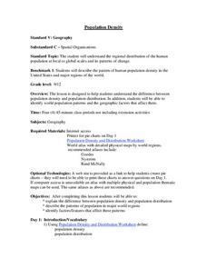
Population Density
Students examine world population density and population distribution. They create pie charts showing population distribution and analyze population patterns in the United States and major regions of the world. They identify...
Curated OER
World Cities
Students examine the settlement patterns of world cities. In groups, they are given a region of the world and asked to create a city in the location. They are given a set of characteristics of the city and determine what would be found...
Curated OER
World Cities of 5 Million or More
Students consult online resources to identify and map the world's largest cities and metropolitan areas. They analyze birth rates, settlement patterns and other demographic data and make predictions for the future. They write essays...
Project Food, Land & People
Loco for Cocoa
Students create a time line and map about how chocolate traveled the world. In this chocolate lesson plan, students also create and taste chocolate.
Curated OER
Where in the World?
Sixth graders research online various types of poetry. In this poetry analysis lesson plan, 6th graders research different types of poetry online, their characteristics, and poets. Students create a class atlas that incorporates the...
Curated OER
Geography and World History
Students build off of their current knowledge of geography and world history, while being introduced to new concepts and ideas.
Curated OER
Coffee Makes the World Go Round
Students examine the concept of "fair trade coffee," then research facts about coffee and the coffee industry and create original exhibits to be included in a "Global Coffee Awareness Fair."
Curated OER
Nunavut, Our Communities
Young scholars locate the communities of Nanavut on a territorial map and identify community characteristics. They research the online Atlas of Canada
Curated OER
Deportation of the Acadians
Students use an online atlas to identify the presence of Acadian culture in the Maritime provinces of Canada and explore the deportation.
Curated OER
Interdependence in a Global Community
Students locate the geographic origin of a variety of products used in our society. They find countries in an atlas or on a wall map. They define the term imports and emphasize the theme of MOVEMENT and use it to explain interdependence.
Curated OER
The Influence of Physical Geography
Students explore the limits and demands of their physical world and how it relates to the survival and well-being of people.
Curated OER
Baseball in Korea
Seventh graders explore the origins of baseball. In this Geography instructional activity, 7th graders compare Korean baseball teams with other countries. Students create a map of all the baseball teams around the world.
Curated OER
Geomnemonics: Facilitating the Teaching of Social Studies Content with Geography Skills
Students explore how to draw a world map by hand and how to locate countries.
Curated OER
Wow! You're Eating Geography
Students examine patterns of food producing areas, and identify foods that are grown locally, in the U.S., and around the world. They map and graph the major food crops of their local area, the U.S., and other countries, and discuss the...
Curated OER
Design Your Own Building
Learners explore the use of design principles in the real world. They evaluate how problems can be solved using design principles. In groups, students design the floor plan for a building of their choice.
Curated OER
Three Gorges Dam: Will China Sink or Swim?
Seventh graders study the Three Gorges Dam, which is the largest dam built in the world. They examine how the dam impacts China as it prepares for the 21st century.
Other popular searches
- Nystrom World Atlas
- Beginners World Atlas
- Online World Atlas
- World Atlas Geography
- Make a World Atlas
- On Line World Atlas
- Mcdougal Littell World Atlas
- Nostrum World Atlas
- Mcdowell Lit Tell World Atlas


