Curated OER
Physical World Map
In this world map worksheet, students practice their geography skills as they label the 7 continents and 5 oceans. Teachers may use this physical map for various classroom activities
Curated OER
World: Political Map
In this world political outline map worksheet, students examine boundaries of each of the countries in the world. This map not is labeled.
Curated OER
World Pacific Map
In this world Pacific projection outline map worksheet, students examine boundaries of each of the countries in the world. This map not is labeled.
Curated OER
World: Continents Map
In this World outline map worksheet, students note the political boundaries of the continents of the world on this Robinson projection map.
Curated OER
World Climate Map
In this world climate map learning exercise, students examine the tropical, dry, warm temperate, cool temperate, polar and subartic, and highland climate regions of the world.
Curated OER
World: Continents Map
In this outline map worksheet, students note the political boundaries of the continents of the world. The map is labeled with the names of the 7 continents.
Curated OER
Mapmaker, Make Me a Map!
Here is a well-designed, very thorough lesson plan on mapping for very young children. Within the six-page plan, you will find everything you need to implement the lesson plan. They will identify various landforms found in Colorado on a...
Oregon State
World Map of Plate Boundaries
Young geologists piece together the puzzle of plate tectonics in an earth science lesson. Given a physical map of the world, they search for land formations that indicate the location of different types of plate boundaries.
Curated OER
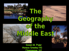
The Geography of the Middle East
Topographic, political, and satellite maps establish the world of the Middle East for your class- a land about which they have heard quite a lot, but might not really understand. This presentation would be a good introduction into a unit...
Curated OER
Where in the World Is Mexico?
Students practice map-reading skills as they locate Mexico and its cities on a world map. By creating a puzzle out of a map of Mexico, students engage in a meaningful hands-on activity to help them explore that country's geography.
Curated OER
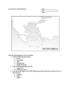
Ancient Greece Map Worksheet
Since the beginning of time, geography has shaped the development of human civilization, and ancient Greece is no exception. This instructional activity supports young historians with exploring this relationship as they first identify...
New York State Education Department
Global History and Geography Examination: August 2015
Need a comprehensive test about global history and geography? Look no further! Test young historians' understanding of how to use primary sources to formulate answers with an assessment that uses multiple-choice questions that require a...
New York State Education Department
Global History and Geography Examination: June 2016
Assess scholars' knowledge of the changing borders in Germany during World War II with a test that includes both multiple choice and essay questions.
Population Education
Population Map
Here is a very interesting graphic of a world map where each country's size is adjusted accordingly to its population. The bottom row of the document also includes several maps depicting the major shifts and growth of the world...
Curated OER
World Geography - Climate Notes
A challenging activity helps young geographers explore the temperatures around the world! They study how the Earth's land temperatures are affected by their proximity to an ocean, as well their latitude and their altitude. A very...
Curated OER
Where in the World is Hawaii?
Students compare a globe and a two-dimensional world map and explore how they both represent the planet Earth. They locate the Hawaiian Islands on the globe or the world map and describe how the geographical position is unique.
Curated OER
Countries of the World
Students define the meaning of the word country. In this countries of the world map lesson plan, students identify boundaries, countries, and symbols within countries on the map. Students distinguish the words country and continent.
Curated OER
Geomnemonics: Facilitating the Teaching of Social Studies Content with Geography Skills
Students explore how to draw a world map by hand and how to locate countries.
Curated OER
Magical Maps
Second graders discuss the importance of using maps and how they are used. After they listen to a folktale, they develop their own story line maps and write their own folktale to accompany a map. They also identify and locate the seven...
Curated OER
The Crimean War
Use the list of cities, countries, and water ways to correctly label a map of the regions associated with the Crimean War. There are approximately 20 locations to locate and identify.
Curated OER
Map Puzzles
Students make puzzles from world maps, dramatizing how much of the globe is covered by ocean.
Richmond Community Schools
Map Skills
Young geographers will need to use a variety of map skills to complete the tasks required on this worksheet. Examples of activities include using references to label a map of Mexico, identify Canadian territories and European countries,...
Alpha Omega
History and Geography—Two World Wars
Here's a combination textbook/workbook that examines the conditions in Europe that lead to World War I. Ideal for homeschoolers as well as classroom use.
Academy of American Poets
Teach This Poem: "Maps" by Yesenia Montilla
After examining a physical map of the world, learners conduct a close reading of Yesenia Montilla's poem "Maps." They note the interesting words and phrases, the way the poem is structured, and list questions they might have. After...


