Curated OER
The End of the War: WWII
Enhance your student's reading with this presentation on the end of WWII. This series of slides contains information, focus questions to guide student reading, and a video entitled, The Impact of World War II. Note: To view the...
Curated OER
Virtual Field Trip
This hands-on resource has future trip planners analyze graphs of mileage, gasoline costs, and travel time on different routes. While this was originally designed for a problem-solving exercise using a Michigan map, it could be used as a...
Curated OER
Mapping Japan
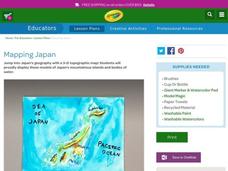
Students research the islands of Japan to investigate their location in the world and the islands' characteristics. They comprehend map making and topography. Studnets construct a scale-model map of the Japanese islands and surrounding...
Curated OER
You Are Here
Students map local places and learn to use scale and distance. In this mapping instructional activity, students map their school and a favorite place. Students recreate their maps showing distance and scale sizes. Students...
Tech Know Teaching
6th Grade Constructed Response Question
Graphs, charts, maps, diagrams. Reading and comprehending informational text is far more than just decoding the words on a page. Here's a packet that provides young readers with practice answering constructed response questions using...
National Geographic
Australia, Antarctica, and Oceana
Go on a traveling adventure throughout Australia, Oceana, and Antarctica! This textbook excerpt offers a full unit of study that can easily be supplemented by extra projects or research materials. Learners study maps, read about...
National Park Service
Remembering Pearl Harbor: The USS Arizona Memorial
Young historians use primary source materials to investigate the 1941 attack on Pearl Harbor and the sinking of the USS Arizona. After reading background articles and studying maps and images of the attack, class members consider whether...
Science Matters
Ring of Fire
Over a period of 35 years, earthquakes and volcanoes combined only accounted for 1.5 percent of the deaths from natural disasters in the United States. The 15th lesson in a 20-part series connects the locations of earthquakes and...
American Battle Monuments Commission
The Meuse-Argonne Offensive
America's entrance into World War I drastically changed the scope of the conflict. An interactive map and timeline takes learners through the Meuse-Argonne Campaign, which lasted from September 26, 1918, to the eventual German armistice...
American Battle Monuments Commission
The Strategic Bombing Campaign
An extensive look at World War II details the strategic bombing campaign of the Allied forces. Beginning in September 1939 and ending in May 1945, the interactive map follows British and American forces throughout the bombing campaigns...
Teach Engineering
Stormy Skies
Young meteorologists examine the four main types of weather fronts and how they appear on a weather map. Participants learn about the difference between the types of weather fronts along with their distinguishing features. A...
Curated OER
Ancient Greece Map Worksheet
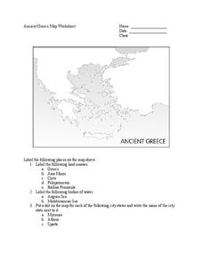
Since the beginning of time, geography has shaped the development of human civilization, and ancient Greece is no exception. This worksheet supports young historians with exploring this relationship as they first identify key land...
American Battle Monuments Commission
The Normandy Campaign: The Advance Inland
Over the summer of 1944, the Allied powers of World War II came together to take back the beaches of France. See the ways each division operated to turn the tide of war with an interactive timeline and map.
CK-12 Foundation
Direction on the Earth: Using a Compass
Navigate the world of orienteering in an informative interactive. Earth science scholars learn practical direction skills, such as proper polar coordinates and pairing compasses with maps. The interactive map allows them to practice...
Curated OER
Math: Navigating the World Around Me
Young mathematicians research and discuss real world math word problems and ways in which they apply math concepts in their everyday lives. They create a storyboard of a math word problem from which they create a slide for a multi-media...
American Battle Monuments Commission
The Battle of the Atlantic
World War II is known for its land and air battles in Europe, but the waters of the Atlantic saw its share of skirmishes from 1939 to 1945. Learn more about the roles of the Allied powers in establishing ocean territory during World War...
American Battle Monuments Commission
The Great War: U.S. Division Under Allied Command
The victory of Allied forces in World War I is due in large part to the continued collaboration and support of the Allied divisions themselves. Learn more about the ways Australia, Britain, France, and the United States worked together...
Curated OER
Europe Map
In this world geography worksheet, learners study the map of Europe and locate the 48 countries within the continent. Students write the names on the provided lines.
Curated OER
Weather In The World
Students investigate the weather in different places in the world. In this algebra lesson, students use technology to gain an understanding of how to study integers. They add and subtract integers on a number line.
Curated OER
Virtual Field Trip
Are we there yet? Young trip planners learn about their state and plan a trip. They will select sites to see in three cities in their state, and record associated costs in a spreadsheet. While this was originally designed as a...
Indiana Department of Education
The Represented World: Communication—Packaging
Challenge your classes to design and market a new product. Collaborative groups use geometry skills to create packaging for their products. Finally, they plan a marketing strategy to present to a marketing specialist.
Los Angeles Unified School District
River Systems
Scholars must react to the ecosystems of a river. They use inquiry-based learning along with maps and visuals to better understand the impact of rivers on everyday life. To finish, they create final written projects and presentations.
K-State Research and Extensions
Water
How are maps like fish? They both have scales. The chapter includes six different activities at three different levels. Scholars complete activities using natural resources, learn how to read a map, see how to make a compass rosette,...
Curated OER
Anne Frank: One of Hundreds of Thousands
Middle schoolers conduct research to put Anne Frank's diary into historical context. They use maps, timelines, essays and websites to examine the early victories of the German army, paying special attention to the Netherlands and...
Other popular searches
- World War Ii Map
- World War I Map
- World War 2 Map
- World War I Outline Map
- World Climate Map
- World Biomes Map
- World Outline Map
- Blank Map of the World
- World Political Map
- Ancient World Greece Map
- World Time Zone Map
- Deciduous Forests Map World

