Montana State University
Who’s on Top?
What's it like to climb Mount Everest? An educational resource encourages an in-depth knowledge of Mount Everest's scientific missions through a variety of activities, including an analysis of maps, a KWL chart, videos, a simulation, and...
Curated OER
Enough To Make Your Head Spin
Students examine body language in the United States and Bulgaria. They also discover other forms of communication. They also examine a map of Bulgaria.
Curated OER
Sequencing
Are you looking for a way to teach sequence of events in your narrative writing unit? Bring this lesson to your middle school class, as it prompts young writers to create a narrative sequence map of events that have happened at school...
Weebly
Liberty Theme Park Project
Invite your young historians to demonstrate how the American Revolution truly was one crazy ride after another as they design a theme park! This unique and engaging project prompts learners to consider major events leading up to and...
California Historical Society
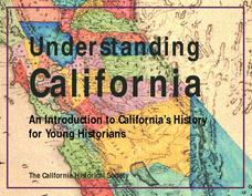
Understanding California
Here is a beautiful handout through which learners can explore the history of California, from the earliest Europeans to visit the Golden State up through its experiences during the Great Depression and position in the modern...
Environment Agency - Abu Dhabi
Plate Tectonics
Young scholars observe a presentation on plate tectonics, layers of the earth, and plate boundaries. They then use the Internet to research major plates and label them on a world map.
Skyscraper Museum
Changes in a City Over Time
Investigate the growth and development of New York City with the final lesson in this four-part series on skyscrapers. Learners first explore the concept of urban growth by looking closely at a series of three paintings made of Wall...
Super Teacher Worksheets
My Explorer Report
This is the perfect resource to accompany your class project on famous explorers! Learners detail basic information about their chosen explorer, his/her main events of exploration and means of transportation, and finally,...
Aurora Trust
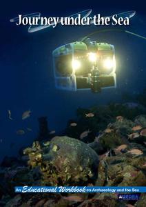
Journey Under the Sea
Discover the interesting world of maritime archaeology and explorations under the sea with this nice set of worksheets, which cover such topics as search tools and techniques of underwater archaeology, carbon dating,...
Science Matters
A Model of Plate Faults
The San Andreas fault is one of the longest fault zones in the world. In a series of 20 lessons, the fourth lesson has pupils use a paper model to recreate various types of plate faults. Each is held in position then drawn...
Scholastic
STEM Challenges and Activity Sheets for Grades 6–8
From 3-D cities to building bridges, young engineers engage in innovative STEM challenges that promote brainstorming and collaboration. Learners take on the roles of different types of engineers as well as become familiar...
National Nanotechnology Infrastructure Network
What’s In Your Neighborhood?
Chart your way to an understanding of nanoscale. Using a Google map, learners estimate a radius around their location of 1,000 and 1,000,000 meters. Predicting what 1,000,000,000 meters would look like takes them off the charts!...
Echoes & Reflections
Perpetrators, Collaborators, and Bystanders
After the Holocaust, the world grappled with how to bring justice to the Nazis. But what to do with the thousands—if not millions—who allowed it to happen? Young historians consider the issues of guilt, collaboration, and responsibility...
Curated OER
Zones of Conflict
Students read maps and identify specific countries involved in conflict. They classify countries in cultural realms. They relate maps to what they know about world conflict.
Curated OER
Current Events, Geography
Students read the newspaper to become aware of what is happening in their city, state, nation, and world. They summarize, find locations on a map and ask thought-provoking questions.
Curated OER
Historical Atlas
Sixth graders evaluate how revolutions have affected the world throughout history (i.e. boundaries of nations, culture, economics, etc...) through the research for and creation of a historical atlas for assigned countries.
Curated OER
SAMMY DISCOVERS SHAPES AT SCHOOL
Students study maps and use them for real world experiences.
Curated OER
Walking that Line
Students attempt to describe and use longitude and latitude. They will identify different countries, their neighbors, and borders around the world. Included in the lesson the students identify natural features that control the borders of...
Curated OER
Home on the Range
Young scholars use maps and mathematics to determine the appropriate panther population in a given area. In this Florida ecology lesson, students research the area requirements of male and female panther and use a map to help calculate...
Curated OER
Navigating Your Community
Learners draw a map from memory describing the route between their classroom and the gym including a legend, a compass rose, a map scale, symbols, and a landmark at every change of direction. They then retrace their steps in their maps...
Curated OER
Piecing It Together!
Students use clues to identify states on maps. They work together to identify the state a major city is in as well. They share their map with the class once it is completed.
Curated OER
Selecting A Destination
Students utilize atlases, maps, and Internet resources to select destinations and places to stop along the way on a day trip. They examine and write about the reasons they want to visit the particular places they chose.
Curated OER
Stranded along the Coast
Students plot stranding sites onto a map using latitude and longitude as well as compass directions with respect to coastal features. They identify several species of marine animals that might become stranded; distinguish their...
Curated OER
Exploring Explorers
Learners research a selected explorer and teach their small group about their explorer during a jigsaw activity. Independently they write a letter as if they were on a voyage with their explorer, and create a world map that includes the...
Other popular searches
- World War Ii Map
- World War I Map
- World War 2 Map
- World War I Outline Map
- World Climate Map
- World Biomes Map
- World Outline Map
- Blank Map of the World
- World Political Map
- Ancient World Greece Map
- World Time Zone Map
- Deciduous Forests Map World


