National Wildlife Federation
Quantifying Land Changes Over Time Using Landsat
"Humans have become a geologic agent comparable to erosion and [volcanic] eruptions ..." Paul J. Crutzen, a Nobel Prize-winning atmospheric chemist. Using Landsat imagery, scholars create a grid showing land use type, such as urban,...
National Wildlife Federation
Quantifying Land Changes Over Time in Areas of Deforestation and Urbanization
Is qualitative or quantitative research more convincing when it comes to climate change? In the eighth instructional activity during this 21-part series, scholars begin by performing a quantitative analysis of deforestation and...
Curated OER
Ecology Explorers: Historical Air Photo Interpretation
Students identify and analyze land use changes over time with historic aerial photographs, and classify different land use into categories.
Curated OER
They're Tilling that Field Behind the Mall
Unfortunately, the article for which this resource was written is not available. You can, however, find another current document on agriculture and urban development for your class to read together, and then still follow the suggested...
Curated OER
The New Segregation
Young scholars use census data to analyze the racial and economic diversity of their community. They discuss the role of diversity within communities and the impact that land use decisions can have on the composition of a community.
Curated OER
From Forest to Farm to Urban Forest
High schoolers participate in a group discuss revolving around urban development and their answers to worksheet questions. They analyze maps and historical records to compare and contrast the day to day activities of a forest manager.
Curated OER
Urbanization
Students examine the impact of urban change. In this Indiana history lesson, students read excerpts of The World Does Move by Booth Tarkington and then research the noted Web sites about the urbanization of Indianapolis. Students then...
Curated OER
The Growth Of A City
Pupils define what a city is. They investigate the top 10 - 15 most populated cities. SDescribe factors influencing the location and growth of urban sites. They site examples of cities that have grown with different models of urban...
Curated OER
Gwynns Falls
Students investigate the question: What is the impact of urban development and expansion on the health of a decidious forest ecosystem and humans? They examine the issue of land development by responding to a specific scenario and...
Curated OER
Looking for the Dirty Scoop
High schoolers read "The Negative Effects of Urban Sprawl." They discuss the main forms of transportation in their city and conduct research about the development of their community in terms of land use. Students sketch a map of their...
Kenan Fellows
Sustainability: Learning for a Lifetime – Soil
Do great gardeners really have green thumbs—or just really great soil? Environmental scholars discover what makes Earth's soil and soil quality so important through research and experimentation. Learners also develop an understanding of...
Curated OER
Development Issues in the Northern Suburbs
Young scholars demonstrate the ability to obtain geographic information from a variety of print and electronic sources. They use a variety of maps and data to identify and locate geographical features of Minnesota and Anoka County. in...
Curated OER
The Cost of Community Services
Students identify the types of services provided to citizens by local government and evaluate tax revenue versus the costs of delivering these services to developments. They evaluate the advantages of spatial relations to delivery of...
Curated OER
Land Use and Nitrogen
Students consider the effects of development on water quality. They test nitrogen levels in waters before and after development, investigate wastewater treatment options and research best management practices to reduce nitrogen loads.
Curated OER
Selecting Trees for Urban Environments
Young scholars consider the best place to plant a tree. In this environment lesson, students identify urban locations that are compatible with particular tree types. Young scholars decide what trees would go where and why they would...
Chicago Botanic Garden
Personal Choices and the Planet
How big is your footprint? Activity three culminates the series by having groups complete carbon footprint audits with people in their schools and/or around the districts. Groups then gather their data, create a presentation including...
Curated OER
"I've Been Working on the Railroad" - Federal Land Grants and the Construction of the Illinois Central Railroad in Mid-nineteenth Century Illinois
Eleventh graders, in groups, design a self-sufficient community. Groups present the communities they've designed. They compare and contrast the communities presented. They research the theories of Johann Heinrich von Thunen online and...
Curated OER
Louisiana Purchase
Students use maps to locate and describe the area purchased by the Louisiana Purchase. In groups, they write a letter to Thomas Jefferson in which they evaluate the topography, climate and geography of the land. They determine the land's...
Curated OER
What Can a Map Tell You?
Students investigate how maps can provide useful information about health issues. They study a map to draw conclusions about cholera death in London.
Curated OER
A Contouring We Go
Students examine the built environment and infrastructures of their community by constructing contour equipment, using the equipment, and comparing their results to current topographical maps of the same area
Curated OER
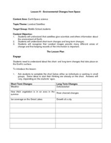
Environmental Changes from Space
Young scholars discuss Landsat Satellites and the use of the images they provide as well as the purpose of keeping records of the information from the satellites. The class works in groups to complete a worksheet on short term and long...
Chicago Botanic Garden
Personal Choices and the Planet
The last activity in the series of four has individuals determine steps they can take to reduce their carbon footprints and then analyze their schools' recycling programs. Through a sustainability audit, they identify how and where their...
Curated OER
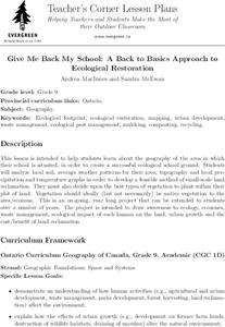
Give Me Back My School: A Back to Basics Approach to Ecological Restoration
Ninth graders research local geography to create successful, ecological school landscaping. They determine soil type, average weather patterns and temperature graphs and use the information to select ideal plants and plant maintenance...
Curated OER
Save Our Soil
Students explore the need for good farm land and reasons for the disappearance of agricultural areas. They brainstorm environmental friendly decisions and soil conservation. In their community, students explore new land developments...


