National Geographic
Types of Volcanic Eruptions
Blow the roof off your classroom with this multimedia science lesson plan on volcanic eruptions. A short online video teaches young geologists about shield and composite volcanoes and explores the examples of Kilauea and Mt....
Space Awareness
Let's Map the Earth
Before maps went mobile, people actually had to learn how to read maps. Pupils look at map elements in order to understand how to read them and locate specific locations. Finally, young cartographers discover how to make aerial maps.
Curated OER
Maps and the Pictures in Our Heads
Geographers of all ages examine different types of maps. They draw maps of their environment, utilizing both three-dimensional and picture maps. They interpret map information, noting how it can sometimes be misleading. Some good...
Royal Geographical Society
An Introduction to Maps
First graders are introduced to a variety of maps such as globes, street maps, atlases, and different types of floor plans. The focus of the lesson requires individuals to create their own plan of the classroom using the PowerPoint...
Core Knowledge Foundation
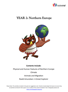
Year 2: Northern Europe
How is life in Northern Europe different from other areas of the world? Historians journey through the various regions of Northern Europe discovering what type of climate, animals, and lifestyles exist in that section of the world. They...
Workforce Solutions
Workforce Solutions 2-3 Lessons
Four lessons and an at-home connection examine 12 jobs. Beginning with an interactive map, scholars view and discuss each one within their small group. Groups focus on the products provided and on their scarcity. Finally, pupils look...
EngageNY
Getting a Handle on New Transformations 2
Use 2x2 matrices to move along a line. The second day of a two-day lesson is the 28th installment in a 32-part unit. Pupils work together to create and solve systems of equations that will map a transformation to a given...
Curated OER
Two-Step Problems and Money Concepts
Elementary schoolers solve two-step equations and practice money concepts. They solve multi-step addition and subtraction contextual problems and apply money concepts to real life situations. Pupils use pictures and counters to help them...
Rainforest Alliance
Knowing the Essential Elements of a Habitat
To gain insight into the many different types of habitats, individuals must first get to know their own. Here, scholars explore their school environment, draw a map, compare and contrast their surroundings to larger ones. They then...
Texas Heart Institute
Anatomy: How Does the Cardiovascular System Work?
How can the circulatory system compare to a city map? Pupils distinguish the "roadways" and "vehicles" of the cardiovascular system, compare the anatomy and function of veins and arteries, and review different types of blood cells with...
Curated OER
Fairy Tales
Once upon a time are four words most children are familiar with when reading a fairy tale. But do they know that fairy tales are a great way to learn the literary elements of reading and writing? Use a thorough fairy tale unit...
Association of American Geographers
Project GeoSTART
Investigate the fascinating, yet terrifying phenomenon of hurricanes from the safety of your classroom using this earth science unit. Focusing on developing young scientists' spacial thinking skills, these lessons engage...
Scholastic
Women's Suffrage for Grades 1–2
Scholars take part in a grand conversation after they examine facts and stories about the Women's Suffrage Movement. Eight discussion questions bring light to influential women, the importance of voting, citizenship, and voting rights.
Curated OER
Landscape Picture Map
Young scholars identify a neighborhood on a Landscape Picture Map. In this geography lesson, students discuss the characteristics of their neighborhood and identify their neighborhood on a Landscape Picture Map. Young scholars use...
Curated OER
Using Local Geography to Make Maps
Learners research, create, and present a scale representation of the county in which they live.
Benjamin Franklin Tercentenary
From Ben’s Pen to Our Lives
What would Ben do? Jumping off from the pseudonymous letters Ben Franklin fooled his older brother into publishing when he was still a teenager, young literary lovers dive into acting, writing, and addressing a local issue with wit and...
Agriculture in the Classroom
A Holiday Tradition: Which Christmas Tree Will You Choose?
Different varieties of Christmas trees provide an interesting way to combine social studies, science, math, and technology. Class members not only research the history of the Christmas tree holiday tradition, they compare and...
Curated OER
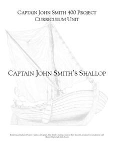
Captain John Smith's Shallop
Young explorers, all aboard the shallop to discover how early European explorers would navigate the American coastline to find resources, map terrain, and trade with Native American tribes.
Curated OER
Using Venn Diagrams to Compare Two Ecosystems
Students explore the distribution of two ecosystems on a global scale; and map the distribution of tropical and temperate rain forests throughout the world. They use a Venn Diagram to describe these ecosystems and the differences between...
Curated OER
Volcanoes: Sixth Grade Lesson Plans and Activities
Bring a set of pre-lab, lab, and post-lab lesson plans on volcanoes to your earth science unit. Sixth graders explore the three types of volcanoes found on Earth, plot the specific locations of these volcanoes on a map, and...
Compton Unified School District
How Can We Locate Places?
How can we locate places? Maps, of course! Expose second graders to the tools available in maps and discuss how these tools can help people find locations. Students also look at communities, including what makes a community and the...
Laboratory for Atmospheric and Space Physics
Charting the Progress of New Horizons
In 2006, New Horizons began its mission to fly to Pluto. As it continues its journey, scholars track its progress with the help of an informative website, all the while reinforcing measurement concepts with the construction of a scaled...
Indian Land Tenure Foundation
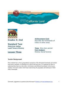
More Tribal Homelands
Here is a very fun idea that introduces young learners to how geographical location affects cultural development. They are introduced to four areas where Native Americans have lived in the past by reading stories and examining images....
Oregon State
World Map of Plate Boundaries
Young geologists piece together the puzzle of plate tectonics in an earth science lesson. Given a physical map of the world, they search for land formations that indicate the location of different types of plate boundaries.


