Curated OER
Canada's Forests and Resource Management
Young scholars are introduced to the Canadian forest industry so that they may assess the economic and environmental sustainability of the industry.
Curated OER
Canada...a Visual Journey
Students, in groups, research Canada's six natural regions (ecozones). They create a visual representation of each region on a large wall map of Canada and present it to the rest of the class.
Curated OER
Earth from Space Maps
Students use photo images from space to create a large map of the United States or the world, find where they live and label other places they know. They are exposed to a Web resource that allows them to view photo images of Earth taken...
Curated OER
A Comparison of Cloud Coverage Over Africa
Students use a NASA satellite data to contrast amounts of cloud coverage over different climate regions in Africa. They explore how Earth's major air circulations affect global weather patterns, and relate to local weather patterns.
Curated OER
Comparison of Snow Cover on Different Continents
Students use the Live Access Server (LAS) to form maps and a numerical text file of snow cover for each continent on a particular date and analyze the data for each map, corresponding text file to determine an estimate of snow cover for...
Curated OER
Save an Endangered Species
Have your young learners work in pairs to find and research an endangered species. They use research to develop ideas about saving their animal from extinction. Pairs develop a three-dimensional model of the animal's habitat. Then, they...
Curated OER
Variables Affecting Earth's Albedo
Students study the variables that affect the Earth's albedo. In this environmental data analysis lesson students interpret and graph information and calculate changes.
University of Minnesota
Connect the Neurons!
Create a neuron frenzy as your pupils play the part of the neurons. An engaging lesson plan creates a human chain of neurons that pass cotton balls posing as neurotransmitters. Scholars learn about pre- and post-synapses as they complete...
Orange County Water Atlas
Location, Location, Location…
Young geographers discover not only how to read and recognize coordinates on a map, but also gain a deeper understanding of latitude and longitude and how climate changes can vary significantly across latitudes.
University of Minnesota
Sheep Brain Dissection
Bored with frog and earthworm dissections? Had your fill of fetal pigs? Anatomy young scholars will be intrigued by the sheep's brain, and you will be prepared with guiding questions, extension activities, and pictures as they dissect...
Curated OER
Scale/Ratio
Investigate the use of ratios in scale drawings. Learners scale objects up or down using ratios then find the actual size of something using ratios. They apply their knowledge of ratios as they make their own telescopes in science class....
Rainer Goebel
Brain Tutor 3D
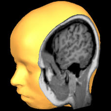
The human brain is staggeringly complex, and its structure can seem impossible to grasp. This user-friendly app allows for exploration of the brain's anatomy, providing nomenclature, 3-D mapping, and functions.
Jude Mphoweh
Vertebrates and Invertebrates
Spine or no spine? Vertebrate or invertebrate? Learners sort and classify a list of animals as vertebrates or invertebrates into a graphic organizer.
Curated OER
The Boreal Forest "In the News"
Students examine and discuss the current issues surrounding the deforestation of Canada's boreal forest. They also explore the issue through the eyes of the forestry industry.
Curated OER
Snow Cover by Latitude
Young scholars create graphs showing the amount of snow coverage at various points of latitude and compare graphs.
Curated OER
Using MY NASA DATA to Determine Volcanic Activity
Students explore how aerosols are used in science to indicate volcanic activity and how biomass burning affects global aerosol activity. Students access data and import into MS Excel using graphical data to make inferences and draw...
Curated OER
Will There Be a White Christmas This Year?
Students examine historical weather data, and create map and color key that illustrates the likelihood of a white Christmas in different locations across the United States.
Curated OER
A world of oil
Students practice in analyzing spatial data in maps and graphic presentations while studying the distribution of fossil fuel resources. They study, analyze, and map the distribution of fossil fuels on blank maps. Students discuss gas...
Curated OER
Plants: Report Planner
Introduce your young learners to the basic research project. They explore plants using a three-page note-taking guide. On the first page, they write down things they would like to know about the topic and where they might look to find...
Curated OER
Exploring the Sky: Reading Maria's Comet
Discover the science behind astronomy. After reading the book Maria's Comet, which is about a young woman who breaks new ground by becoming a female astronomer, young learners practice reading comprehension with worksheet questions about...
Curated OER
Hurricanes As Heat Engines
Students examine sea surface temperatures to see how hurricanes get heat from the oceans surface. In this hurricanes lesson plan students use the Internet to find data and make line plots.
Curated OER
Storm Clouds-- Fly over a Late Winter Storm onboard a NASA Earth Observing Satellite
Students study cloud data and weather maps to explore cloud activity. In this cloud data lesson students locate latitude and longitude coordinates and determine cloud cover percentages.
Curated OER
Think GREEN - Utilizing Renewable Solar Energy
Students use data to find the best renewable energy potential. In this solar energy lesson students import data into Excel and explain how solar energy is beneficial.
Curated OER
A Comparison of Cloud Coverage over Africa
Students identify different climate regions and local weather patterns. In this cloud coverage lesson students use NASA satellite data and import it into Excel.
Other popular searches
- Atlas Reference
- Atlas Skills
- Atlas Canada
- Using an Atlas
- Research Skills Atlas
- Atlas Activities
- World Atlas
- Using the Atlas
- Online Atlas
- Atlas Scavenger Hunt
- Digital Atlas
- Atlas of Canada


