National Endowment for the Humanities
The New Order for "Greater East Asia"
Sometimes the New Order becomes synonymous with its implications for European countries, but what about its consequences for East Asia? The final instructional activity in a four-part series teaches scholars about World War II. High...
Institute for Geophysics
Understanding Maps of Earth
Here is your go-to student resource on primary geography concepts, including facts about the surface of the earth and its hemispheres, latitude and longitude, globes, types of maps, and identifying continents and oceans.
TRAIN Educational & Community Services
Multicultural Activities
From catching stars developed by African pygmy tribes to chop stix pick-up or the Hanukkah dreidel, use this list of diverse multicultural activities to help your learners draw connections to unique cultures of the world.
Curated OER
North Africa & Southwest Asia Map Quiz
In this geography skills instructional activity, students examine the blank outline map of North Africa and Southwest Asia. Students label the countries located in the region.
Curated OER
Introduction to Southeast Asia - Indonesia
Learners explore Southeast Asia. In this Indonesia lesson, students listen to a lecture about the location of Indonesia and complete map activities. Learners also examine Indonesian art forms and explore the process of dying.
Curated OER
Kinds of Maps
In this map worksheet, students match a set of descriptions with the names of different types of maps and answer true/false questions and short answer questions about using maps.
Curated OER
Saudi Arabia -- Future city
Seventh graders summarize an article on Masdar. In this summarizing lesson students clearly explain three of the four points provided in an outline of the article. The students write an essay and identify six physical features of the...
Curated OER
Should the Ming End the Treasure Voyages?
During the first century of Chinese Ming dynasty (1368-1644), the government sent out a total of seven voyages into the Indian Ocean. Young historians will discuss, explain, role play, and compare the decisions made by rulers during the...
Curated OER
Geography and Culture of China
Take out a map, a paper, a ruler, and those coveted colored pencils for a lesson plan on Chinese culture and geography. This is a multifaceted approach to basic geography skills that incorporate story telling, class discussion, primary...
National Endowment for the Humanities
Lesson 3: On the Road with Marco Polo: From Hormuz to Kashgar
Young explorers examine the route that Marco Polo and his father traveled to reach China. They examine online maps of the Silk Road and harsh terrain of Afghanistan to determine challenges that may have been encountered during travel.
Curated OER
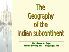
The Geography of the Indian Subcontinent
Gloriously adorned with a glimpse of the Taj Mahal, these slides detail important facts and characteristics of South Asian cultures, such as India, Pakistan, Afghanistan, and several other surrounding countries. Slides cover the...
Curated OER
Christopher Columbus: The Man, the Myth, the Legend
Learn more about maps by examining Christopher Columbus's voyage to the New World. Kindergartners will learn about basic map skills and how to identify the compass rose, oceans, and land masses. They will also discover the purpose of...
Curated OER
Where Is Rome?
Third graders discover Ancient Rome through maps and worksheets. In this world history lesson, 3rd graders locate Rome on a world map and identify the scope of the Roman Empire. Students label an entire map of Italy after printing one...
Curated OER
Central and Northern Asia: Political
In this Central and Northern Asia outline map, students examine the political boundaries of the nations in this region and note the location of their capital cities. This unlabeled map may be used in a variety of classroom activities.
Curriculum Corner
Earth Day Book
This Earth Day, celebrate our beautiful planet with an activity book that challenges scholars to show off their map skills, complete a crossword puzzle, write acrostic poems, alphabetize, and reflect on their personal Earth-friendly habits.
Curated OER
Animals of China and in Asia
Students write an animal report. In this research lesson, students use varied reference materials to find information about animals that live in China and Asia. They write a report about an animal and complete extension activities such...
Curated OER
An Introduction To Southeast Asia Today
Students investigate the region of Southeast Asia. They research the history, geography, and spread of ethnicity throughout the region. The various lessons consist of class discussion and group work to find common themes shared in...
Curated OER
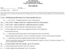
South Asia
Students study South Asia. They complete various activities including answering questions following lectures, researching current events articles, viewing videos of Gandhi, South India, Pakistan, and Nepal. They select activities...
Curated OER
The Interconnectedness of Ancient Peoples Map Study
Seventh graders begin this lesson by viewing various maps of the Ancient World. As a class, they take notes on the changes of different areas in Europe and Asia as their teacher lectures to them. They answer questions about the...
Curated OER
Using Charts and Graphs to Study East Asia's Modern Economy
Students examine East Asia's modern economy. In groups, classmates use the internet to compare the resources, products, and economy of specified countries. After collecting the data, pupils create charts, tables and graphs. They...
Curated OER
Exploring the Hudson in 1609
While this lesson focuses on a study of the Hudson River, it could be used as a template for a discussion of map skills, converting measurements, and plotting a route. The lesson includes vocabulary and other resources to make it a...
August House
The Archer and the Sun
Reinforce reading comprehension with a instructional activity about The Archer and the Sun, a Chinese folktale. Kids learn some background information about Chinese culture before reading the story, and answer literacy questions as they...
National Endowment for the Humanities
How "Grand" and "Allied" Was the Grand Alliance?
Learn more about the Grand Alliance with a scaffolded lesson plan that includes four activities. Class members use primary sources to complete a map exercise, understand the goals and objectives of each individual nation, and participate...
Montana State University
Meet Mount Everest
Learning about one landform might seem boring to some, but using the resource provided practically guarantees scholar interest. The second in a sequential series of eight covering the topic of Mount Everest includes activities such as a...


