Curated OER
Canada Outline Map
In this blank outline map activity, students study the political boundaries of the North American country of Canada as well as those of the provinces located there.
Curated OER
Canada Outline Map: Labeled
In this blank outline map learning exercise, students study the political boundaries of the North American country of Canada as well as those of the provinces located there. This map is labeled.
Curated OER
Canada Outline Map
In this blank outline map instructional activity, students study the political boundaries of the North American country of Canada as well as those of the provinces located there.
Curated OER
Canada Outline Map
In this blank outline map worksheet, students study the political boundaries of the North American country of Canada as well as those of the provinces located there.
Curated OER
Canada Outline Map
In this Canada outline map learning exercise, students make note of the political divisions of the provinces and territories of the nation.
Curated OER
Canada: Outline Map
In this Canadian political map activity, students examine Canada's province boundaries. The map also highlights each of the province's capitals with a star.
Curated OER
Canada
In this geography worksheet, students examine a Canadian outline map. The title "Canada" is at the top, with no other labels. There are no suggested activities.
Curated OER
Organization of a Territory, Map Elements
Third graders compare printed and online maps and use proper geographic terminology to answer questions.
Curated OER
What's Your Temperature?
Learners take a look at the local newspaper and focus on the weather section. They get into small groups, and each one looks at the same map, but of a different part of the country. They must prepare a presentation that shows how...
Curated OER
Canada: Name The Territory or Province
In this geography worksheet, 4th graders examine an outline map of Canada. They write the names of the 13 territories and provinces on the blank lines below the map.
Curated OER
Discovering Dinosaurs: Planning your Summer Vacation
Students use the online Atlas of Canada to gather information about places in Canada.
Curated OER
The Rivers and Lakes of Alberta
Learners are introduced to the online Atlas of Canada and they identify the lakes and major rivers of Alberta.
Curated OER
Historical Indian Treaties and Aboriginal Population
Sixth graders navigate an online atlas of Canada and compare the land area of of historical Aboriginal peoples in Manitoba to present-day figures.
Curated OER
Landscape Diversity in the Yukon Territory
Students review and analyze a satellite image of the Yukon territory.
Curated OER
Using Venn Diagrams to Compare Two Ecosystems
Learners explore the distribution of two ecosystems on a global scale; and map the distribution of tropical and temperate rain forests throughout the world. They use a Venn Diagram to describe these ecosystems and the differences between...
Curated OER
Nunavut, Our Communities
Students locate the communities of Nanavut on a territorial map and identify community characteristics. They research the online Atlas of Canada
Curated OER
From North to South...Quebec's Forest Regions
Students identify and describe the different regions of Canada. With a focus on the forest regions, they use an atlas to locate the ecozones. They identify the characterstics of the climate and vegetation and the relationship between...
Curated OER
Should Kids Vote?
High schoolers develop critical analysis skills important to evaluate democratic structures. They increase their knowledge of the characteristics of voters and voting impact on the Electoral System.
Curated OER
The Exploration and Settlement of North America
Students locate place in Canada and explore highlights of early of early American exploration and settlement. In this North American history instructional activity, students locate provinces, major cities, and physical features...
Curated OER
Canada...A Visual Journey
Students work together to analyze the six natural regions of Canada. Using this information, they create a visual representation of each region on a large wall map and present it to the class. They must identify five key points of each...
Curated OER
Canada...a Visual Journey
Students, in groups, research Canada's six natural regions (ecozones). They create a visual representation of each region on a large wall map of Canada and present it to the rest of the class.
Curated OER
Canada's Forests and Resource Management
Students are introduced to the Canadian forest industry so that they may assess the economic and environmental sustainability of the industry.
Curated OER
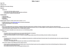
Metis
Fourth graders examine the Metis culture. In this Metis living lesson plan, 4th graders read Things I did Last Summer by Martin Shulman and discuss the life of the main character, Bonnie. Students recreate their favorite...


