Curated OER
Two Faces Of Greece: Athens And Sparta
Pupils investigate the civilizations of Ancient Greece while focusing upon the city-states of Greece and Sparta. They conduct research using a variety of resources. The information is used to create the context for a variety of activities.
Curated OER
Does Conflict Shape Nations? The Middle East
Students locate settlements and observe patterns in the size and distribution of cities using maps, graphics, and other information. They explain the processes that have caused cities to grow.
Curated OER
Weather
High schoolers describe the weather and temperature in the city, state, and/or country in which they live during the 4 seasons.
Curated OER
Maine
In this Maine activity, learners fill in the cities next to the dots in the map of the state of Maine. Students fill in 5 cities including the capital.
Curated OER
Planning a Garden Using a Grid
Third graders plan for a garden. In this garden planning lesson, 3rd graders investigate the use of a grid to accurately map out and plan for a vegetable garden. Students predict the space requirements for different vegetables.
Curated OER
Vermont History True / False
In this Vermont history worksheet, learners read two and a half pages of information about Vermont history. After reading, students complete 10 true or false questions about what they read.
Curated OER
US Policy In Somalia
Students investigate the US policy for the country of Somalia. They conduct research using a variety of resources. They locate the country and then discuss major geographical features of the areas. Students discuss the present US...
Curated OER
Finding Your Spot in the World
Students practice locating places on a Thomas Brothers map. In this map skills lesson, students locate places on the map of where their ancestors are from and then practice finding various community places on a map. Students graph the...
Curated OER
Geological Forces and Topography
Students discuss and research the Earth's geological processes. For this geology lesson, students study maps of Utah and the United States to learn about geological features. Students then complete the research cards for each area of...
Curated OER
Nina Bonita: Culture and Beauty
Students read Nina Bonita by Ana Maria Machado. For this reading comprehension/ geography lesson, students recall various parts of the story and create a map of where the rabbit traveled throughout the story. They participate in group...
Curated OER
Come One, Come All
Students analyze information from core map and other sources and construct routes from New York and Boston to Cincinnati as they might have existed in 1835.
Curated OER
Where Do You Live?
Learners identify their state and city on a map. After completing a reading of Zoom, students identify various landmarks on a globe and on a map. They begin by identifying the United States and refine their identification until they have...
Curated OER
Freeform Rhode Island Map
In this free form Rhode Island map worksheet, students study, locate and memorize key cities, physical attributes and surrounding states for a quiz. Students fill out the major cities on a blank map of Rhode Island.
Curated OER
Mapping Your Neighborhood
Students define and outline their neighborhoods using GIS (geographic information systems) or a regional map and relate their neighborhoods to the principles of Smart Growth.
Curated OER
Real World Investigation- Math and Geography- Elevation Changes
In this math and geography real world investigation, 6th graders plan a driving trip to a city that is located several states away from their home while recording the elevations of three cities that are included in the trip. They use...
Curated OER
The Eagle Has Landed: Aztecs Find a Home
Students investigate the Aztec civilization and locate it on a map. They explain the legend of the city of Tenochtitan and investigate the symbolism of the Mexican flag.
Curated OER
Day to Day Life in a Small African Village
Learners analyze what it is like to live in an African village. They locate Tanzania on a map and compare life there to life here in the United States. They write about the health issues in East Africa.
Curated OER
Tracing Our Own Family Pilgrimages
The Pilgrims may have arrived in North America by way of the Mayflower, but chances are, your class members' ancestors came to the United States in another way. Guide them through an exploration of their own heritage, countries of...
Curated OER
Water Quality and Watersheds: A GIS Investigation
Requiring more than one class period, this resource takes earth science learners on a journey through a watershed. Using ArcGIS Explorer, an online geographic information system, they view maps of watersheds and surrounding landscapes....
Curated OER
California Here We Come!
A highly relevant and great cross-curricular project! In teams, your class will plot a course from the East Coast to Sacramento, California passing through all of the state capital cities along the way. As part of the journey, teams...
Curated OER
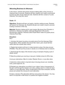
Attracting Business to Arkansas
Groups of learners research a city in Arkansas, then plan and create a brochure which would promote business growth in that city. The groups access the Internet in order to find out the necessary information about the town to put in...
Curated OER
Victory in Europe, 1944-1945
High schoolers examine the overall strategy pursued by the Allies in the final moths of World War II in Europe by examining military documents and consulting an interactive map of the European theater.
Federal Reserve Bank
Piggy Bank Primer: 25 Cents Worth of History
It's all about money. Here's a resource that introduces kids to the Federal Reserve System, different coins produced by the mints, and fun facts about state coins.
Curated OER
Building a School Model: An Academic Challenge
First and second graders explore aspects of design. They discuss and design the ideal classroom building complete with window and door placement. Additionally, students observe and note features found in neighboring classrooms as...


