Curated OER
Electromagnets
Students are introduced to the relationship between electricity and magnetism. Using a compass, they observe and record the effects of placing the object near magnetic fields and electric currents. They also experiment using a steel and...
Curated OER
World Map and Globe - Four Main Directions
Students study the four main directions on a map. In this map lesson, students locate the North and South pole, and learn the four cardinal directions. They use the compass rose on a map to help with the directions. (Map is not included...
Curated OER
Stranded along the Coast
Students plot stranding sites onto a map using latitude and longitude as well as compass directions with respect to coastal features. They identify several species of marine animals that might become stranded; distinguish their...
Curated OER
Measure: Bearings and Scale Drawings
Pupils practice drawing geometric figures. In this geometry lesson plan, learners complete an activity that requires them to draw angles and shapes to the nearest degree.
Curated OER
Shadows and Skyscrapers
Eighth graders explain the relationship between the position of the sun, a city's latitude and shadow length. Ratio's, geometry, and algebra are used to determine the shadow lengths and building heights. A sun angle (altitude) charts to...
Curated OER
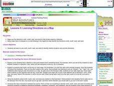
Learning Directions on a Map
Students use north, south, east, and west to identify relative locations and provide directions.
Chicago Botanic Garden
Impacts of Climate on Forest Succession
Part two in a series of four explores the effects of climate on succession or the changing of plant species in a forest. Groups review how to identify trees and then spend a day in the field collecting extensive data on trees to...
EngageNY
Characterize Points on a Perpendicular Bisector
Learn transformations through constructions! Pupils use perpendicular bisectors to understand the movement of a reflection and rotation. They discover that the perpendicular bisector(s) determine the line of reflection and the...
University of Colorado
Looking Inside Planets
Researchers use scientific data to understand what is inside each of the planets. The first in a series of six, this lesson builds off of that concept by having pupils use a data table to create their own scale models of the interiors of...
Virginia Department of Education
Congruent Triangles
Is this enough to show the two triangles are congruent? Small groups work through different combinations of constructing triangles from congruent parts to determine which combinations create only congruent triangles. Participants use the...
Curated OER
Directions on a United States Map
Students generate directions for an imaginary trip. In this map lesson, students review the four main directions and how to use a map legend. Students locate destinations based on directions given by classmates.
Curated OER
Classroom Triangles
Students use bearing measurements to triangulate and determine objects' locations. Working in teams of two or three, students must put on their investigative hats as they take bearing measurements to specified landmarks in their...
Curated OER
Where Is Japan? How Far Is That?
First graders use literature and hands-on activities with maps and globes to explain distance and tools used to measure distance. They select tools to measure various objects in the classroom, then apply those concepts to their map...
Curated OER
BOUND TO BE NEW HAMPSHIRE
Students identify neighborhood, town, and state boundaries. They distinguish between natural and man-made boundaries. They identify major state geological features and explain how NH boundaries have changed over time.
Curated OER
Properties of the Ocean: Change
Students research and create a visual presentation on the seasonal salinity of the Earth's oceans. They apply the research in a simulation of a lab disaster in which they must relabel ocean samples.
Curated OER
Quad Squad
Students pretend they have visited a forest research station on an overnight field trip. They study forest fires, use compass directions, read maps, interpret imagery, and think about the impact of fire on ecosystems.
Curated OER
Lichens as Air Quality Indicators: A beginning lichen identification study (2003
Students use GPS and trees to explore lichens and air quality.
Curated OER
Using Magnetotactic Bacteria to Study Natural Selection
Students demonstrate that living organisms may possess incredible adaptations which enable them to survive. They observe bacteria that are able to orient themselves using the Earth's magnetic field and formulate a hypothesis as to how...
Curated OER
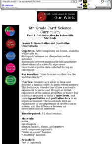
Introduction to Scientific Methods
Sixth graders distinguish between an observation and an inference distinguish between quantitative and qualitative observations of a scientific experiment. They record and organize data collected during an experiment.
Curated OER
Directionality
Second graders discuss the cardinal directions and intermediate directions and then look at the spooky map to locate different points on the map. They answer questions about where things are located in reference to another object and...
Curated OER
Map Creation
Second graders identify a map, symbol, key, and compass rose. Students create and print a map for teacher evaluation using the computer. Students identify the symbols on their map and orally present them to the class.
Curated OER
Marshmallow Moosy
Students stack several different colored marshmallows-one on top of the other-in the tall cylindrical container. They ct a cardboard disk to fit snugly inside of the container on top of the marshmallow stack using a compass if necessary....
Curated OER
Science Inquiry Lesson: Mapping Project
Pupils explore the methods of creating maps. They create a map of Animas River Park using a compass and measuring tape, develop a single map from the team map sections, and devise another map of the Animas River Park using a GPS unit.
Curated OER
Radial Design Mandala
Students design original radial art designs.In this radial design instructional activity, students use compasses and a nature inspired idea to create radial art. Students understand the use of symmetry, balance and design shapes in...
Other popular searches
- Compass Skills Worksheets
- Compass Skills 3rd Grade
- Compass Skills First Grade
- Compass Skills Elementary
- Map and Compass Skills
- Compass Skills Lesson Plans
- Map Compass Skills
- Math Compass Skills
- Tecahing Compass Skills
- Decaying Compass Skills
- Compass Skills Yr 10
- Math Compass Skills Triangle


