Curated OER
Map Puzzles
Students make puzzles from world maps, dramatizing how much of the globe is covered by ocean.
Teach Engineering
What's Wrong with the Coordinates at the North Pole?
Here is an activity that merges technology with life skills as individuals use Google Earth to explore the differences between coordinate systems and map projections. The self-guided worksheet is the fourth segment in a nine-part unit....
Environment Agency - Abu Dhabi
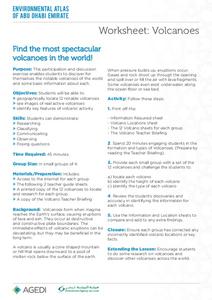
Find the Most Spectacular Volcanoes in the World!
Heat things up in your earth science class with this collaborative lesson on volcanoes. After first being introduced to the different types of volcanoes and how they are formed, young geologists work in small groups to...
American Museum of Natural History
Fossils
Sixteen slides showcase an average day on the job for a paleontologist, Ross MacPhee. Engaging images include world maps and real-world photographs from an archeological dig in Antarctica. A brief description accompanies each slide.
Howard Hughes Medical Institute
Lesson 2: Gorongosa National Park
How has Gorongosa National Park changed over time? Discover the park's rich history, dating back to primitive human times, through an interactive timeline and scientific reading. The second installment in an eight-part series explores...
Curated OER
Create Your Own Country Project
Young scholars demonstrate their knowledge of geography with this fun, collaborative social studies project. Working in small groups, students develop their very own countries, writing descriptions...
Curated OER
Geography Puzzles
Learners study the continents of the world. In this Internet geography lesson, students connect to online mapping games. Learners collaborate in order to develop their understanding of world geography, including countries and capital...
Curated OER
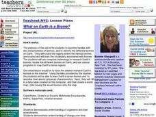
What on Earth is a Biome?
Students explore organisms and their environments. They examine change over time
demonstrate an understanding of physical positions on Earth. They survey earth's diversity, write a report, fill in a data table created on the...
Curated OER
Earth Forces
High schoolers use geological techniques such as plate tectonics, mountain building, earthquakes, and volcanoes, in order to explain the earth.
Curated OER
Geography And The Gulf War
Students develop maps, tables, graphs, charts, and diagrams to depict the geographic implications of current world events, and analyze major human conflicts to determine the role of physical and cultural geographic features in the...
Curated OER
The Earth Moves Under My Feet
Students study earthquakes, monitor seismic activity using the Web, and plot real-time activity. They examine movement of the Earth's tectonic plates. They create an earthquake preparedness project.
Curated OER
Shaky New Zealand
Students explore Earth science by building a model in class. In this tectonic plate lesson, students identify the impact tectonic shifts have on humans and animals and where the plates and faults lie under New Zealand. Students examine...
Curated OER
Worksheet 9: Comparisons- Geography
In this geography worksheet, students complete 7 sentences with descriptive words from the word bank. All sentences compare two geographical features.
Curated OER
Clouds and the Earth's Radiant Energy System
Wow! What a lesson plan! Six terrific activities are described in great detail, in this 31-page document! Learners will model and explain cloud formation, sketch and identify certain cloud types, calculate and compare incoming and...
Curated OER
Maps as Models of Earth
Eighth graders use different types of maps to find locations and surface features. In this map-reading lesson plan students use a compass to find direction.
Curated OER
Geography Vocabulary
In this identifying geographic terms and their definitions online interactive worksheet, students match the vocabulary words with their definitions. Students match 24 answers.
It's About Time
Plate Boundaries and Plate Interactions
How does the Earth continually repair itself? Explore the answer to this question, and others, with a unit on plate boundaries and interaction. Pupils classify the types of movement at plate boundaries and identify the...
National Park Service
Glaciers and Water
Explore the amazing power of glaciers with a hands-on earth science experiment! After first learning basic background information, learners go on to create their very own chunks of frozen water and gravel in order to...
Curated OER
The Potential Consequences of Climate Variability and Change
Students analyze the impact of climate variability and change utilizing a broad span of topics over a wide range of grade levels. This three lesson unit is easily adapted for the various instructional levels listed.
Curated OER
Landforms of Illinois
Fifth and sixth graders are introduced to the primary landforms of Illinois and discover how they were created. Landform cards are made for each pupil. They use the twenty-questions format until they have identified each one. Then,...
Environmental Education in Wisconsin
Biome Travel Guide
In a perfect marriage of social studies and science, groups work together to research and create a travel guide presentation to share with the class. Not only do kids learn about the climate and geography of a biome, but also the...
Bowland
Sundials!
Time to learn about sundials. Scholars see how to build sundials after learning about Earth's rotation and its relation to time. The unit describes several different types of possible sundials, so choose the one that fits your needs — or...
K5 Learning
Landforms
Valleys, mountains, and plateaus are just a few geographic landforms on our Earth. Read about these types and more in a brief landform passage. After reading, learners respond to six short answer comprehension questions.
Space Awareness
Navigating with the Kamal
Historians have proven that as early as 1497 skilled navigators were using a kamal to sail across oceans. Scholars learn about navigation tools and astronomy before building their own kamals. They then learn how to use it to determine...
Other popular searches
- World Map Earth's Biomes
- Geography Earths Crust
- Geography the Earths Crust
- World Map Earths Biomes
- World Map Earth's Bio Mes


