Curated OER
Photosynthesis
Fifth graders work in small groups to brainstorm responses to a problem related to some disaster that wipes out half or all plant life on earth. Groups complete a graphic organizer to compare and contrast their ideas. Students select...
Curated OER
Continental Drift
Be sure to come prepared to discuss the theory of Pangaea and the two super-continents, Laurasia and Gondwanaland. Collaborative learners look for fossil evidence that supports the theory that one super-continent divided into two. They...
Curated OER
Plate Tectonics: Kindergarten Lesson Plans and Activities
This unit focuses primarily on plate tectonics and plate boundaries surrounding continents. It contains pre- and post-lab sections that walk young geologists through plate movements in order to visualize what's going on inside Earth.
California Academy of Science
Earthquakes and Tectonic Plates
Here is a comprehensive package in which middle schoolers learn about types of seismic waves, triangulation, and tectonic plate boundaries. Complete vocabulary, colorful maps, and a worksheet are included via links on the webpage. You...
Curated OER
The Nine Planets
A solid lesson on teaching the nine planets in our solar system is here for you. In it, young scientists learn the correct order of the planets, and they choose one of the planets to do a research report on. They must come up with five...
Curated OER
Hazards: First Grade Lesson Plans and Activities
Examine the environmental hazards associated with volcanoes with a three-part science lesson. In the pre-lab, first graders learn that gas, landslides, ash, and lava are all hazards that come from volcanoes. They then explore...
Curated OER
Arkansas: A Changing Climate, a Changing Land
Here is a lesson on the climate zones and geography of Arkansas. In it, learners look at maps (embedded) of different climate zones found throughout Arkansas. They engage in discussions regarding how global warming and climate change is...
California Academy of Science
Discovering Rainforest Locations
How many rainforests are there, where are they, and do global factors effect their locations? These are great questions that have great answers. Children in grades four through eight use several different maps to determine why...
It's About Time
Volcanic History of Your Community
Did you know there are 20 volcanoes erupting at any given time? Pupils look at various igneous rocks, read local geologic maps, and determine if their area has a history of volcanic activity. A reading passage and analysis questions...
Discovery Education
Satellite Telemetry
Satellites require rockets to launch, but it doesn't take a rocket scientist to understand them. Future engineers learn about how satellites send data to Earth and how to interpret satellite images. They see how radio waves play a role...
University of Wisconsin
Follow the Drop
Young surveyors look for patterns in water flow around campus. Using a map of the school (that you will need to create), they mark the direction of the path of water. They also perform calculations for the volume that becomes runoff. The...
Curated OER
Fish and Zooplankton Through Remote Sensing
Ecology aces examine sea surface temperature maps and relate temperatures to concentration in fish and zooplankton populations. Take your class to a computer lab and provide experience with actual remote sensing data. Some of the links...
Curated OER
Planetary Jeopardy!
Space Science can be so much fun, especially when you play Planetary Jeopardy! This game tests students on what they know about Roman Gods, the planets and moons in our solar system, and the Earth's rotation.
Sea World
Endangered Species
Study different endangered species with several activities that incorporate math, science, language arts, and research strategies. A great addition to your lesson on conservation or Earth Day.
Curated OER
A Model of Three Faults
Students observe fault movements on model of the Earth's surface, find fault movements associated with different types of plate boundaries, research examples of non-plate boundary faults, and research and report on the types of faults...
National Wildlife Federation
An Energy Mix: Renewable and Nonrenewable Resources
What did the windmill say about renewable energy? I'm a BIG fan! Lesson three in the series of 12 has classes discuss potential and kinetic energy and then, in pairs, they complete a web quest over the different types of energy...
Science 4 Inquiry
Edible Plate Tectonics
Many people think they can't observe plate tectonics, but thanks to GPS, we know that Australia moves at a rate of 2.7 inches per year, North America at 1 inches per year, and the Pacific plate at more than 3 inches per year! Scholars...
Science 4 Inquiry
An Investigative Look at Florida's Sinkholes
In May of 1981, the Winter Park Sinkhole in Florida first appeared and is now referred to as Lake Rose. Scholars learn about the causes of sinkholes through an inquiry project. Then, they analyze recent data and draw conclusions to...
Curated OER
Contour Map Worksheet #3
Earth scientists answer five multiple choice questions about the topographical map atop the worksheet. Use this as a quick assessment of understanding after having taught how to read contour lines and topographic maps.
Curated OER
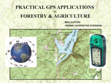
Practical GPS Applications in Forestry & Agriculture
An explanation of the Global Positioning System (GPS) and the Geographic Information System (GIS) is given in this presentation. Uses and applications are considered. How it works and sources of error are also touched upon. A large...
Curated OER
Understanding a Geological Map
Students identify different types of maps and observe a geological map. In this geology instructional activity students create a replica map of a geological area that includes a key.
Curated OER
Earth and Space Science: Exploring Earthquakes
Students explore earthquakes. In this earthquake lesson, students research earthquakes and identify where they take place. Students use map skills to track down earthquake locations. There are internet sites suggested in this lesson.
Curated OER
Geological Maps of the Western Regions
Students study the geological makeup of the West. In this geological maps lesson students creat a map that includes a key and present it to the class.
Curated OER
Chart Making for Navigators
Young scholars discuss the importance and function of nautical maps for sailors. They, in groups, take soundings of a simulated bay in a shoebox and develop a nautical chart that enable them to navigate the shoebox safely.

